|
|
|
| Maps > United States > Early America 1400-1800 |
A collection of historic maps of early America from explorations and settlements of the English, French, and Spanish, to the end of the American Revolutionary War.
|
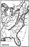
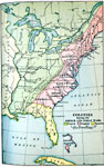
English, French, and Spanish Occupation,
1750 |
|
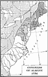
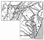
Designation of Members to the General Congress of Albany,
1754 |
|
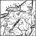
Chief Scene of Operations — French and Indian War,
1754–1755 |
|
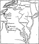
The Disputed Territory during the French and Indian War,
1754–1763 |
|
Colonies During the French and Indian Wars ,
1754–1763 |
|
Braddock's March,
1755 |

|
The Territory of the Present United States during the French-Indian Wars,
1755–1763 |
|
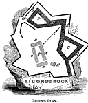
Fort Ticonderoga,
1755–1781 |
|
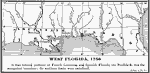
West Florida,
1756 |
|
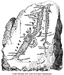
Lake George and Part of Lake Champlain,
1757 |
| First | Previous | Next | Last |
| Maps > United States > Early America 1400-1800 |
Maps ETC is a part of the Educational Technology Clearinghouse
Produced by the Florida Center for Instructional Technology © 2009
College of Education, University of South Florida