|
|
|
| Maps > United States > Early America 1400-1800 |
A collection of historic maps of early America from explorations and settlements of the English, French, and Spanish, to the end of the American Revolutionary War.
|
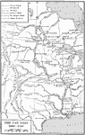
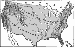
The Far West,
1686–1754 |
|
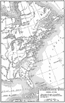
Intercolonial Wars,
1689–1713 |
|
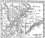
Pennsylvania and West Jersey,
1698 |
|
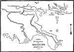
Carte Des Environs du Mississippi,
1700 |

|
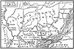
Development of Colonies and Early Western Explorations,
1700–1775 |
|
Pioneer Settlements on the Western Frontier,
1700s |
|
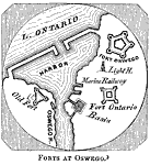
Fort Oswego,
1727–1756 |
|
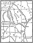
Georgia Projected,
1732 |
|
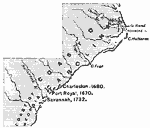
Colonial Georgia,
1732–1763 |
|
The Present Territory of the United States as claimed by European Powers,
1749 |
| First | Previous | Next | Last |
| Maps > United States > Early America 1400-1800 |
Maps ETC is a part of the Educational Technology Clearinghouse
Produced by the Florida Center for Instructional Technology © 2009
College of Education, University of South Florida