|
|
|
| Maps > United States > Early America 1400-1800 |
A collection of historic maps of early America from explorations and settlements of the English, French, and Spanish, to the end of the American Revolutionary War.
|
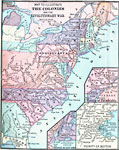
The Colonies and the Revolutionary War,
|
|
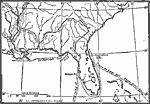
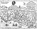
Routes of Spanish Explorers,
1513–1565 |
|
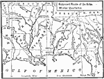
Route of De Soto,
1539–1542 |
|
The Route of DeSoto,
1539–1542 |
|
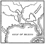
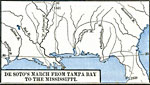
DeSoto's March from Tampa Bay to the Mississippi,
1539–1542 |
|
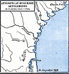
Attempts at Huguenot Settlements in Florida,
1562–1565 |
|
Virginia,
1577 |
|
Roanoke Island, Jamestown, and St. Mary's,
1584–1632 |
|
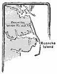
Roanoke Island,
1585 |
|
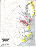
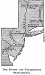
Dutch and Neighboring settlements,
1600s |
| Next | Last |
| Maps > United States > Early America 1400-1800 |
Maps ETC is a part of the Educational Technology Clearinghouse
Produced by the Florida Center for Instructional Technology © 2009
College of Education, University of South Florida