|
|
|
| Maps > United States > Early America 1400-1800 |
A collection of historic maps of early America from explorations and settlements of the English, French, and Spanish, to the end of the American Revolutionary War.
|
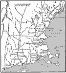
The New England Colonies,
1600s |
|
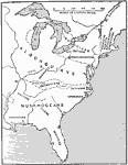
The Location of the Eastern Indian Tribes,
1600s |
|
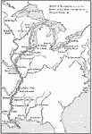
French Explorations and Forts,
1600s |
|
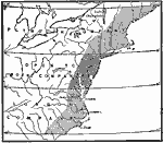
Crown Grants To Trading Companies in North America,
1606 |
|
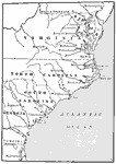
The Southern Colonies,
1606 |
|
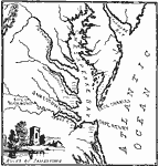
Jamestown and Vicinity,
1607–1609 |
|
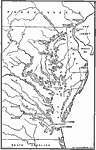
The Chesapeake Bay Settlements of Jamestown and Richmond,
1607–1611 |
|
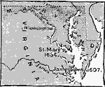
Colonial Maryland and Virginia,
1607–1634 |
|
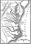
The Chesapeake Bay Colonies.,
1607–1729 |
|
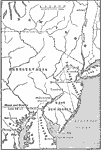
The Middle Colonies,
1609–1702 |
| First | Previous | Next | Last |
| Maps > United States > Early America 1400-1800 |
Maps ETC is a part of the Educational Technology Clearinghouse
Produced by the Florida Center for Instructional Technology © 2009
College of Education, University of South Florida