Maps Site map
  Maps > United States > Early America 1400-1800
Site Map  

  Record   21   to   30  of   199

A collection of historic maps of early America from explorations and settlements of the English, French, and Spanish, to the end of the American Revolutionary War.
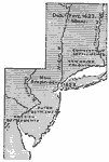
New Netherlands, New Sweden, and New England, 1614–1664
A map of the Atlantic coast area from the Delaware Bay to the Connecticut River showing the territory claimed by the Dutch as New Netherlands (1614–1664), the territory around the Delaware Bay and Delaware River claimed by Sweden as New Sweden ...

New Sweden and New Netherland, 1614–1664
A map of the area from the Delaware Bay to the Connecticut River showing the territory claimed by the Dutch as New Netherlands (1614–1664) and the territory around the Delaware Bay and Delaware River claimed by Sweden as New Sweden (1638–...

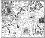
Smith's Map of New England, 1616
A facsimile of an early map of New England as observed by Captain John Smith in 1616. The map covers the coastline from Cape James (Cape Cod) and Stuards Bay (Cape Cod Bay) north to Pembrocks Bay, and includes the inscription "The most remarquea...

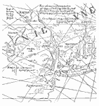
From the Figurative Map, 1616
A facsimile of a map discovered by Brodhead (1850) in the archives at the Hague, known as "The Figurative Map," cartographer unknown and dated 1616, one of a pair of similar maps. This is the oldest map of the territory now comprising the S...

The Early European Settlements of Pennsylvania and New Jersey, 1617–1683
A map of New Jersey and eastern Pennsylvania showing the early European settlements in the area from Bergen, New Jersey established in 1617 to Philadelphia, Pennsylvania, established in 1683. The map shows the boundary between West New Jersey and Eas...

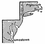
Jamestown and Plymouth, 1620
A map of the two principal English settlements in North America under the charters of the Virginia Company, with the London Company (Jamestown—1607) in the south, and the Plymouth Company (Plymouth—1620) in the north....

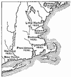
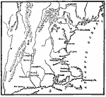
New England Colonies, 1620–1638
A map of the New England colonies showing the early permanent Pilgrim settlements and their dates of establishment, including Plymouth (1620), Little Harbor, New Hampshire (1623), Pemaquid, Maine (1625), Salem, Massachusetts (1628), Boston (1630), Pr...

New England Colonies, 1620–1641
A map of the New England Colonies showing the westward expansion of the Pilgrims from Plymouth (1620) to Stamford, Connecticut (1641). The map shows settlements in the area with dates of establishment given, colony boundaries, New Netherlands and the...

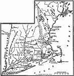
The Chief Settlements made in New England, 1620–1675
A map of the New England region showing the chief early European settlements between 1620–1675. The map shows rivers, terrain and coastal features, the coastal settlements of Pemaquid, Saco, Dover, Portsmouth, Salem, Cambridge, Watertown, Bosto...

Middle Colonies, 1620–1702
A map of the New Jersey Colony between the establishment of the Dutch settlement at Bergen (1620) and the unification of East and West Jersey in 1702. The map shows the ‘North River’ (Hudson River) and ‘South River’ (Delaware ...

First Previous Next Last


  Maps > United States > Early America 1400-1800
Site Map  

Maps ETC is a part of the Educational Technology Clearinghouse
Produced by the Florida Center for Instructional Technology © 2009
College of Education, University of South Florida