Maps Site map
  Maps > United States > Regional Maps >Eastern States
Site Map  

  Record   1   to   10  of   17

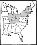
States Controlled by Protectionists, 1828
States controlled by Protectionists. ...

Routes of the Underground Railroad, 1830–1865
The routes of the Underground Railroad, 1830-1865. ...

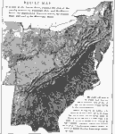
Relief Map of the States East of the Mississippi River, 1872
A relief map from 1872 of the United States east of the Mississippi River. This map was used as a classroom exercise, giving instructions for the pupils to locate specific points on the map. The map shows terrain features of the Appalachian Mountain ...

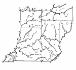
Drawing Ohio, Indiana, and Kentucky, 1872
Illustrates instructions for drawing Ohio, Indiana, and Kentucky....

Eastern North America, 1903
Eastern North America in 1903....

The North Eastern Section of the United States, 1904
The Northeastern section of United States from the confluence of the Mississippi and Ohio Rivers, showing state boundaries, major cities, railroad lines, canals and navigational rivers. Physical features such as mountain ranges with elevation measure...

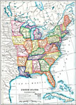
The Eastern United States, 1910
A map from 1910 of the eastern part of the United States showing state lines, capitals and major cities, lakes, and rivers....

The Fall Line, 1910
A map from 1910 of the eastern region of the United States showing the natural feature known as the Fall Line of the Atlantic Coastal Plain. There are rapids and falls along this line because the streams have been able to dig more rapidly into the so...

Drainage of the Appalachian Region, 1911
A map from 1911 of the Appalachian mountain system showing the watershed drainage in the Appalachian region. The map shows the Appalachian Plateau, Cumberland Plateau, the ridge system of the Allegheny Front, the Blue Ridge system, Piedmont Plateau, ...

The Southern Appalachians, 1911
A map from 1911 of the southern Appalachian mountain system showing the deformed Cretaceous Peneplain, and the areas not reduced to base level by wasting. The map is keyed to show the area of the coastal plain, bordering plateaus, the Great Appalachi...

Next Last


  Maps > United States > Regional Maps >Eastern States
Site Map  

Maps is a part of the Educational Technology Clearinghouse
Produced by the Florida Center for Instructional Technology © 2009
College of Education , University of South Florida