| Maps > United States > Rhode Island |
 |
Rhode Island, 1600's Map of Rhode Island. |
 |
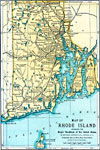
Rhode Island, 1872 Physical map of Rhode Island with map inserts of Providence, Newport, and Block Island. Includes railroads and time zones. |
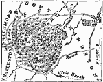 |
Narragansett Fort and Swamp, 1872 The swamp is a short distance S.W. from the village of Kingston, in the town of South Kingston, Washington County, Rhode Island. |
 |
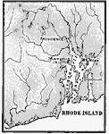
Narragansett Bay, 1872 Narragansett Bay is in the eastern part of the state of Rhode Island, and is twenty-eight miles long from N to S, and from eight to twelve broad. |
 |
Rhode Island, 1891 A map of Rhode Island in 1891. |
 |
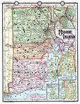
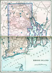
Rhode Island, 1906 Map of Rhode Island in 1906. |
 |
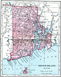
Rhode Island, Post World War I Map of Rhode Island. |
 |
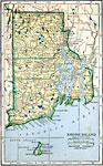
Rhode Island, 1922 Physical map of Rhode Island. |
| Maps > United States > Rhode Island |
Maps is a part of the Educational Technology Clearinghouse
Produced by the Florida Center for Instructional Technology © 2007
College of Education, University of South Florida