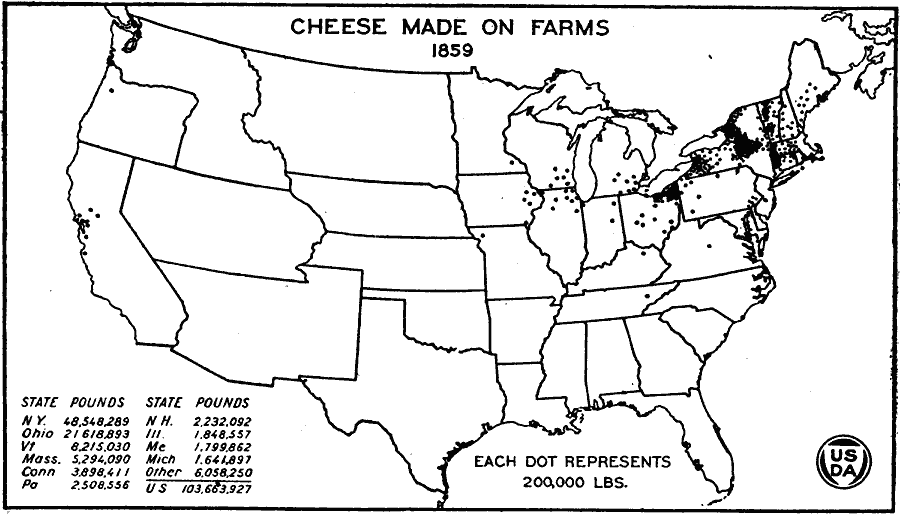
Description: A map of the United States from the U. S. Department of Agriculture (1922) showing the distribution of cheese made on farms by state in 1859. "Some cheese was reported from California and Oregon for 1859. Minnesota was another new State to report about 200,000 pounds of cheese. Increases may be noted in Wisconsin, Iowa, and Michigan, on the other hand, reductions in New England." — United States Department of Agriculture Yearbook 1922, 1923.
Place Names: Agriculture, New York, Ohio, Vermont, Massachusetts, Connecticut, Pennsylvania, New Hampshire, Illinois, Maine, Michigan, �chees
ISO Topic Categories: boundaries,
inlandWaters,
farming,
economy
Keywords: Cheese Made on Farms, physical, �political, �statistical, �cheese made on farms, cheese production by state, kAgriculture, physical features, country borders,
major political subdivisions, agriculture,
economic, boundaries,
inlandWaters,
farming,
economy, Unknown, 1859
Source: , United States Department of Agriculture Yearbook 1922 (Washington, DC: Government Printing Office, 1923) 307
Map Credit: Courtesy the private collection of Roy Winkelman |
|