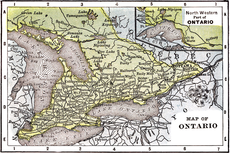
Description: A map from 1904 of Ontario showing major cities and towns, railways, rivers, lakes, and the frontier with Quebec. An inset map shows the northwestern portion of the province along Lake Superior. "Ontario is the most important Province of Canada. Principal products, grain, fruit, lumber, petroleum, copper and iron. The population of Ontario is one–third of the whole Dominion. Toronto, the capital, is the manufacturing and educational center. The population of the Province is largely of British descent." — Wark 1904.
Place Names: Canada, Ottawa, �Lake Ontario, �Lake Erie, �Lake Huron, ��Montrea
ISO Topic Categories: society,
inlandWaters,
transportation
Keywords: Ontario, physical, �political, �transportation, physical features, country borders,
major political subdivisions, railroads, society,
inlandWaters,
transportation, Unknown, 1904
Source: Henry Wark, ed. , Wark's Modern Educator (New York, NY: Henry Wark, 1904) 882
Map Credit: Courtesy the private collection of Roy Winkelman |
|