mapsMaps ETC Site map
 Maps ETC > Africa > A Complete Map of Africa > Africa, 1914
Site Map 

Africa, 1914


Puzzle Directions: Click on a puzzle piece and drag it where you want it. When you connect two pieces correctly, they will join together. Mix up the pieces again. View finished map in pop-up window.

Title: Africa
Projection: Unknown, Unknown
Source Bounding Coordinates:
W: -35 E: 65 N: 35 S: -35

Back to Map Page
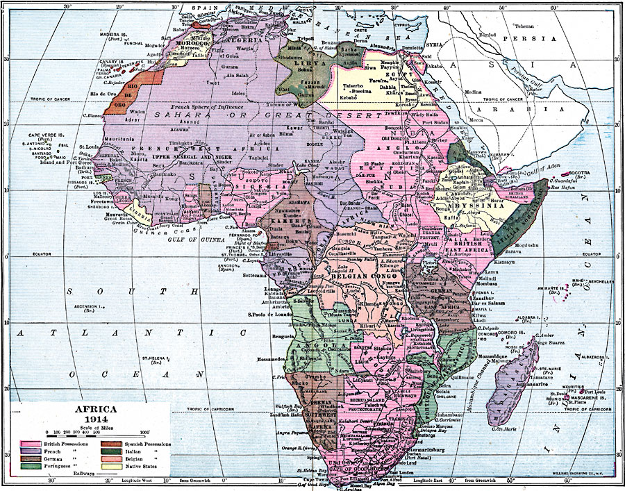
Description: A map of Africa in 1914, showing the presence of European powers, including British, French, German, Portuguese, Spanish, Italian, and Belgian possessions. Native states, major cities and major railways are also shown.
Source: Lucius Hudson Holt, Ph.D., The History of Europe from 1862 to 1914 (New York, NY: The Macmillan Company, 1918) 334
Map Credit: The Private Collection of Roy Winkelman
SearchLicensePDF HelpGIS Help Google Earth Help Zoomify Help

 Maps ETC > Africa > A Complete Map of Africa > Africa, 1914