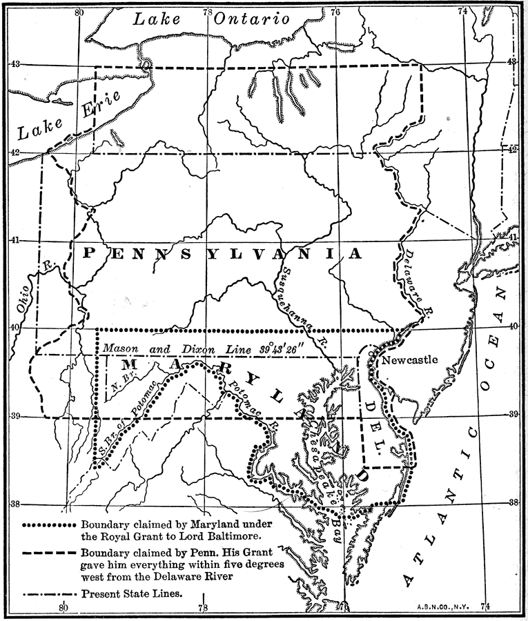
Description: A map showing the boundary dispute between the British colonies of Pennsylvania, Maryland, and Delaware between 1681 and 1767. The map shows the lands in dispute, as English King Charles II paid his debt to William Penn by issuing him a charter for the proprietary colony of Pennsylvania and later Delaware (1681). This charter involved Penn in a dispute with the state of Maryland which was unsettled during his lifetime. A compromise was made and the present boundary, known as the Mason-Dixon line (named for the surveyors Charles Mason and Jeremiah Dixon), between Maryland and Pennsylvania was agreed upon in 1767.
Place Names: Early America 1400-1800, Delaware, �Maryland, �Pennsylvania, �Colonial America, �Englis
ISO Topic Categories: location,
inlandWaters,
oceans,
boundaries
Keywords: Boundary Dispute between Maryland and Pennsylvania, historical, �location, �physical, �political, �disputed boundaries, physical features, major political subdivisions, historical event, location,
inlandWaters,
oceans,
boundaries, Unknown, 1681–1767
Source: Nathaniel Wright Stephenson, An American History (Boston, MA: Ginn and Company, 1913) 94
Map Credit: Courtesy the private collection of Roy Winkelman |
|