| Maps > Miscellaneous > Miscellaneous |
|
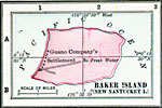
Baker Island (New Nantucket Island), Map of Baker Island (New Nantucket Island) in 1906. |
|
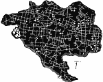
Catacombs of Callixtus, A map showing part of the Catacomb of Callixtus. |
|
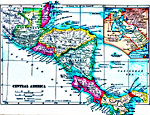
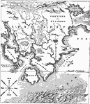
Central America, Map of Central America in 1919. |
|
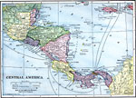
Central America, Map of Central America. |
|
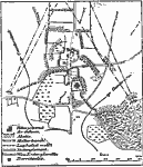
Defense of Towns and Villages, A map illustrating the defense of towns or villages. |
|
Geographical Features, A map illustrating terms used in geography, and their pictorial representations. |
|
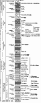
Geological Strata, A chart showing the various levels of geological strata. |
|
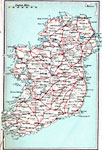
High Roads of Ireland, High Roads of Ireland |
|
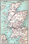
High Roads of Scotland, High Roads of Scotland |
|
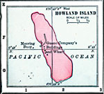
Howland Island, Map of Howland Island in 1906. |
|
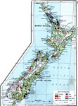
New Zealand, A map showing main economic products & principal railways throughout New Zealand. |
|
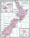
New Zealand, Map of New Zealand in 1906. |
|
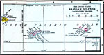
Samoan Islands (Navigators Islands), Map of the Samoan Islands (Navigators Islands) in 1906. |
|
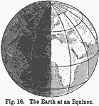
The Earth at an Equinox, Map showing the Earth at an equinox. |
|
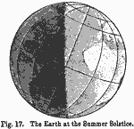
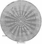
The Earth at the Summer Solstice, Map showing the Earth at the summer solstice. |
|
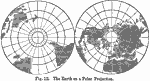
The Earth on a Polar Projection, Map of the Earth. |
|
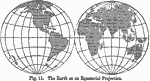
The Earth on an Equatorial Projection, Map of the Earth. |

|
The Earth on Mercator's Projection, Map of the Earth. |
|
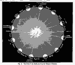
The Orbit of the Earth Showing the Change of Season, Map showing the orbit of the Earth illustrating the change of seasons. |
|
The Solar System, Map of the Solar System. |
|
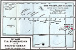
The Westward Islands in the North Pacific Ocean, Map of the Westward Islands in 1906. |
|
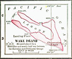
Wake Island, Map of Wake Island in 1906. |
|
Water Table, |
|
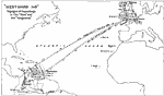
"Westward Ho" , Voyages of Amya Leigh in the "Rose" and the "Vengeance" |
| Maps > Miscellaneous > Miscellaneous |
Maps is a part of the Educational Technology Clearinghouse
Produced by the Florida Center for Instructional Technology © 2007
College of Education, University of South Florida