| Maps > United States > Massachussetts |
 |
Shell Heaps on Cape Cod, A map of the Cape Cod region, showing the shell heaps that mark the sites of Indian settlements. |
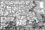 |
Map of Massachusetts, Map of Massachusetts. |
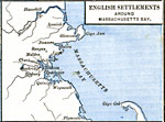 |
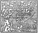
English Settlements around Massachusetts Bay, 1492-1620 Map shows English Settlements around Massachusetts Bay. |
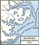 |
Raleigh's Explorations, 1584, 1492-1620 Map shows Raleigh's Explorations, 1584. |
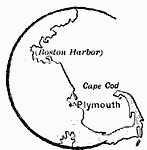 |
Plymouth, 1620 A map showing the region of Massachusetts around Plymouth. |
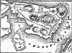 |
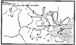
Battle of Bunker Hill, 1775 Plan of the Battle of Bunker Hill, fought during the American Revolutionary War. |
 |
Siege of Boston, 1775 A map showing the seige of Boston. |
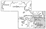 |
Massachusetts, 1775 A map of Massachusetts, at the outbreak of the American Revolution. |
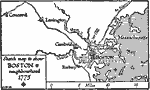 |
Boston and Neighborhood, 1775, 1775 A sketch map to show Boston and neighborhood, 1775. |
 |
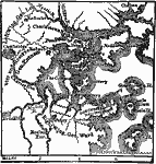
Plan of the Siege of Boston, 1775 A map showing the plan of the siege of Boston. |
 |
Boston and vicinity, 1775-6, 1775-1776 Map showing Boston and vicinity, 1775-1776. |
 |
The Campaign around Boston, 1775-1776, 1775-1776 Map showing the campaign around Boston, 1775-1776. |
 |
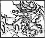
Vinland, 1837 A map fof the area around Boston, Massachusetts, proposed by Rafn to have been settled by early Norse explorers before the time of Columbus. |
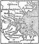 |
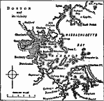
Vicinity of Boston, 1872 Boston, the largest town in New England, and the capital of Massachusetts, is situated on a peninsula of an uneven surface, two miles long and about one miles wide, conneceted with the mainland, on the south, by a narrow neck about forty rods across. |
 |
Connecticut River Valley, 1872 Valley of the Connecticut River in Massachusetts. |
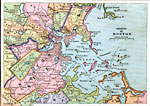 |
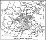
Boston Vicinity, 1883 Boston and vicinity. |
 |
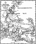
Massachusetts, 1891 A map of Massachusetts in 1891. |
 |
Boston, 1901 City of Boston and the vicinity. |
 |
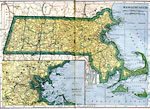
Massachusetts, 1906 Map of Massachusetts in 1906. |
 |
Boston and Vicinity, 1916 A map of Boston and the surrounding vicinity in 1916. |
 |
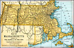
Massachusetts, 1919 A map of Massachusetts in 1919, showing railway routes and cities. |
 |
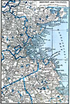
Boston and Vicinity, 1919 A map showing Boston and the surrounding vicinity around 1919. |
 |
Massachusetts, Post World War I Map of Massachusetts. |
 |
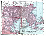
Massachusetts, 1922 Physical map of Massachusetts. |
 |
Boston and Vicinity, 1922 Boston and neighboring counties. |
| Maps > United States > Massachussetts |
Maps is a part of the Educational Technology Clearinghouse
Produced by the Florida Center for Instructional Technology © 2007
College of Education, University of South Florida