| Maps > United States > Pennsylvania |
 |
Preglacial Drainage of Western Pennsylvania, A map showing the probable preglacial drainage of western Pennsylvania, the limit of glaciation is shown by the broken crossed line. |
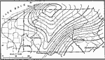 |
Tertiary Peneplain of the Central Appalachians, A map showing the warped surface of the early Tertiary (Harrisburg) peneplain of the central Appalachians. |
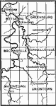 |
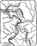
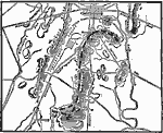
Past and Present Courses of Monongahela and Youghiogheny Rivers, A map showing the present and pre-Pleistocene courses of Monongahela (left) and Youghiogheny rivers. |
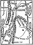 |
Vicinity of Gettysburg, A map showing the vicinity of Gettysburg during the Civil War. |
 |
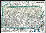
Map of Pennsylvania, Map of Pennsylvania. |
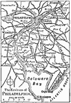 |
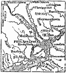
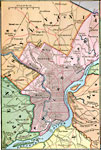
The Environs of Philadelphia, Map of the vicinity of Philadelphia, Pennsylvania. |
 |
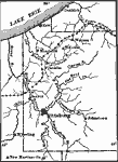
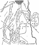
Braddock's Defeat, 1755 A map showing the scene of General Braddock's defeat during the French and Indian War, near present-day Pittsburg. |
 |
Battle of Gettysburg, 1863 A plan of the Battle of Gettysburg, which took place between July 1-3, 1863. |
 |
Gettysburg, July 1863 Battle of Gettysburg in the American Civil War. July 2, 3, 4 shown. |
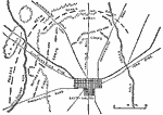 |
Gettysburg, July 1, 1863 Battle of Gettysburg in the American Civil War. July 1 shown. |
 |
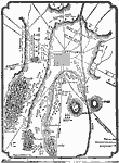
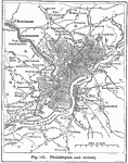
Philadelphia and Vicinity, 1872 A map of Philadelphia and its vicinity. |
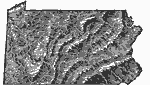 |
Relief Map of Pennsylvania, 1872 Relief map of Pennsylvania. |
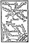 |
West of Philadelphia, 1872 A map showing the area west of Philadelphia. |
 |
Philadelphia Vicinity, 1883 Philadelphia and vicinity. |
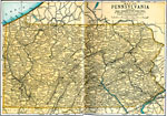 |
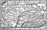
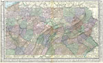
Pennsylvania, 1891 A map of Pennsylvania in 1891. |
 |
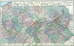
Pennsylvania, 1906 Map of Pennsylvania in 1906. |
 |
Battle of Gettysburg, 1910 A map showing the positions of the armies at the Battle of Gettysburg. |
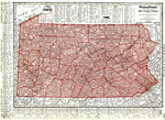 |
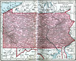
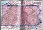
Pennsylvania, 1912 A map of Pennsylvania in 1912. |
 |
Philadelphia and Vicinity, 1916 A map of Philadelphia and the surrounding vicinity in 1916. |
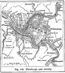 |
Pittsburg and Vicinity, 1916 A 1916 map of Pittsburg and the surrounding vicinity. |
 |
Pennsylvania, 1919 A map of Pennsylvania in 1919, showing cities and railway routes. |
 |
Pennsylvania, 1920 Map of Pennsylvania. |
 |
Pennsylvania, 1920 Physical map of Pennsylvania. |
 |
Pennsylvania, 1922 Physical map of Pennsylvania. |
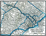 |
Philadelphia and Vicinity, 1922 Philadelphia and neighboring counties. |
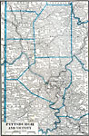 |
Pittsburgh and Vicinity, 1922 Pittsburgh and neighboring counties. |
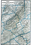 |
Anthracite Region, 1922 The anthracite region in northeast Pennsylvania. |
| Maps > United States > Pennsylvania |
Maps is a part of the Educational Technology Clearinghouse
Produced by the Florida Center for Instructional Technology © 2007
College of Education, University of South Florida