The 1763-1788 American Revolution Places ClipArt gallery provides 303 illustrations of the Apollo Room, Carpenter's Hall, Concord, Faneuil Hall, Mount Vernon, the Old South Meeting House, and other locations associated with the American War for Independence.
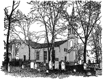
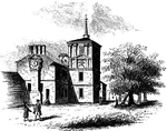
St. John's Church
"St. John's Church, Richmond, VA. Where the famous orator Patrick Henry made is great speech." -Gordy,…
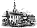
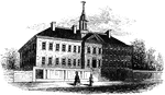
State House
"Walnut Street front of the State House in 1776. This gives the appearance of the shorter steeple, which…
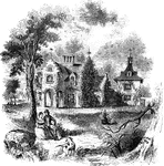
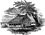
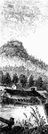
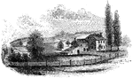
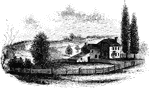
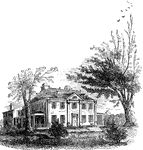
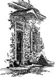
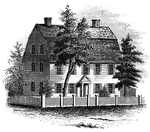
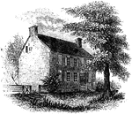
Steuben's Head-Quarters
Steuben's head-quarters. This view is from the field in front of the house, looking north. The dwelling…
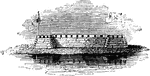
Stony Point
"Rear view at Stony Point. This sketch presents a rear view of the old embankments of the fort, and…
Stony Point
The Battle of Stony Point was a battle of the American Revolutionary War. Here is a view of Stony Point…
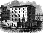
Sugar House in Liberty Street
Perhaps the worst of all the New York prisons during the American Revolution was the third Sugar House,…
Sunnyside
"View of 'Sunnyside,' the residence of Washington Irving. Built by Wolfert Ecker and known famously…
Tappan head-quarters
"Washington's head-quarters at Tappan. This view is from the yard, near the well. The date of its erection…
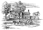
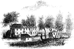
Tavern at Elizabethport
Old Tavern at Elizabethport. This view is looking eastward. In the distance, on the right, is seen a…
Temple
"The Temple. This view is from the site of the Temple, looking southeast. In the distance is…
The Billop House
The Conference House (also known as the Bentley Manor and the Captain Christopher Billop House)was built…
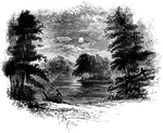
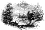
The Falls
View below the Falls. This view was taken from under the bridge, looking down the river. The cave opens…
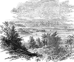
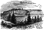
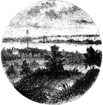
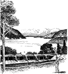
Ticonderoga and the Lake, from Mount Defiance
The crossing between Lakes George and Champlain had been used by natives for thousands of years. The…
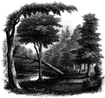
Toby's Eddy
View near Toby's Eddy. The Moravians had established six missionary settlements in the vicinity of the…
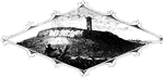
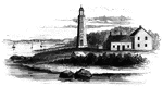
Tonomy Hill
"Top of Tonomy Hill. This view is from the northside of the hill, looking south. The wall appearance…
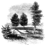
Torn Rock
"Torn Rock. This view is from the verge of the dam above the Ramapo works, near the rail-way, looking…
Trading Ford
"Trading Ford. This view of the Trading Ford, where greene, with Morgan and his light troops, crossed…
Trenton
"Trenton Bridge and vicinity. This view is from the north side of the Assanpink, a few rods above the…
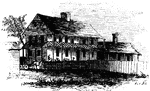
Governor Jonathan Trumbull House
John Trumbull Birthplace, also known as Governor Jonathan Trumbull House, is a house on Lebanon Green,…
Governor Trumbull's War Office
Jonathan Trumbull, Sr. (12 October 1710 – 17 August 1785) was one of the few men who served as…
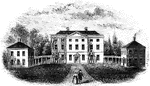
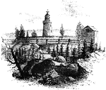
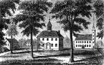
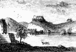
Tryon Palace
"Front view of Tryon's Palace. The view here given was the north front, toward the town. The center…
Tuckesege Ford
"View at Tuckesege Ford. This view is from the western bank of the Catawba, looking down the stream."—Lossing,…
Turtle Bay
"View at Turtle Bay. Turtle Bay is a small rock-bound cove of the East River, at the foot of Forty-seventh…
Washington's Headquarters at Valley Forge
The headquarters in Valley Forge of General George Washington during the American Revolution.
Van Cortlandt's Sugar House
Van Cortlandt's Sugar House was a famous (or infamous) prison of the Revolution. It stood on the northwest…
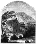
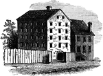
Van Schaick's Mill
Van Schaick's Mill. This view is taken from the left bank of the Walloomscoick, a little below the bridge.…
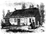
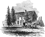
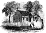
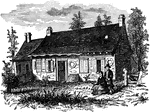
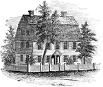
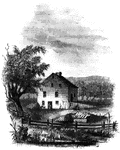
Vankleek House
The Vankleek House. It was built by Myndert Vankleek, one of the first settlers in Dutchess county,…
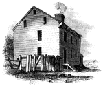
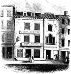
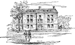
Walnut Street Prison
"The Walnut Street Prison. This edifice was erected in 1774, and taken down in 1836. The beautiful new…
Washington's head-quarters
"Washington's head-quarters. This view is from the Reading rail-road, looking east, and includes a portion…
Washington's Head-Quarters
"Washington's head-quarters. I was informed by the venerable Anna van Antwerp, about a fortnight before…
Washington's Head-Quarters
"Washington's head-quarters. The house occupied by Washington while the army was at White Plains is…
Washington's Headquarters at Cambridge, 1775
Washington used the home as his headquarters and home while he planned the Siege of Boston between July…
Washington's Headquarters at Morristown
The Ford Mansion is part of the Morristown National Historical Park, and is located on a hilltop in…
Washington's Headquarters at New York
The Morris-Jumel Mansion (also known as the Roger and Mary Philipse Morris House), located in historic…
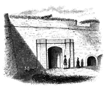
Entrance to Washington's Headquarters, Newburgh
Hasbrouck House served as Washington's headquarters during the Revolutionary War from April 1782 until…
Washington's Quarters
"Washington's Quarters. This is a view of the southwest front of the mansion. The room occupied by Washington…
Fort Washington
"View at Fort Washington. This is a view from the site of the interior works at Fort Washington from…
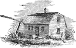
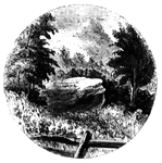
Fort Watson
"Site of Fort Watson."—Lossing, 1851 The Siege of Fort Watson was an American Revolutionary War confrontation…
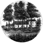
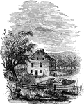
Webb House
The Webb House. This house is still standing (1848), in the central part of Wethersfield, a few rods…
The Webb House
Joseph Webb House is a historic Georgian-style house in Wethersfield, Connecticut that was the site…
West Point
"West Point in 1780. This view is from a print published in the New York Magazine for 1790.…
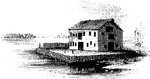
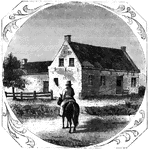
Whitall's House at Red Bank
"South of the fort a short distance was a brick house with 'I.A.W. 1748' on one of the gables, the initials…
William's Rock
William's Rock. This view is taken from the road, looking northward. In the distance is seen the highest…
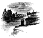
Williams landing-place
"Landing-place of Roger Williams. This view is on the left bank of the Seekonk, looking south. The point…
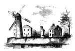
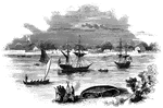
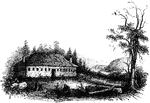
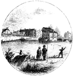
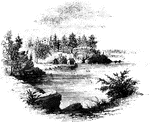
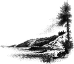
Wind-Mill Point
Wind-mill Point. This view was sketched from the steam-boat, when a little below the wind-mill, looking…
Site of Wintermoot's Fort
The Battle of Wyoming was an encounter during the American Revolutionary War between American Patriots…
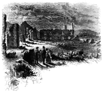
Wintermoot's Fort
Site of Wintermoot's Fort. This view is from the ancient bed of the Susquehanna, looking west. The building,…
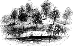
Wolfe's Ravine
Wolfe's Ravine. This scene is about half way up the ravine from Wolfe's Cove, looking down the road,…