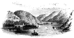
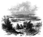
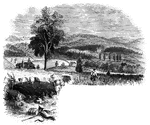
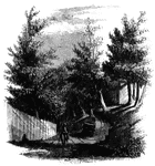
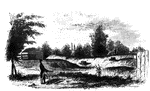
Roger's Rock
Roger's Rock. This sketch is from the lake, a little south of Cook's Point, seen just over the boat…
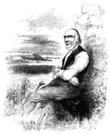
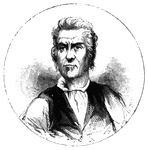
Isaac Rice
Isaac Rice was the name of our octegenarian guide. Like scores of those who fought our battles for freedom,…
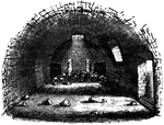
Bakery
The bakery. Near the southeastern angle of the range of barracks is the bakery; it is an under-ground…
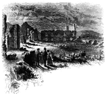
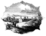
Fort Anne
Site of Fort Anne. This view is from the bridge which crosses Wood Creek, looking south. The distant…
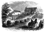
Battleground near Fort Anne
Battleground near Fort Anne. This sketch was taken from the rail-road, looking north. The forest upon…
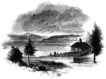
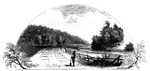
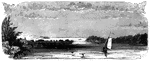
Sholes's Landing
View from Shole's Landing. This is a view from Chipman's Point, or Sholes's Landing, looking north.…
Chimney Point
Chimney Point Landing. This view is taken from the green in front of the inn at Chimney Point, looking…
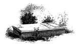
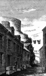
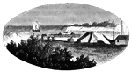
Western Line of Barracks
Western line of barracks. There were four large buildings used for barracks within the fort, the walls…
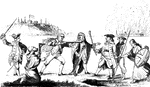
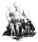
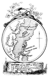
Representation of 1775
Virtual representation, 1775. 1. One String Jack, Deliver your property. 2. Begar, just so in France.…
Ethan Allen Tomb
Tomb of Ethan Allen as seen in 1851. Shortly thereafter, this original plaque disappeared. In 1858,…
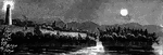
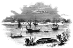
Arnold's Battle
Scene of Arnold's naval battle. This sketch was made from the pilot's room of the steam-boat just after…
Isle Aux Noix
Isle Aux Noix, in the Sorel. The sketch was made from the pilot's room of the steam-boat, about half…
St. John's
Military establishment at St. John's. This view is taken from the eastern side of the river, near the…
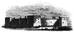
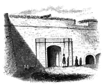
Fort at Chambly
Fort at Chambly, this is a view of the south and west sides of the fort, looking toward the river. It…

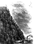
Beloeil Mountain
Beloeil Mountain, this sketch is taken from the southeast angle of old Fort chambly, showing the rapids…
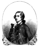
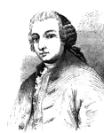
Sir Guy Carleton
Sir Guy Carleton, afterward Lord Dorchester, was Wolfe's quartermaster at the storming of Quebec, and…
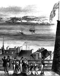
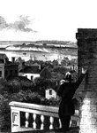
Point Levi
View of Point Levi from Durham Terrace, Quebec. This sketch is taken from Durham Terrace, near the north…
Wolfe's Ravine
Wolfe's Ravine. This scene is about half way up the ravine from Wolfe's Cove, looking down the road,…
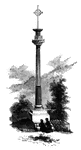
Wolfe's Monument
Wolfe's Monument. Since 1848, the remains of this monument have been removed, and a column forty feet…
Cape Diamond
Cape Diamond, this is a view of the spot where Montgomery was killed. The cliff is Cape Diamond, crowned…
Arnold Wounded
Place where Arnold was wounded. This view is in a narrow alley near the north end of Sault au Matelot…
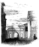
Palace Gate
Palace Gate, outside. This is one of the most beautiful gates of the city, and opens toward the St.…
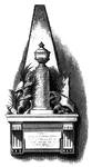
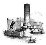
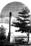
Richard Montgomery's Monument
Richard Montgomery's Monument, states: "This monument is erected by order of Congress, 25th of January,…
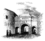
Palace Gate
Palace Gate, inside. This sketch is a view from within Palace Street, looking out upon the open country…
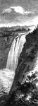
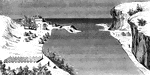
Cascades
The Cascades, on St. Ann's Rapids. These rapids are so called from the cirumstance that a village of…
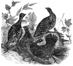
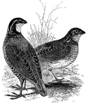
Canada Grouse
Also known as the spotted or spruce grouse, the Canada grouse is found in the northerly latitudes of…
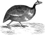
Guinea Fowl
The Guinea-fowl (or pintado) was originally native to Africa, but was introduced to American poultry-yards.
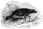
Common American Carolina Rail
Also known as the Carolina rail, soree rail, and the English rail, the common American rail is found…
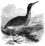
American Bittern
Measuring approximately twenty-six inches in length, the American bittern is a nocturnal hunter. It…
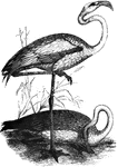
Flamingoes
The American flamingo stands about five feet tall, and is found throught tropical America, including…
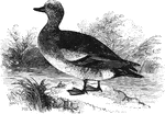
American Widgeon
The American widgeon (or baldpate) averages about nineteen inches in length. It is common in North America,…
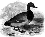
American Scaup Duck
The American scaup duck is common in North America, accidental in Europe. It is also known as the creek…
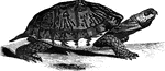
American box-tortoise
Posessing a nearly perfectly hemispherical shell, the American box turtle ranges from Canada to Florida.…
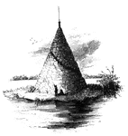
Cairn
Cairn on the St. Lawrence. This is probably the only structure of the kind on the American continent.…
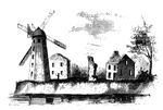
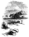
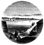
Wind-Mill Point
Wind-mill Point. This view was sketched from the steam-boat, when a little below the wind-mill, looking…
Oswego
Oswego in 1755. This view is looking north toward the lake. It is a reduced copy of the frontispiece…
Fort Oswego
View of Oswego and the Fort in 1798. This view is from the west side of the river, near the site of…
Oswego Harbor
View of Oswego Harbor, 1848. This view is from the top of the United States Hotel, looking east-northeast.…