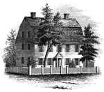
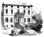
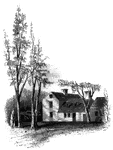
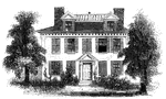
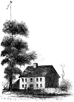
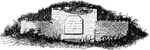
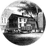
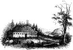
Webb House
The Webb House. This house is still standing (1848), in the central part of Wethersfield, a few rods…

Pine-Tree Shilling
The Pine-Tree Shilling. This is a fac-simile of the first money coined in America. The mint-master,…
Liberty Tree
"Liberty Tree. I am indebted to the Hon. David Sears, of Boston, for this sketch of the 'Liberty Tree,'…
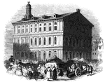
Province House
"The Province House. The Province House, the residence of the colonial governors, is still standing,…
Faneuil Hall
"Faneuil Hall has been denominated 'the cradle of American liberty,' having been the popular gathering-place…
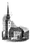
Old South
"The Old South. This venerable and venerated edifice, that stood through all the storms of the Revolution,…
Hancock's House
"Hancock's House, Boston. This is a substantial stone building, situated upon Beacon Street, fronting…
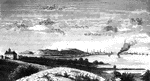
Boston
"View of Boston from Dorchester Heights in 1774. This picture is from an English print of the time.…
Clark's House
"Clark's House, Lexington. This building was standing when I visited Lexington in 1848. It was built…
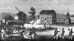
Skirmish at Lexington
"Skirmish at Lexington. The largest building in the picture is the meeting-house, and the officer on…
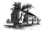
Barrett's House
"Colonel Barrett's House. This sketch is from the road leading to the village of Concord by the way…
Treasury Note
"Reverse of a Massachusetts Treasury note. This is a fac simile of the device on the back of one of…
Charlestown
"Charlestown in 1775. No. 1 is Bunker Hill; 2, Breed's Hill; 3, Moulton's Point; 4, a causeway near…
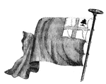
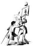
New England Flag
"The New England flag. This is copied from an old Dutch work, preserved in the library of the New York…
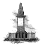
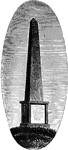
Lexington Monument
"Monument at Lexington. This view is from the Concord Road, looking eastward, and shows a portion of…
Riedesel House
"The Riedesel House, Cambridge. This is from a pencil sketch by Mr. Longfellow. I am also indebted to…
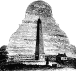
Bunker Hill Monument
"Bunker Hill Monument. This monument stands in the center of the grounds included within the breast-works…
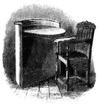
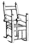
Speaker's Desk and Winslow's Chair
"Speaker's desk and Winslow's chair. This desk is made of ash. The semicircular front is about three…
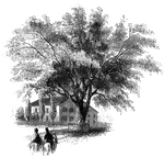
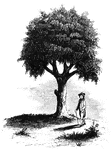
Washington Elm
"The Washington Elm. The horse seen in this sketch is one of the oldest in Cambridge, having been built…
Pine-Tree Flag
"The Pine-Tree Flag. This engraving is a reduced copy of a vignette on a map of Boston, published in…
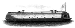
Floating Battery
"American Floating Battery. I am indebted to the kindness of Peter Force, Esq., of Washington city (editor…
New London Harbor
"New London Harbor, looking north. This little sketch shows the relative position of the forts. Fort…
Arnold Landing-place
"View of the landing-place of Arnold. This sketch is from the west side of the cove in which the troops…
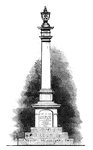
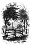
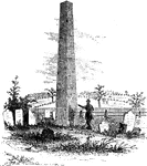
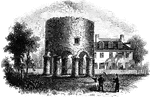
Groton Monument
"Monument at Groton. This is a view from the southwest angle of old Fort Griswold, looking northeast.…
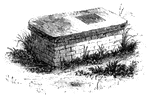
Seabury's Monument
"Bishop Seabury's Monument. The following is the inscription upon the slab: 'Here lieth the body of…
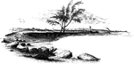
Williams landing-place
"Landing-place of Roger Williams. This view is on the left bank of the Seekonk, looking south. The point…
Providence Tavern
"Old Tavern in Providence. This view is from the market, looking north. The building stands on the east…
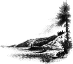
Gaspee Point
"Gaspee Point. This view is from the bank of the cove just below the Point, looking northeast, showing…
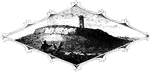
Tonomy Hill
"Top of Tonomy Hill. This view is from the northside of the hill, looking south. The wall appearance…
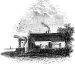
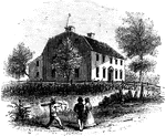
Hubbard's House and Mill
"Hubbard's House and Mill. The inscriptions upon the monument are as follows: East Side: "Oliver Hazard…
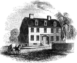
Prescott's Headquarters
"Prescott's Headquarters. This house is on the east side of the west road, about a mile from the bay.…
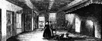
Dining-Hall
"The dining-hall, or room with seven doors. In the December number of the New York Mirror for 1834,…
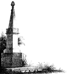
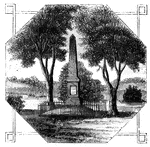
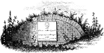
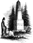
Goshen Monument
"Monument at Goshen. During the battle, Major Wood, of Goshen, made a masonic sign, by accident, which…
Plum Point
"Remains of fortifications at Plum Point. This view is from the interior of the redoubt looking eastward…
Greene and Knox Head-Quarters
"Head-quarters of Greene and Knox. This view is from the turnpike road, looking southeast. The water…

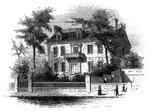
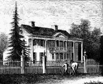
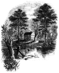
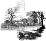
Mrs. Falls'
"Mrs. Falls'. This house, now (1850) owned by Mr. Samuel Moore, is a frame building, and stands on the…
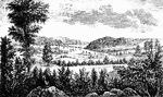
Temple
"The Temple. This view is from the site of the Temple, looking southeast. In the distance is…
Camp Ground
"View of the Camp Ground. This is from a painting by Tice, in my possession. The land on which the encampment…
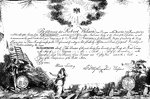
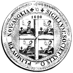
Society of the Cincinnati
"Society of the Cincinnati, member's certificate. This engraving is a fac simile of a certificate, about…
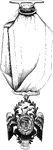
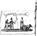
Order of the Cincinnati
"Order of the Cincinnati. This was drawn from an original in the possession of Edward Phalon, Esq.,…
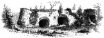
Fort Putnam
"Interior of Fort Putnam. This little sketch is a view of the remains of the casemates, or vaults, of…