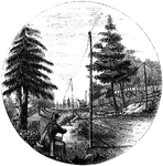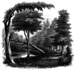
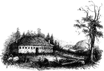
View near Toby's Eddy. The Moravians had established six missionary settlements in the vicinity of the Forks of the Delaware, or the junction of the Delaware and Lehigh Rivers, viz., Nazareth, Bethlehem, Nain, Freidenshal, Gandenthaul, and Gnadenhutten. The latter, the name of which in English is "Huts of Mercy," was founded chiefly for the accommodation and protection of those Indians who embraced the Christian faith. Hence it was the first settlement attaked by the hostile savages.

Toby's Eddy

View near Toby's Eddy. The Moravians had established six missionary settlements in the vicinity of the…
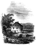
Site of Wintermoot's Fort. This view is from the ancient bed of the Susquehanna, looking west. The building, formerly the property of Colonel Jenkins, and now owned by Mr. David Goodwin, is upon the site of old Fort Wintermoot, which was destroyed at the time of the invasion in 1778. It is upon the ancient bank of the river, here from fifteen to twenty feeth high, and about sixty rods from the stream in its present channel.

Wintermoot's Fort

Site of Wintermoot's Fort. This view is from the ancient bed of the Susquehanna, looking west. The building,…

The Susquehanna at Monocasy Island. This view is from the left of eastern bank of the Susquehanna, opposite the center of Monocasy Island, looking up the river. Toward the foreground, on the right of the picture, a little beyond the bar-post, is seen a ravine, through which the fugitives who crossed the river in safety made their way. On the left are seen the upper end of Monocasy, and a sand-bar which divides the waters of the river. The distant hills on the left are those which bound the western side of the valley. From the head of Monocasy Island, across the sand-bar, the river is often fordable in summer to the eastern side.

Monocasy Island

The Susquehanna at Monocasy Island. This view is from the left of eastern bank of the Susquehanna, opposite…
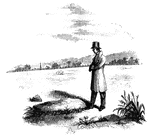
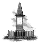
Queen Esther's Rock. This view is near the ancient river bank, looking westward. The rock is a sort of conglomerate, a large proportion of which is quartz. Some of it is of a reddish color, which the credulous believe to be stains of blood still remaining. The rock projects only about eighteen inches off the ground, and its size is denoted by the figure standing beside it. In the distance, on the left, is seen the monument which has been erected to the memory of those who fell on the occasion. This scene includes a portion of the battle-ground. The little village of Troy also occupies a part of the field of conflict.

Queen Esther's Rock

Queen Esther's Rock. This view is near the ancient river bank, looking westward. The rock is a sort…

The Yeoman House. This view is from the road, looking north. An attempt was made by a soldier to burn the house, but so rapid was the march of the invaders that the flames had made but little progress before the troops were far on their road to the village. An [African American] woman, who was concealed under some corn-stalks near, extinguished the flames. The house is about half a mile from the river, on the right side of the road from the landing to Kingston village.

Yeoman House

The Yeoman House. This view is from the road, looking north. An attempt was made by a soldier to burn…
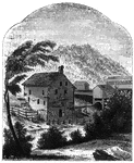
Van Schaick's Mill. This view is taken from the left bank of the Walloomscoick, a little below the bridge. The mill belonged to a Whig named Van Schaick, who had joined General Stark's collecting forces at Bennington.

Van Schaick's Mill

Van Schaick's Mill. This view is taken from the left bank of the Walloomscoick, a little below the bridge.…

The Bennington battle-ground. This view is from the hill on the southwest bank of the Walloomscoick, a little west of the road from the bridge to Starkville, looking northeast. The road over this hill existed at the time of the battle. The river, which here makes a sudden bend, is seen at two points- near the cattle, and at the bridge, in the distance, on the right. The house on the left, near the bridge, is Mr. Barnet's, and the road that crosses the center of the picture from right to left is the road from Bennington to Van Schaick's or North Hoosick. It passes along the river flat, at the foot of the hills where the battle occurred. The highest point on the distant hills, covered with woods, is the place where the Hessians were intrenched. From that point, along the hills to the left, for about two miles, the conflict was carried on; and upon the slopes, now cultivated, musket-balls and other relics of the battle have been plowed up.

Bennington Battle-ground

The Bennington battle-ground. This view is from the hill on the southwest bank of the Walloomscoick,…

Distant view of Compo. This view is from the top of a high hill northeast of the dwelling of Mr. Ebenezer Smith, near Norwalk. Its long sand-bar is seen stretching into the Sound on the right, and over the lowest extemity of the point the shade trees of Fairfield are visible. The water on the left is the mouth of the Saugatuck River, and that in the distance, on the right, is Long Island Sound.

Compo

Distant view of Compo. This view is from the top of a high hill northeast of the dwelling of Mr. Ebenezer…

Place of the barricade, Ridgefield. This view is at the north end of the main street. It was taken from the spot where, traditions asserts, Arnold's horse was killed, which is on the west side of the street, near a maple-tree, about one hundred yards southwest of the house of Samuel Stebbins, Esq., seen on the right in the picture. While making this sketch an old man came along, and informed me that on the day after the battle himself and some other boys skinned Arnold's horse, and discovered nine bullet-holes in his side. The escape of the rider seemed miraculous.

Ridgefield

Place of the barricade, Ridgefield. This view is at the north end of the main street. It was taken from…

Fitch's Point, the landing-place of the British. This view is from the west side of Gregory's Point, looking north-northwest. The promontory toward the left, covered with dark trees, is called Fort Point. There was an Indian fortification when the first settlers arrived at Norwalk. Further to the left, on the extreme edge of the picture, is seen one end of the rail-road bridge, which crosses Norwalk River. The New York and New Haven Rail-road was then in progress of construction. The point derives its name from its former proprietor, Governor Thomas Fitch, whose residence was Norwalk. He was Governor of the colony of Connecticut, and his name is among the beloved of his generation. He died July 18th, 1774, in the seventy-fifth year of his age.

Fitch's Point

Fitch's Point, the landing-place of the British. This view is from the west side of Gregory's Point,…
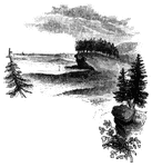
Savin's Rock. This is a view of the spot where Farth landed, in Orange, formerly West Haven. It is between three and four miles below New Haven, on the western side of the harbor entrance, and is a place of considerable resort in summer for the people of the city.

Savin's Rock

Savin's Rock. This is a view of the spot where Farth landed, in Orange, formerly West Haven. It is between…

West Bridge and Milford Hill. This view is from the Milford Road, eastward of West Bridge. The high ground in the distance is Milford Mill, on which is seen on the road, directly over the umbrella. A little to the right of the road is the spot where Major Campbell was buried. West Bridge is about a mile and a half from the central part of New Haven.

Milford Hill

West Bridge and Milford Hill. This view is from the Milford Road, eastward of West Bridge. The high…
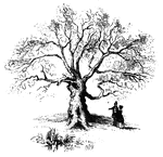
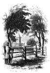
The Charter Oak. This venerable relic is still virgorous, and is a "gnarled oak" indeed. It stands upon the northern slope of the Wyllys Hill, a beautiful elevation on the south side of charter Street, a few rods east of Main Street. This engraving is from a sketch which I made of the tree from Charter Street, on the 3d of October, 1848. I omitted the picket fence in front, in order to show the appearance of the whole trunk.

Charter Oak

The Charter Oak. This venerable relic is still virgorous, and is a "gnarled oak" indeed. It stands upon…
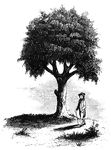
"Liberty Tree. I am indebted to the Hon. David Sears, of Boston, for this sketch of the 'Liberty Tree,' as it appeared just previous to its destruction by the British troops and Tories, during the siege of Boston in August, 1775. Mr. Sears has erected a row of fine buildings upon the site of the old grove of elms, of which this tree was one; and within a niche, on the front of one of them, and exactly over the spot where the <em>Liberty Tree</em> stood, he has placed a sculptured representation of it, as seen in the picture. From the time of the Stamp Act excitement until the armed possession of Boston by General Gage and his troops in 1774, that tree had been the rallying-place for the patriots, and had fallen, in consequence, much in disfavor with the friends of government. It was inscribed 'Liberty Tree,' and the ground under it was called 'Liberty Hall.' The Essex Gazette of August 31st, 1775, in describing the destruction of the tree, says, 'They made a furious attack upon it. After a long spell of laughing and grinning, sweating, swearing, and foaming with malice diabolical, they cut down the tree because it bore the name of liberty. A soldier was killed by falling from one of its branches during the operation.'"&mdash;Lossing, 1851

Liberty Tree

"Liberty Tree. I am indebted to the Hon. David Sears, of Boston, for this sketch of the 'Liberty Tree,'…
A close up view of the head of a developing embryonic tadpole.

A developing tadpole's head

A close up view of the head of a developing embryonic tadpole.

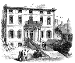
"The Province House. The Province House, the residence of the colonial governors, is still standing, in the rear of stores on Washington Street, oppposite Milk Street. It is a large brick building, three stories high, and was formerly decorated with the king's arms richly carved and gilt. A cupola surmounted the roof. In front of the house was a pretty lawn with an iron fence, and on each side of the gate was a large oak-tree. The ground sloped, and in front were about twenty stone steps. Its grounds are now covered with buildings, and the house can not be seen without entering Province Court. The king's arms are in the cabinet of the Massachusetts Historical Society."—Lossing, 1851

Province House

"The Province House. The Province House, the residence of the colonial governors, is still standing,…
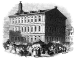
"Faneuil Hall has been denominated 'the cradle of American liberty,' having been the popular gathering-place of the Sons of Liberty during the incipient stages of the Revolution. It was erected in 1742, at the sole expense of Peter Faneuil, Esq., of Boston, and by him generously given to the town-the basement for a market, with a spacious and most beautiful hall, and other convenient rooms above, for public meetings of the citizens. It was burned in 1761, nothing but the brick walls remaining. The town immediately ordered it to be rebuilt. Mr. Faneuil had then been dead several years. The engraving shows it as it appeared during the Revolution. It was enlarged in 1805, by the addition of another story, and an increase of forty feet in its width. The hall is about eighty feet square, and contains some fine paintings of distinguished men. The lower part is no longer used as a market. From the cupola is obtained a fine view of the city and harbor. The original vane still turns upon the pinnacle. It is in the form of a huge grasshopper, an emblem of devouring, and significant of the original occupation of the basement story."&mdash;Lossing, 1851

Faneuil Hall

"Faneuil Hall has been denominated 'the cradle of American liberty,' having been the popular gathering-place…
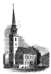
"The Old South. This venerable and venerated edifice, that stood through all the storms of the Revolution, and yet remains, stands on the corner of Washington and Milk Streets. It is of brick, and was erected in 1729-30, upon the site of an edifice built by the Pedo-baptists in 1669. The ancient church was of cedar, two stories high, with a steeple, gallery, and pews. The 'Old South' was the famous gathering-place of the people during the excitements of 1773. The British troops occupied it as a circus for the drill of cavalry in 1775, after removing all the wood-work within, except the eastern gallery and the pulpit and sounding-board. The British officers felt no compunctions in thus desecrating a Presbyterian chapel. It was repaired in 1782, and remains a fine model of our early church architecture. This view is from Washington Street."&mdash;Lossing, 1851

Old South

"The Old South. This venerable and venerated edifice, that stood through all the storms of the Revolution,…

"View of Boston from Dorchester Heights in 1774. This picture is from an English print of the time. Then the principal portion of the town was upon the eastern slope and flats. There were a few houses upon the higher ground in the vicinity of Beacon Hill, around the Common, among which was that of John Hancock. In this picture, Beacon Hill is designated by the pole, which, with its barrel, is noticed in a preceding chapter. The peninsula originally contained about seven hundred acres. The hills have been razed and the earth carried into the water, by which means the peninsula is so enlarged that it now comprises about fourteen hundred acres."&mdash;Lossing, 1851

Boston

"View of Boston from Dorchester Heights in 1774. This picture is from an English print of the time.…

"View of the lines on Boston neck."&mdash;Lossing, 1851

Boston Neck

"View of the lines on Boston neck."—Lossing, 1851

"Skirmish at Lexington. The largest building in the picture is the meeting-house, and the officer on horseback in front of it is Major Pitcairn. The figures in the foreground are the provincial militia. The dwelling with the two chimneys on the left (which is still standing), was Buckman's Tavern. The position of the monument since erected upon Lexington Green, is about where the provincials on the left are seen dispersing. The merit of this picture consists in its truthfulness in depicting the appearance of the spot at the time of the engagement."&mdash;Lossing, 1851

Skirmish at Lexington

"Skirmish at Lexington. The largest building in the picture is the meeting-house, and the officer on…

"Charlestown in 1775. No. 1 is Bunker Hill; 2, Breed's Hill; 3, Moulton's Point; 4, a causeway near the Neck, at the foot of Bunker Hill; 5, Charlestown, at the foot of Breed's Hill. Charlestown neck is on the extreme left."&mdash;Lossing, 1851

Charlestown

"Charlestown in 1775. No. 1 is Bunker Hill; 2, Breed's Hill; 3, Moulton's Point; 4, a causeway near…
"Monument at Lexington. This view is from the Concord Road, looking eastward, and shows a portion of the inclosure of the Green. The distant building seen on the right is the old 'Buckman Tavern,' delineated in Doolittle's engraving. It now belongs to Mrs. Merriam, and exhibits many scars made by the bullets on the morning of the skirmish."&mdash;Lossing, 1851

Lexington Monument

"Monument at Lexington. This view is from the Concord Road, looking eastward, and shows a portion of…
"Monument at Lexington, up close view."&mdash;Lossing, 1851

Lexington Monument

"Monument at Lexington, up close view."—Lossing, 1851

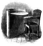
"Speaker's desk and Winslow's chair. This desk is made of ash. The semicircular front is about three feet in diameter. The chair, which belonged to Governor Winslow, is of English oak. It was made in 1614."&mdash;Lossing, 1851

Speaker's Desk and Winslow's Chair

"Speaker's desk and Winslow's chair. This desk is made of ash. The semicircular front is about three…

"View of the landing-place of Arnold. This sketch is from the west side of the cove in which the troops under Arnold landed. In the distance, on the extreme right, is the point where the division under Eyre debarked, and near the center is seen the monument on Groton Hill, near Fort Griswold. The shores of the cove are sandy, but the projections which form them are bold promontories of granite rock."—Lossing, 1851

Arnold Landing-place

"View of the landing-place of Arnold. This sketch is from the west side of the cove in which the troops…
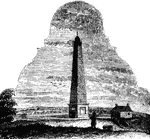
"Monument at Groton. This is a view from the southwest angle of old Fort Griswold, looking northeast. The embankments of the fort are seen in the foreground; near the figure is the well, the same mentioned by Mr. Hempstead in his narrative; and just beyond this is the old entrance, or sally-port, through which the enemy, under Broomfield, entered the fort."—Lossing, 1851

<p>It is dedicated to the defenders who fell during the Battle of Groton Heights on September 6, 1781. Built between 1826 and 1830, the Monument stands 135 feet tall with 166 steps. A plaque affixed to the monument above the entrance reads
"THIS MONUMENT WAS ERECTED UNDER THE PATRONAGE OF THE STATE OF CONNECTICUT, A.D. 1830, AND IN THE 55TH YEAR OF THE INDEPENDENCE OF THE U.S.A. IN MEMORY OF THE BRAVE PATRIOTS, WHO FELL IN THE MASSACRE AT FORT GRISWOLD, NEAR THIS SPOT, ON THE 6TH OF SEPT. A.D. 1781, WHEN THE BRITISH, UNDER THE COMMAND OF THE TRAITOR, BENEDICT ARNOLD, BURNT THE TOWNS OF NEW LONDON AND GROTON, AND SPREAD DESOLATION AND WOE THROUGHOUT THIS REGION."

Groton Monument

"Monument at Groton. This is a view from the southwest angle of old Fort Griswold, looking northeast.…
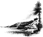
"Landing-place of Roger Williams. This view is on the left bank of the Seekonk, looking south. The point on which the figure stands is the famous rock, composed of a mass of dark slate, and rising but little above the water at high tide. The high banks are seen beyond, and on the extreme left is India Point, with the rail-road bridge near the entrance of the river into Narraganset Bay."&mdash;Lossing, 1851

Williams landing-place

"Landing-place of Roger Williams. This view is on the left bank of the Seekonk, looking south. The point…
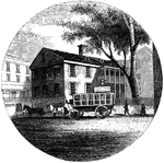
"Old Tavern in Providence. This view is from the market, looking north. The building stands on the east side of the square and parallel with its front commences North Main Street. In the yard on the right is venerable horse-chestnut tree, standing between the house and the Roger Williams' Bank. In former times, a balcony extended across the front. The door that opend upon it is still there, but the balcony is gone. The roof is completely overgrown with moss, and every appearance of age marks it."&mdash;Lossing, 1851

Providence Tavern

"Old Tavern in Providence. This view is from the market, looking north. The building stands on the east…

"Gaspee Point. This view is from the bank of the cove just below the Point, looking northeast, showing its appearance at low water when the clam-fishers are upon it. The buoy is seen beyond the extreme end of the Point on the right. The bank is about fifteen feet high. In front of Pawtuxet, about a mile above, are the remains of breast-works, thrown up during the war of 1812. There are also breast-works at Field's Point, two miles below Providence, where is a flag-staff. There is the quarantine ground."&mdash;Lossing, 1851

Gaspee Point

"Gaspee Point. This view is from the bank of the cove just below the Point, looking northeast, showing…

"Top of Tonomy Hill. This view is from the northside of the hill, looking south. The wall appearance is a steep precipice of huge masses of pudding-stone, composed of pebbles and larger smooth stones, ranging in size from a pea to a man's head. It is a very singular geological formation. In some places the face is smooth, the stones, and pebbles appearing as if they had been cut with a knife while in a pasty or semi-fluid state. On the top of this mound are traces of the breast-works that were thrown up, not high, for the rocks formed a natural rampart, on all sides but one, against an enemy, Here Miantonomoh had his fort, and here his councils were held when he planned his expeditions agains the Mohegans. The observatory is a strong frame covered with lattice-work. On the right is seen the city of Newport in the distance."&mdash;Lossing, 1851

Tonomy Hill

"Top of Tonomy Hill. This view is from the northside of the hill, looking south. The wall appearance…
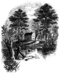
"Prescott's Headquarters. This house is on the east side of the west road, about a mile from the bay. The view is from the road where the small stream crosses, after leaving the pond seen in the picture. It is a beautiful summer residence, the grounds around it being finely shaded by willows, elms, and sycamores. The present occupant kindly showed me the room in which Prescott was lying at the time of his capture. It is on the second floor, at the southwest corner of the house, or on the right as seen in the engraving. It is a well-built frame house, and was probably then the most spacious mansion on the island out of Newport."—Lossing, 1851

Prescott's Headquarters

"Prescott's Headquarters. This house is on the east side of the west road, about a mile from the bay.…
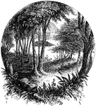
"Remains of fortifications at Plum Point. This view is from the interior of the redoubt looking eastward upon the river. In the distance is seen Pollopel's Island, near the upper entrance to the Highlands, beyond which rise the lofty Beacon Hills, whereon alarm-fires often gleamed during the war."&mdash;Lossing, 1851

Plum Point

"Remains of fortifications at Plum Point. This view is from the interior of the redoubt looking eastward…
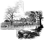
"Head-quarters of Greene and Knox. This view is from the turnpike road, looking southeast. The water in front is a mill-pond over the dam of which passes a foot-bridge. The mill is hidden by the trees in the ravine below. This side was originally the rear of the house, the old Goshen road passing upon the other side. The old front is a story and a half high. Captain Morton, the proprietor, is a son of the late General Jacob Morton, of New York city."—Lossing, 1851

Greene and Knox Head-Quarters

"Head-quarters of Greene and Knox. This view is from the turnpike road, looking southeast. The water…
"The Temple. This view is from the site of the <em>Temple</em>, looking southeast. In the distance is seen the opening of the Highlands into Newburgh Bay. On the right is Butter Hill, and near it is the village of Cornwall. The form and appearance of the <em>Temple</em> was drawn from the description given by Major Burnet, and doubtless has a general resemblance to the original."&mdash;Lossing, 1851

Temple

"The Temple. This view is from the site of the Temple, looking southeast. In the distance is…

"View of the Camp Ground. This is from a painting by Tice, in my possession. The land on which the encampment on the west side of the meadow was, in now owned chiefly by Gilbert Tompkins and Nathaniel Moore. This view is from the land of Mr. Tompkins, looking east-southeast. On the slopes seen in the foreground, and on the margine of the meadow beyond Van Cortlandt's New York regiment, and the Maryland and Virginia troops were encamped. On the east side of the meadow, upon the most distant elevation in the middle ground, the New England troops were stationed. On the slope toward the right o that elevation stood the <em>Temple</em>. In the distance is seen the upper entrance of the Hudston into the Highlands. The meadow was formerly called Beayer Dam Swamp, from the circumstance that beavers constructed dams at the lower extremity, causing the waters to overflow the low grounds."&mdash;Lossing, 1851

Camp Ground

"View of the Camp Ground. This is from a painting by Tice, in my possession. The land on which the encampment…

"Interior of Fort Putnam. This little sketch is a view of the remains of the casemates, or vaults, of Fort Putnam. There were nine originally, but only six remain in a state of fair preservation. They were built of brick and covered with stone; were twelve feet wide and eighteen feet deep, with an arched roof twelve feet high. Each one had a fire-place, and they seem to have been used for the purposes of barracks, batteries, and magazines. In the center of the fort is a spring, that bubbles up in a rocky basin. The whole interior is very rough, it being the pinnacle of a bald, rocky elevation."&mdash;Lossing, 1851

Fort Putnam

"Interior of Fort Putnam. This little sketch is a view of the remains of the casemates, or vaults, of…
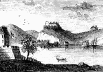
"West Point in 1780. This view is from a print published in the <em>New York Magazine</em> for 1790. It was taken from Constitution Island. On the left is seen a portion of old Fort Constitution. The great chain, four hundred and fifty yards in length, and covered by a strong battery, is seen stretched across the river, immediately below Fort Clinton, the structure on the high point. In the distance, on the left, two mountain summits are seen, crowned with fortifications. These were the North and Middle Redoubts. Upon the range of the Sugar Loaf Mountain, higher than these, and hidden, in the view, by Fort Clinton, was another redoubt, called the South Battery."—Lossing, 1851

West Point

"West Point in 1780. This view is from a print published in the New York Magazine for 1790.…
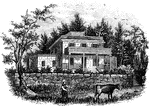
"Smith's House. This view is from the slope in front of the house. The main building is of stone; the wings are wood. The piazza in front of the main building, and the balustrades upon the top, are the only modern additions; otherwise the house appears the same as when Arnold and Andre were there. It stands upon a slope of <em>Treason Hill</em>, a few rods west of the road leading from Stony Point to Haverstraw, and about half way between the two places. It was in a room in the second story that the conspirators remained during the day of their arrival. The present owner of the house and grounds is Mr. William C. Houseman."&mdash;Lossing, 1851

Smith's House

"Smith's House. This view is from the slope in front of the house. The main building is of stone; the…

"The Breakfast Room. This is a view of the room in the Robinson House in which Arnold was at breakfast when he received Colonel Jameson's letter announcing the arrest of Andre. It is preserved in its original style, which is quite antique. The ceiling is low; the heavy beams are bare; the fire-place surrounded with neat panel-work, without a mantel-shelf. The door on the right opens into a small room which Arnold used as an office; the windows on the left open upon the garden and lawn on the south."&mdash;Lossing, 1851

Breakfast Room

"The Breakfast Room. This is a view of the room in the Robinson House in which Arnold was at breakfast…

"View at Beverly Dock. This view is taken from the Hudson River rail-road, looking north. The dock, covered with cord wood, is seen near the point on the left. It is at the termination of a marsh, near the point of a bold, rocky promontory, through which is a deep rock cutting for the road. The distant hills on the extreme left are on the west side of the Hudson; and through the gorge formed for the road may be seen the military edifices of West Point."—Lossing, 1851

Beverly Dock

"View at Beverly Dock. This view is taken from the Hudson River rail-road, looking north. The dock,…
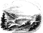
"View near Fort Montgomery. This view is from an eminence near the mountain road, about three quarters of a mile in the rear of Fort Montgomery. In the distance, the cultivated slopes of West Chester, between Peekskill and Verplanck's Point, are seen. On the left is the high, rocky promontory called Anthony's Nose; on the right is the Dunderberg, with a portion of Beveridge's Island; the buildings in the center of the picture, owned by Mrs. Pelham, denote the site of Fort Clinton; toward the right is seen the deep ravine through which flows Poplopen's Creek, and on the extreme right, partly hidden by the tree in the foreground, and fronting the river, is the site of Fort Montgomery. The scenery from this point of view is indeed magnificent."&mdash;Lossing, 1851

Fort Montgomery

"View near Fort Montgomery. This view is from an eminence near the mountain road, about three quarters…
"Lake Sinnipink, or Bloody Pond. This view is from the outlet of the lake, within a few rods of the spot where a large number of the Americans and British were slain in a preliminary skirmish on the afternoon when the forts were taken. The bodies were thrown into the lake, and from that circumstance it was afterward called Bloody Pond."—Lossing, 1851

Lake Sinnipink

"Lake Sinnipink, or Bloody Pond. This view is from the outlet of the lake, within a few rods of the…

"View from Peekskill Landing. This view is from Peekskill landing, looking up the river. On the left is the Dunderberg, or Thunder Mountain, over which the troops marched to Forts Clinton and Montgomery. The dark spot on the brink of the river, upon the extreme left, shows the place of the coffer-dam made by the deluded seekers after Captain Kidd's treasure. At the water's edge, on the right, is seen the grading of the Hudson River railroad, in course of construction when the sketch was made. The dark mountain on the right is Anthony's Nose. Intermediately, and projecting far into the river, is a high, sandy bluff, on which stood Fort Independence. Further on is Beveridge's Island; and in the extreme distance, behind the flag-staff, is seen Bear Mountain. Between the point of Fort Independence and the rock cutting of the railroad is the mouth of Peek's Kill, or Peek's Creek."&mdash;Lossing, 1851

Peekskill Landing

"View from Peekskill Landing. This view is from Peekskill landing, looking up the river. On the left…
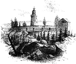
"Rear view at Stony Point. This sketch presents a rear view of the old embankments of the fort, and of the light-house, which is seen by all travelers upon the river, just before entering the Highlands. The beacon stands exactly in the center of the fort, upon the site of the magazine. There was a covered way toward the water on the north side of the hill, and about twenty yards in the rear are some prominent remains of the ravelins which extended across the point."&mdash;Lossing, 1851

Stony Point

"Rear view at Stony Point. This sketch presents a rear view of the old embankments of the fort, and…
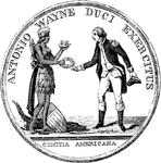
"Gold medal awarded by Congress to General Wayne. This is a representation of the medal, the size of the original. On this side is a device repesenting an Indian queen crowned, a quiver on her back, and wearing a short apron of feathers. A mantle hangs from her waist behind, the upper end of which appears as if passed through the girdle of her apron, and hangs gracefully by her side. With her right hand she is presenting a wreath to General Wayne; in her left she is holding up a mural crown toward his head. At her feet, on the left, an alligator is lying. The American shield is resting against the animal. Over the figure is the legend 'Antonio Wayne duci exercitas,' and beneath, 'Comitia Americana,' 'The American Congress to General Anthony Wayne.'"&mdash;Lossing, 1851

Wayne Medal Front

"Gold medal awarded by Congress to General Wayne. This is a representation of the medal, the size of…
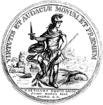
"Medal awarded to Lieutenant-colonel De Fleury. This is a representation of the medal, the size of the original. The device is a helmeted soldier, standing against the ruins of a fort. His right hand is extended, holding a sword upright; the staff of a stand of colors is grasped by his left; the colors are under his feet, and he is trampling upon them. The legend is, 'Virtutis et audacle monum et premium. D. D. Fleury equiti gallo primo muros resp. Americ. D. D.;' 'A memorial and reward of valor and daring. The American Republic has bestowed (this medal) on Colonel D. de Fleury, a native of France, the first over the walls (of the enemy).'"&mdash;Lossing, 1851

De Fleury Medal Front

"Medal awarded to Lieutenant-colonel De Fleury. This is a representation of the medal, the size of the…
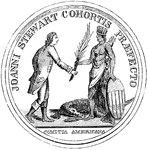
"Medal awarded to Major Stewart. This represents the medal the size of the original. The device is America personified by an Indian queen, who is presenting a palm branch to Major Stewart. A quiver is at her back; her left hand is resting on the American shield, and at her feet is an alligator crouchant. The legend is, 'Joanni Stewart Cohortis Prefecto, Comitia Americana,' 'The American Congress to Major John Stewart.'"&mdash;Lossing, 1851

Stewart Medal Front

"Medal awarded to Major Stewart. This represents the medal the size of the original. The device is America…
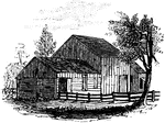
"View of the place where Andre was captured."—Lossing, 1851

Andre Captured

"View of the place where Andre was captured."—Lossing, 1851

"Colonel Jameson's head-quarters. This is a view of the out-buildings of Mr. Sands, at North Castle, situated a few yards from his residence. The lowest building, on the left, is the dwelling, now attached to the barn of Mr. Sands, which Jameson used as his head-quarters. In that building Andre was kept guarded until sent to West Point."&mdash;Lossing, 1851

Jameson's Head-quarters

"Colonel Jameson's head-quarters. This is a view of the out-buildings of Mr. Sands, at North Castle,…
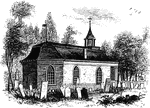
"Ancient Dutch Church in Sleepy Hollow. This view is from the church-yard, looking southwest. The porch seen on the right fronts upon the highway, and is a modern addition, the ancient entrance being on the south side. This is believed to be the oldest church in existence in this state, having been erected, according to inscription upon a stone tablet upon its front, by Vredryck Flypsen (Frederic Philips) and Catharine his wife, in 1699. It is built of brick and stone, the former having been imported from Holland for the express purpose. The old flag-shaped vane, with the initials of the founder cut out of it, yet turns upon its steeple, and in the little tower hangs the ancient bell, bearing this inscription: 'Si. Deus. Pro. Nobis. Quis. Contra. Nos. 1685.' The pulpit and communion-table were imported from Holland; the latter alone has escaped the ruthless hand of modern improvement."—Lossing, 1851

Sleepy Hollow Church

"Ancient Dutch Church in Sleepy Hollow. This view is from the church-yard, looking southwest. The porch…
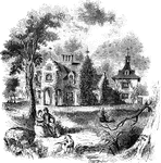
"View of 'Sunnyside,' the residence of Washington Irving. Built by Wolfert Ecker and known famously as 'Wolfert's Roost.'"&mdash;Lossing, 1851

Sunnyside

"View of 'Sunnyside,' the residence of Washington Irving. Built by Wolfert Ecker and known famously…
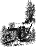
"The Livingston Mansion. This is a view from the lawn on the north side. It is embowerd in trees and shrubbery, and is one of the most pleasantly-located mansions in the country, overlooking interesting portios of the Hudson River. Within its walls many of the leading men of the Revolution were entertained. It was the head-quarters of Washington, when he abandoned an attempt to capture Cornwallis. There, at the close of the war, Washington, Governor Clinton, and General Sir Guy Carleton, and their respective suites, met to make arrangements for the evacuation of the city of New York by the British. Washington and Clinton came down the river from West Point in a barge; Carleton ascended in a frigate. Four companies of American Infantry performed the duty of guards on that occasion."—Lossing, 1851

Livingston Mansion

"The Livingston Mansion. This is a view from the lawn on the north side. It is embowerd in trees and…
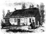
"Washington's head-quarters at Tappan. This view is from the yard, near the well. The date of its erection (1700) is made by a peculiar arrangement of the bracks in the front wall. In the large room called 'Washington's quarters' the fireplace is surrounded by Dutch pictorial tiles illustrative of Scripture scenes. Indeed, the whole house remains in precisely the same condition, except what the elements have changed externally, as it was when the chief occupied it."&mdash;Lossing, 1851

Tappan head-quarters

"Washington's head-quarters at Tappan. This view is from the yard, near the well. The date of its erection…

"Torn Rock. This view is from the verge of the dam above the Ramapo works, near the rail-way, looking northeast. The eminence is called Torn Rock, from its ragged appearance on its southeastern side. There is a deep fissure in a portion of the bare rock, from which comes up a sound like the ticking of a watch, caused by the water which percolates through the seams in the granite. A tradition was long current that Washington lost his watch in the fissure, and that, by some miraculous power, it continued to tick!'"&mdash;Lossing, 1851

Torn Rock

"Torn Rock. This view is from the verge of the dam above the Ramapo works, near the rail-way, looking…

"Remains of intrenchments the Ramapo Pass. This view is from the road, looking north toward the village of Ramapo. The remains of the intrenchments are seen along the right in the foreground. On the left, in the distance, is seen a glimpse of the hills on the other side of the narrow valley."&mdash;Lossing, 1851

Ramapo Pass

"Remains of intrenchments the Ramapo Pass. This view is from the road, looking north toward the village…
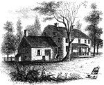
"The Hopper House. This view is from the road, looking northeast. The low part, on the left, is a portion of the old mansion of the Revolution, which contained the dining-hall. It was a long stone building. A part of it has been taken down, and the present more spacious edifice, of brick, was erected soon after the war."&mdash;Lossing, 1851

Hopper House

"The Hopper House. This view is from the road, looking northeast. The low part, on the left, is a portion…
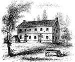
"Friends' meeting-house. This view is from the shed in the yard, looking southeast. The building stands in the center of a large square, if of imported brick, and very spacious. The Quakers were numerous in this vicinity in the time of the Revolution, and a large number of the present inhabitants are members of that sect."&mdash;Lossing, 1851

Friends' meeting-house

"Friends' meeting-house. This view is from the shed in the yard, looking southeast. The building stands…
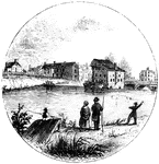
"Trenton Bridge and vicinity. This view is from the north side of the Assanpink, a few rods above the bridge, looking south. The bridge, seen upon the right, is built of stone, and very strong, and is upon the site of the old one. The creek is curbed by a dam near the bridge, and forms the sheet of water seen in the picture. The old 'Stacey Mill' of the Revolution, the largest building in the sketch, was quite dilapidated from the effects of fire and flood, when I was there. The two old houses on the left of it are of stone, covered with stucco, and were there at the time in question. On the bank, between them and the house of Mr. Timothy Abbott, seen on the extreme left, was a building used as a tavern, in the Revolution. It was demolished a few years ago. Along the high bank, from the mill eastward to the rail-way, now covered with houses and gardens, and also westward, some distance toward the Delaware, the Americans were encamped. The bank was being terraced when I visited Trenton, and will, in time, be a beautiful spot."&mdash;Lossing, 1851

Trenton

"Trenton Bridge and vicinity. This view is from the north side of the Assanpink, a few rods above the…
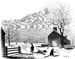
"View of the battle-ground near Princeton. This view, looking north, is from the carriage gate of Mr. John Clarke, owner of the house in which General Mercer died, which is situated about seventy rods from the Trenton turnpike. That dwelling is represented in the foreground of the picture, on the extreme right. The distant view includes almost the whole field of action. Near the center of the picture, over the head of the dark figure, is seen the house of William Clark, and his out-buildings. The barn, a little more to the left, with a tree in front, is upon the spot from whence Mercer rushed forward to the hedge-fence. That fence was upon the line of the present turnpike, denoted in the sketch by the fence passing down the slope beyond the large tree on the extreme left. The 'high ground' for which both parties were aiming, to secure advantage, is seen in the extreme distance. The dark spot between the tree in the second field and the barn denotes the spot where Mercer fell. The house of William Clark, in the distance, is about a quarter of a mile from the one in the foreground, where Mercer died. The hollow between the two houses was the space between the belligerents when Washington advanced to the support of Mercer. The place of conflict is about a mile and a quarter south of Princeton. The turnpike passes directly through it."&mdash;Lossing, 1851

Princeton battle-ground

"View of the battle-ground near Princeton. This view, looking north, is from the carriage gate of Mr.…