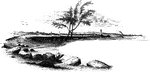
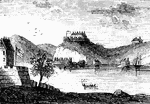
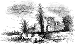
Arnold Landing-place
"View of the landing-place of Arnold. This sketch is from the west side of the cove in which the troops…
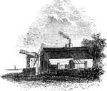
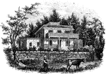
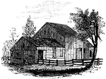
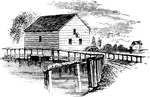
Hubbard's House and Mill
"Hubbard's House and Mill. The inscriptions upon the monument are as follows: East Side: "Oliver Hazard…
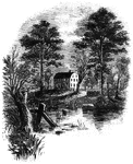
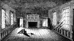
Prescott's Headquarters
"Prescott's Headquarters. This house is on the east side of the west road, about a mile from the bay.…
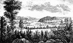
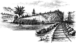
Camp Ground
"View of the Camp Ground. This is from a painting by Tice, in my possession. The land on which the encampment…
West Point
"West Point in 1780. This view is from a print published in the New York Magazine for 1790.…
Smith's House
"Smith's House. This view is from the slope in front of the house. The main building is of stone; the…
Beverly Dock
"View at Beverly Dock. This view is taken from the Hudson River rail-road, looking north. The dock,…
Fort Montgomery
"View near Fort Montgomery. This view is from an eminence near the mountain road, about three quarters…
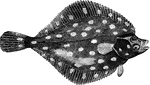
Plaice
"Weighing six to twelve pounds; it feeds on mollusca, crustacea, and young fish; inhabits sandy banks…
Jameson's Head-quarters
"Colonel Jameson's head-quarters. This is a view of the out-buildings of Mr. Sands, at North Castle,…
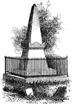
Van Wart's Monument
"Van Wart's monument. The following are the inscriptions upon this monument: North Side: 'Here repose…
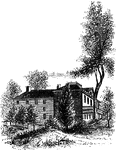
Livingston Mansion
"The Livingston Mansion. This is a view from the lawn on the north side. It is embowerd in trees and…
Treaty Monument
"Treaty Monument. This monument stands near the intersection of Hanover and Beach Streets, Kensington,…
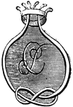
Penn's seal and signature
"Penn's Seal and Signature. This is a representation of the seal and signature of William Penn attached…
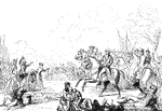
Monmouth
"The field of Monmouth. In the picture here given, the chief is seen most prominently on his white charger,…
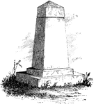
Washington Monument
"Washington Monument. The following are the inscriptions on the monument: East front: 'To George Washington,…
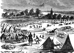
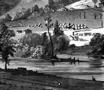
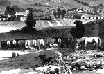
Camp Zagonyi
"Camp Zagonyi, encampment of Fremont's army on the prairie, near Wheatland, Mo., October 14th, 1861.…
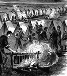
Camp Zagonyi
"Camp Zagonyi, encampment of Fremont's army on the prairie, near Wheatland, Mo., October 14th, 1861.…
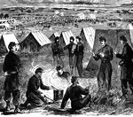
Camp Zagonyi
"Camp Zagonyi, encampment of Fremont's army on the prairie, near Wheatland, Mo., October 14th, 1861.…
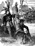
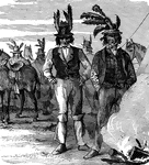
Delaware Indians
"Delaware Indians acting as scouts for the Federal army in the West. General Fremont, on taking command…
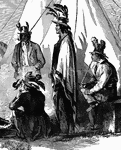
Delaware Indians
"Delaware Indians acting as scouts for the Federal army in the West. General Fremont, on taking command…
Delaware Indians
"Delaware Indians acting as scouts for the Federal army in the West. General Fremont, on taking command…
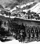
Grafton Occupied by Federal Troops
"View of Grafton, West Virginia, occupied by the Federal Troops, under the command of General McClellan,…
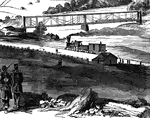
Railroad at Grafton
"View of Grafton, West Virginia, occupied by the Federal Troops, under the command of General McClellan,…
Federal Troops at Grafton, West Virginia
"View of Grafton, West Virginia, occupied by the Federal Troops, under the command of General McClellan,…
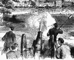
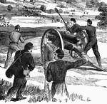
Battle at Dam No. 4
"Battle at Dam No. 4, Potomac River, between Butterfield's brigade and a large Confederate force. A…
Battle at Dam No. 4
"Battle at Dam No. 4, Potomac River, between Butterfield's brigade and a large Confederate force. A…
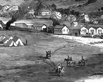
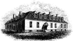
Village of Clarksburg
"Village of Clarksburg, Western Virginia, headquarters of General Rosecrans. Clarksburg, a post village,…
Village of Clarksburg
"Village of Clarksburg, Western Virginia, headquarters of General Rosecrans. Clarksburg, a post village,…
James River
"Scene on the James River, at Richmond. This view is from a long shaded island extending up the river…
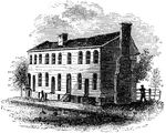
Old City Tavern
"Old City Tavern. This is a frame building, and stands on the northwest corner of Main and Nineteenth…
Apollo Room
"The Apollo Room. The room used for public meetings is in the rear building of the old Raleigh tavern…
Raleigh Tavern
"Raleigh Tavern. When I visited Williamsburg in December, 1848, the front part of the old Raleigh tavern…
Nelson Tombs
"The Nelson Tombs. This view is from the burial-ground looking down the York River toward Chesapeake…
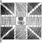
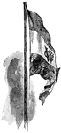
British Flag
"British flag. This is a representation of one of the flags surrendered at Yorktown, and presented to…
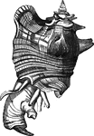
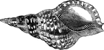
Murex regius
"The M. regius is found on the west coast of Central America, and suprasses all power of description…
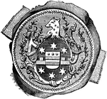
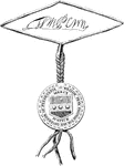
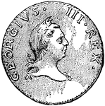
William Tryon Seal
"Seal and signature of Tryon. William Tryon was a native of Ireland, and was educated to the profession…
Strome
"Found in the West Indies, the Red Sea, India, Mauritius, and various other seas." — Goodrich,…
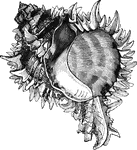
Marine trumpet-shell
"The marine trumpet or Triton's shell, Triton variegatus, is elegantly variegated with red…
Guilford Battle-ground
"View of the battle-ground. This view is from the eminence southwest of the site of old Guilford Court…
Catawba
"View of the Great Falls of the Catawba. This view is from the west side of the Catawba, looking northeast,…
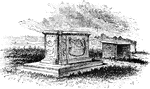
Frederica
"Ruins of Oglethorpe's Barracks at Frederica. This is from a sketch made by W. W. Hazzard, Esq., in…
Brower's Mill
"Brower's Mill. This is a view of the old mill of the Revolution, as it appeared when I made the sketch…
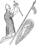
William the Conqueror
"William the Conqueror (1066-1087), as represented on his seal. Although William really ruled 'as king…
Dutch West India Flag
"Flag of the Dutch West India Company. When the rights of the company ceased, a new and more powerful…
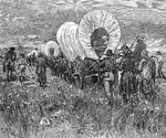
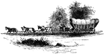
Western Train
"A western emigrant train. The occupation of the west. With every year the line of settlements was pushed…
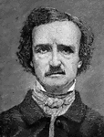
Edgar Allan Poe
"Edgar Allan Poe, the son of a Baltimore gentleman and an actress, Elizabeth Arnold, was born in Boston,…

John Brown
In 1859, John Brown collected a small body of men, white and black, in the mountains of Maryland. He…
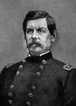
George B. McClellan
"George Brinton McClellan was born at Philadelphia, December 3, 1826. He was for two years a student…
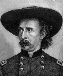
George Armstrong Custer
"George Armstrong Custer, a brilliant cavalry officer, was born at New Rumley, Ohio, December 5, 1839.…
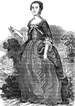
Martha Washington
Martha Danridge was born in the county of New Kent, Virginia, in May, 1732. Martha was a widow of Park…

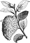
Sour-Sop
"Cultivated in the West and East Indies; it produces a large pear-shaped fruit, of an greenish color,…

Troilus Butterfly
"The Troilus Butterfly, Papilio Troilus, is a superb insect, the wings denticulated, black,…
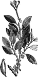
Cacao Plant
"Cacao, or cocoa, is the chocolate tree, and also the powder and beverage made with it obtained from…