| Maps > Asia > India |
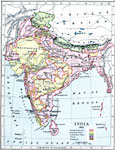
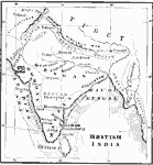 | British India, A map showing British India. |
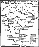 | Chief Foreign Settlements in India, 17th Century, A map showing the chief foreign settlements in India at the end of the 17th century. |
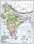
 | Economic Map of India, A map showing main economic products & principal railways throughout India. |
 | India, 1785, A map of India in 1785 showing the British Dominions, the Mahratta States, Native States, French holdings and Portuguese holdings. |
 | India, 1804, A map of India showing the territorial possessions of the British and Portuguese and Independent States. |
 | India, 1857, Map of India in 1857 showing British dominions, Independent states, and French and Portuguese territory. |
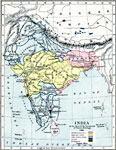
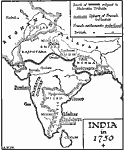 | India in 1750, A map of India in 1750. |
 | Mumbai, A map of Mumbai (fomerly known as Bombay) around 1919. |
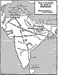 | The Rise of Buddhism, A map to illustrate the rise of Buddhism. |
| Maps > Asia > India |
Maps is a part of the Educational Technology Clearinghouse
Produced by the Florida Center for Instructional Technology © 2007
College of Education, University of South Florida