Maps Site map
  Maps > Europe > Complete Maps
Site Map  

  Record   101   to   110  of   121

Historic and contemporary maps of Europe, including physical and political maps, early history and empires, WWI maps, climate maps, relief maps, vegetation maps, population density and distribution maps, cultural maps, and economic/resource maps.
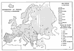
Distribution of Peoples, 1916
Distribution of peoples in Europe according to their linguistic relationship, including Celts, Germans, Slavs, Latins, Greeks, and Albanians. Also included on this map are peoples not related by blood to the Indo–European tribes such as the Lap...

Distribution of Languages, 1916
A map of the distribution of Indo–European languages in Europe, including Celtic, Germanic, Latin, Slavic, Greek, and Albanian languages. Areas where language families other than Indo–European are also shown, including Lapp, Finnish, Esto...

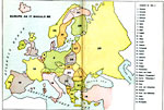
Europe "As it Should be", 1916
A map created by the author to represent what he felt the layout of Europe should be in 1916 after WWI. "The chapter, entitled "Europe as it Should Be," with its accompanying map, shows the boundaries of the various nations as they wou...

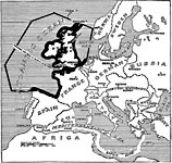
Barred and Safety Zones, 1917
A map of the "barred zones" and "safety lanes" outlined in Germany's 1917 note to the United States regarding neutral shipping to and from Europe. The barred zone includes the British Islands, and the coast from the Dutch Terschei...

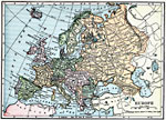
Europe, 1919
A map of Europe in 1919, showing cities and railway routes. ...

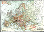
Europe, Post WWI, 1920
Map of Central and Western Europe after the Treaty of Versailles at the end of WWI. The map includes railroads, canals, shipping routes, major cities and capitals, and the country boundaries established by the Treaties of Versailles, proposed boundar...

Europe, 1920
A map showing country boundaries of Europe as they existed in 1920, including major cities, rivers, railroad routes, and shipping distances between major ports. ...

Political Boundaries in Europe, 1920
Map of Central and Western Europe after the Treaty of Versailles at the end of WWI. The map includes railroads, canals, shipping routes, major cities and capitals, and the country boundaries established by the Treaties of Versailles, proposed boundar...

Europe, 1920
Map of Central and Western Europe after the Treaty of Versailles at the end of WWI. The map includes railroads, canals, shipping routes, major cities and capitals, and the country boundaries established by the Treaties of Versailles, proposed boundar...

Central and Western Europe, 1920
Map of Central and Western Europe after the Treaty of Versailles at the end of WWI. The map includes railroads, canals, major cities and capitals, and the country boundaries established by the Treaties of Versailles, proposed boundaries of new states...

First Previous Next Last


  Maps > Europe > Complete Maps
Site Map  

Maps ETC is a part of the Educational Technology Clearinghouse
Produced by the Florida Center for Instructional Technology © 2009
College of Education, University of South Florida