Maps Site map
  Maps > Europe > Regional Maps >Southeastern Europe
Site Map  

  Record   1   to   10  of   43

Regional European maps of the Southeastern Europe region from the Maps ETC collection. This includes physical and political maps, early history and empires, WWI maps, climate maps, relief maps, vegetation maps, population density and distribution maps, cultural maps, and economic/resource maps.
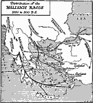
Distribution of Hellenic Races, 1,000–800 BC
A map of the Hellas region showing the distribution of the Hellenic races, between 1,000 and 800 BC. The map shows the migration of the Illyrians, Macedonians, and Thracians from the northern Balkans, the Epirotes, Aeolians, and Dorians through Greec...

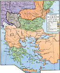
Eastern Europe as regulated by the Treaty of Berlin, 13th June–13th July, 1878
A map of Eastern Europe as regulated by the Treaty of Berlin, 13th June–13th July, 1878, at the end of the Russo–Turkish War. This map is color–coded to show the effects of the treaty on the Ottoman Empire with regards to territory ...

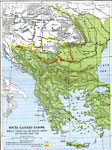
South Eastern Europe, 1648–1739
A map of southeastern Europe, subtitled "Wars of Turkey with the Empire, Venice and Poland 1648–1739." This map is color–coded to show the extent of the European Turkish Ottoman Empire in 1739, and shows the border of the Austro...

Southeastern Europe, 1690
A map of southeastern Europe in 1690 at the time of the Great Turkish War, showing the territories and distribution of peoples, including the Turkish Ottoman Empire in Europe at its greatest extent, Montenegro, Hungary, lands of the Republic of Venic...

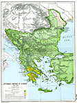
Ottoman Empire in Europe, 1792–1870
A map of the Ottoman Empire in Europe between 1792 and 1870. The map is color–coded to show the boundaries of the Empire in 1792 at the end of the Russo–Turkish War (1787–1792), the territory ceded to Russia in 1812, the territory c...

Southeastern and Central Europe, 1796
A map of southeastern and central Europe in 1796, showing the partition of the Kingdom of Poland, portions of the Republic of Venice, Austria–Hungary, and the extent of the Turkish Ottoman Empire in Europe at the time. The map shows the Kingdom...

South Eastern Europe and Turkey, 1856
A map of southeastern Europe and surrounding lands, shown in 1856 after the Crimean War. The map is color–coded to show the Turkish dominions and the countries paying tribute to the Sultan at the time. An inset map details the Crimean peninsula...

Changes in Turkey in Europe, 1856–1878
A map of southeastern Europe showing the changes in Turkish borders between 1856 and 1878, and the establishment of independent countries in 1881 and 1882. This map shows the Ottoman Empire's northern boundaries in blue as they were established by th...

The Balkan States, 1856–1912
A map showing the Balkan States, from the Treaty of Paris marking the end of the Crimean War in 1856 to 1912. This map shows the boundaries established in 1856 to 1878, the proposed boundaries established by the Treaty of San Stefano (March 3, 1878),...

Turkey in Europe, 1859
A hand–colored map of Turkey in Europe from 1859 showing the Ottoman territories south of the Danube and in Moldavia, and including major cities, rivers, and mountain systems....

Next Last


  Maps > Europe > Regional Maps >Southeastern Europe
Site Map  

Maps is a part of the Educational Technology Clearinghouse
Produced by the Florida Center for Instructional Technology © 2009
College of Education , University of South Florida