|
|
|
| Maps > Globes and Multi-continent > Complete Maps |
A collection of world and multi-continent maps, including various projections, hemispheric maps, physical and political maps, early known world maps, climate maps, relief maps, ocean current maps, population density and distribution maps, vegetation maps, and economic/resource maps.
|
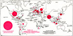
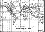
World Distribution of Tobacco Production,
1912 |
|
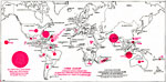
World Distribution of Cane Sugar Production,
1912 |
|
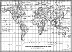
Chief Meat Producing Areas of the World,
1912 |
|
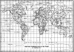
Chief Wool Producing Areas of the World,
1912 |
|
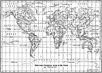
Chief Wheat Producing Areas of the World,
1912 |
|
Chief Coal and Petroleum Areas of the World,
1912 |
|
Chief Iron Producing Areas of the World,
1912 |
|
Chief Gold Producing Areas of the World,
1912 |

|
Territories, Telegraph Cables, and Ocean Routes of the World,
1912 |
|
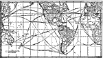
Trade Routes and Distances by Existing Lines and by the Panama Canal,
1913 |
| First | Previous | Next | Last |
| Maps > Globes and Multi-continent > Complete Maps |
Maps ETC is a part of the Educational Technology Clearinghouse
Produced by the Florida Center for Instructional Technology © 2009
College of Education, University of South Florida