| Maps > Globes & Multi-Continent > Western Hemisphere |
 |
West Indies and Central America 1910, 1910 Map of West Indies and Central America in 1910. Map is color-coded to show various powers' rule over the area. |
 |
The Philippines, 1898 Map showing The Philippines in 1898. |
 |
The Spanish American War in the West Indies, 1898 Map showing the Spanish American War in the West Indies. |
 |
The Danish West Indies, 1916-1917 Map showing the Danish West Indies. |
 |
North and South Hemispheres, 1910 A map of the globe, showing the north and south hemispheres and some of the circles of latitude. |
 |
, Diagram to show the position of the trade winds belts and the belt of calms in the summer. |
 |
, Diagram to show the position of the belt of calms and the trade winds in the winter. |
 |
, The rainy east coasts and arid west coasts of the trade wind belts. |
 |
, The heavy rainfall where prevailing westerlies blow over the rising coast. |
 |
The Continent of America, Map of the Americas. |
 |
The Verrazano Map, 1881 Map used by explorer Hieronimo da Verrazano on his expedition to the Indies. |
 |
Verrazano, 1529, 1881 Map used by explorer Hieronimo da Verrazano on his expedition to the Indies. Map shows area that is now around Newfoundland, Canada. |
|
The Philippines, 1898 Map showing The Philippines in 1898. |
|
The Spanish American War in the West Indies, 1898 Map showing the Spanish American War in the West Indies. |
|
The Danish West Indies, 1916-1917 Map showing the Danish West Indies. |
 |
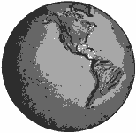
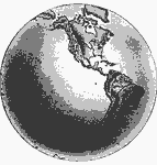
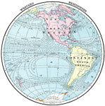
, Untitled map shows the western continents of North America and South America. |
 |
, Untitled map shows the unlabeled western continents of North America and South America. |
|
The Continent of America, Map of the Americas. |
|
, Untitled map shows the western continents of North America and South America. |
|
, Untitled map shows the unlabeled western continents of North America and South America. |
 |
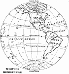
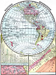
Western Hemisphere, 1910 A map showing the Western hemisphere. |
 |
The Western Hemisphere, A map of the Western hemisphere. |
 |
Western Hemisphere, 1909 A map of the Western hemisphere, showing outlines of the continents. |
 |
Western Hemisphere, 1909 A map of the Western hemisphere, showing mountain ranges and rivers. |
 |
Western Hemisphere, 1906 Map of the western hemisphere in 1906. |
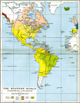 |
The Western World, 1815 Map showing The Western World, subtitled "European Colonies and Dependencies 1815." Map is color-coded to show lands controlled by various powers. |
|
Western Hemisphere, 1906 Map of the western hemisphere in 1906. |
|
Western Hemisphere, 1909 A map of the Western hemisphere, showing outlines of the continents. |
|
Western Hemisphere, 1909 A map of the Western hemisphere, showing mountain ranges and rivers. |
 |
Western Hemisphere, Map of the Western Hemisphere. |
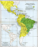 |
Spanish & Portuguese Settlements in America, 1792-1870 Map showing Spanish & Portuguese Settlements in America. |
| Maps > Globes & Multi-Continent > Western Hemisphere |
Maps is a part of the Educational Technology Clearinghouse
Produced by the Florida Center for Instructional Technology © 2007
College of Education, University of South Florida