|
|
|
| Maps > North America > Canada |
Historic and contemporary maps of Canada including physical and political maps of provinces and territories, early exploration and settlement, climate, vegetation, battle plans, geomorphic, and automobile route maps.
|
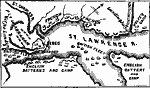
Operations during the Capture of Quebec,
1759 |
|
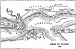
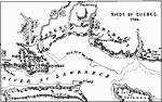
Siege of Quebec 1759,
1759 |
|
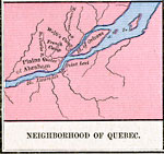
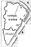
Neighborhood of Quebec,
1759 |
|
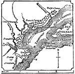
Battle of Quebec,
1759 |
|
Siege of Quebec,
1759 |
|
Point Levi, Quebec,
1770s |
|
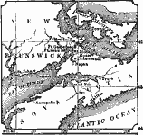
Bay Verte,
1775 |
|
The Acadian Peninsula,
1775 |
|
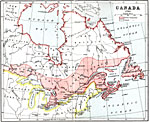
British Canada,
1791 |
|
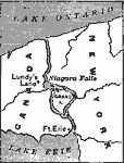
Niagara Falls During the War of 1812,
1814 |
| First | Previous | Next | Last |
| Maps > North America > Canada |
Maps ETC is a part of the Educational Technology Clearinghouse
Produced by the Florida Center for Instructional Technology © 2009
College of Education, University of South Florida