Maps Site map
  Maps > North America > Canada
Site Map  

  Record   31   to   40  of   156

Historic and contemporary maps of Canada including physical and political maps of provinces and territories, early exploration and settlement, climate, vegetation, battle plans, geomorphic, and automobile route maps.

British North America, 1840–1867
A map of British America (Canada) between the Act of Union (1840) which merged East Canada and West Canada into the United Provinces, and the British North America Act of 1867 which formed the confederation of Canada. The map is color–coded to ...

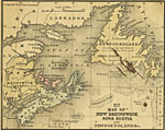
New Brunswick, Nova Scotia and Newfoundland, 1858
A map from 1858 of New Brunswick, Nova Scotia and Newfoundland, which surround the Gulf of St. Lawrence. The map shows major cities and ports, rivers, and coastal features. The figures attached to Cities and Towns indicate the number of thousands of ...

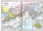
British Provinces in Eastern Canada, 1872
A map from 1872 of the eastern British provinces in Canada at the time. The map shows the eastern portion of Ontario, southern portion of Quebec, New Brunswick, Prince Edward Island, Nova Scotia, and an inset map of Newfoundland. The map shows major ...

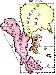
Size of the Maritime Provinces, 1872
A map exercise from 1872 showing the comparative size of the Canadian Maritime provinces of New Brunswick, Prince Edwards Island, and Nova Scotia with an outline of Kansas (dashed line) overlain at the same map scale. This image is rotated so that no...

The Dominion of Canada, 1882
A map from 1882 of the southern part of the Dominion of Canada at the time, showing the provinces of British Columbia, Alberta, Athabaska, Saskatchewan, Assinboia, Manitoba, Keewatin, Ontario, Quebec, New Brunswick, Prince Edward Island, Noza Scotia,...

Eastern Canada and Newfoundland, 1883
A map from 1883 of the eastern part of Canada showing the political boundaries at the time, the capital and provincial capitals, major cities and towns, railways, mountains, lakes, rivers, coastal features, and islands. The territories shown are Keew...

Canada, 1883
The Dominion of Canada....

Eastern Canada, 1885
A map from 1885 of eastern Canada showing the provinces of Ontario, Quebec, New Brunswick, Prince Edward Island, Nova Scotia, with an inset map of Newfoundland. This map shows the county boundaries for the region, including the open–ended count...

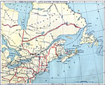
Southeastern British Provinces, 1888
A map from 1888 of the southeastern provinces of British America (Dominion of Canada). The map shows the province boundaries of Keewatin to the west of Hudson Bay, North East Territory to the east of Hudson Bay, the eastern part of Ontario, and the p...

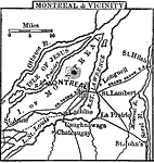
Montreal, 1888
A map from 1888 of Montreal and vicinity showing the city, the Island of Montreal, St. Lawrence River, Isle of Jesus, Ottawa River, Rivière des Prairies, Sorel River, and Lake St. Louis, and the neighboring cities and towns of Longueil, St. Hi...

First Previous Next Last


  Maps > North America > Canada
Site Map  

Maps ETC is a part of the Educational Technology Clearinghouse
Produced by the Florida Center for Instructional Technology © 2009
College of Education, University of South Florida