|
|
|
| Maps > United States > Early America 1400-1800 |
A collection of historic maps of early America from explorations and settlements of the English, French, and Spanish, to the end of the American Revolutionary War.
|
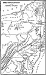
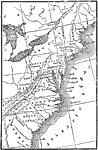
The Revolution in the Middle States,
1776 |
|
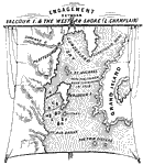
Engagement Between Valcour Island and the Western Shore (Lake Champlain),
1776 |
|
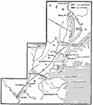
Campaigns in New York and New Jersey,
1776 |
|
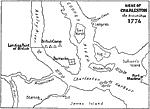
Siege of Charleston,
1776 |
|
The United Colonies,
1776 |
|
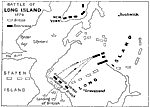
Battle of Long Island,
1776 |
|
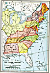
The American Indian Nations,
1776 |
|
The Thirteen Colonies ,
1776 |
|
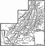
Washington's Winter Campaign,
1776–1777 |
|
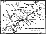
Valley Forge, Philadelphia, and Brandywine,
1776–1778 |
| First | Previous | Next | Last |
| Maps > United States > Early America 1400-1800 |
Maps ETC is a part of the Educational Technology Clearinghouse
Produced by the Florida Center for Instructional Technology © 2009
College of Education, University of South Florida