| Maps > United States > Midwest Region |
 |
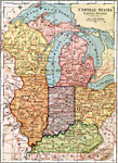
Lake Superior and Michigan, 1911 A map of part of the Great Lakes region. The heavy broken line is the boundary between the Superior Highlands on the north and the Prairie Plains on the south. It is, however, more prominent as a geologic boundary than as a topographic boundary. Note the connection at the west end of Lake Superior between the Superior Highlands and the Laurentian Plateau of Canada. The special districts indicated are portions of the region described in the text. |
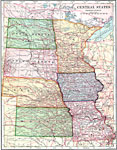 |
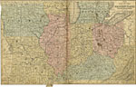
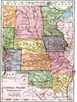
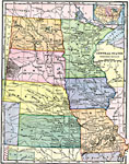
Central States - Western Division, 1902 Map of the Central United States. |
 |
Map of a Portion of the Terminal Moraine (Western), Second Glacial Epoch Map showing the terminal moraine of the second glacial epoch west of the Great Lakes region, including the glacial landscape features of prairie pot-hole lakes, the Coteau des Prairie, and the driftless area near La Crosse, Wisconsin. The map includes the drift bearing area, the generalized directions of glacial movement, the direction of glacial striae, and the locations of prominent terminal moraines. Map scale is one inch equals 60 miles, and referenced to Julius Bien and Co. lith. |
 |
Glacial Moraines in the Northern Midwest, 1911 A map showing the distribution of glacial moraines and direction of ice movement in southern Michigan and northern Ohio and Indiana. |
 |
Drift Sheets of Iowa and Northern Illinois, 1911 A map showing the relations of the drift sheets of Iowa and northern Illinois. 1, Kansan; 2, Illinoian; 3, Iowan; 4, Early Wisconsin; 5, Late Wisconsin; 6, Driftless area; 7, course of the Mississippi River during the Illinoian glacial epoch. |
 |
Dakota Glacial Lobe, 1911 A map showing the southern limit of the Pleistocene ice sheet and distribution of moraines of the Dakota glacial lobe, North and South Dakota. |
 |
Algonkian and Iroquois Beaches, 1911 An isobasic map of the Algonkian and Iroquois beaches, showing the broader features of warping numbers. Numbers indicate elevation of raised beaches above the sea. |
 |
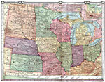
Map of the Western States, 1858 Map of the Chief part of the Western States, including Iowa, Wisconsin, Michigan, Ohio, Indiana, Illinois, Missouri, Kentucky, and Virginia along with a small part of Pennsylvania and Canada. |
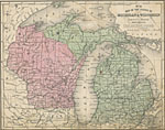 |
Map of the States of Michigan and Wisconsin, 1858 AD Map of Michigan and Wisconsin including the Great Lakes; Lake Michigan, Lake Superior, and Lake Huron, and parts of Illinois, Indiana, Ohio, and Canada. |
 |
Central States, 1872 Physical map of the central states. Includes map inserts of principal products. Time zones are provided. Red numbers indicate the rank of cities in population. Select land elevations are given. |
 |
Drawing of Wisconsin, Minnesota and Michigan, 1872 Illustrates instructions for drawing Wisconsin, Minnesota, and Michigan. |
 |
Drawing of Illinois, Iowa, and Missouri, 1872 Illustrates instructions for drawing Illinois, Iowa, and Missouri. |
 |
East Central States, 1883 States of the east central United States. |
 |
West Central States, 1883 States of the west central United States. |
 |
Central States, 1888 Central states of the United States. |
 |
Central States, 1899 Map of Central States in color. Cities with populations of over 100,000 are underscored. |
 |
West Central States, 1906 Physical map of the west central states. |
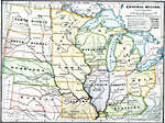 |
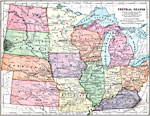
The Central States, 1909 A map of the central states, showing Ohio, Indiana, Kentucky, Illinois, Wisconsin, Michigan, Minnesota, Iowa, Missouri, Kansas, Nebraska, South Dakota, and North Dakota. |
 |
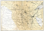
St. Louis, Kansas City, Omaha, Minneapolis, and St. Paul, 1910 A map showing the location of St. Louis, Kansas City, Omaha, Minneapolis, and St. Paul. |
 |
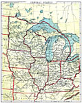
Relief Map of the Central States, 1910 A relief map of the Central States. |
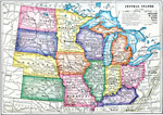 |
The Central States, 1910 A map of the Central States. |
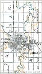 |
Red River Basin, 1916 A map of the area around Fargo and Moorhead, part of the Red River basin. |
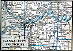 |
Kansas City and Vicinity, 1922 Kansas City, in both Kansas and Missouri, and neighboring counties. |
| Maps > United States > Midwest Region |
Maps is a part of the Educational Technology Clearinghouse
Produced by the Florida Center for Instructional Technology © 2007
College of Education, University of South Florida