| Maps > United States > Other Regions |
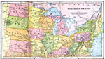 |
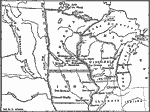
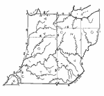
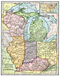
Northern Section, 1897 Map of northern United States. |
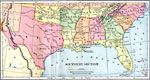 |
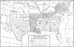
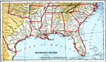
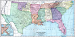
Southern Section, 1897 Map of southern United States. |
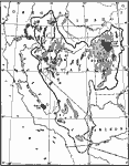 |
Climactic and Life Provinces, 1911 A map detailing the climatic and life provinces of western North America. |
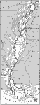 |
Alluvial Valley of the Mississippi, 1911 A map showing the lower alluvial valley of the Mississippi. |
 |
Around the Gulf of Mexico, 1800-1820 Map showing area around the Gulf of Mexico circa 1800. |
 |
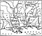
States and Territories in the South and West, 1812 Map of the States and Territories in the South and West in 1812. |
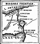 |
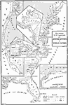
Niagara Frontier, 1812 Map of the Niagara Frontier in 1812. |
 |
Louisiana, Mississippi, and Alabama, 1834 Map shows the overlapping of three white and red sovereignties in the South (Louisiana, Mississippi, and Alabama). |
 |
Along the Upper Mississippi and around the Great Lakes, 1840-1850 Map showing area along the Upper Mississippi and around the Great Lakes. |
 |
Reconstruction in the South, 1862-1877 A map showing the process of Reconstruction in the South after the Civil War. |
 |
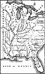
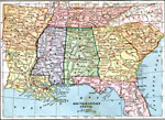
South Central States, 1870 The South Central States. |
 |
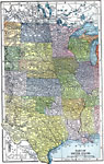
Southern and South Western States, 1872 Physical map of southern and southwestern states. Includes map inserts of Texas, the area's chief products and the vicinity of New Orleans. Time zones are provided. Red numbers indicate the rank of cities in population. |
 |
Drawing of Arkansas, Alabama, Mississippi, Louisiana, and Tennessee, 1872 Illustrates instructions for drawing Arkansas, Alabama, Mississippi, Louisiana, and Tennessee. |
 |
Drawing of Ohio, Indiana, and Kentucky, 1872 Illustrates instructions for drawing Ohio, Indiana, and Kentucky. |
 |
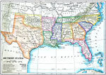
Southern States, 1882 AD Southern States. |
 |
South-Eastern States, 1883 The southeastern United States. |
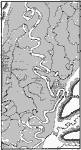 |
Sinuosities of the Mississippi, 1885 Sinuosities of the Mississippi river. |
 |
Coast Guard, 1886 U.S. coast line and the cruising grounds of revenue cutters. "Besides those mentioned there are fourteen vessels engaged in harbor duty, or upon inland waters, a sailing bark, and two steamers out of commission." —Harper's New Monthly Magazine Volume LXXIII, 1886 |
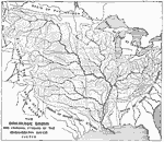 |
Drainage Basin and Principal Streams of the Mississippi River System, 1888 Shows rivers and basins that feed into the Mississippi River. |
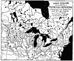 |
Great Lake Region Bounded by a Terminal Moraine, 1888 Lake region bounded by a terminal Moraine extending from Cape Cod west through Dakota. The arrows indicate direction of striae. Eclectic Physical Geography, 1888 |
 |
Southern Section of the United States, 1898 AD A map of the Southern Section of the United States as of 1898 AD. "Long, hot summers and short, temperate winters prevail over nearly the whole of this section. Although snow sometimes falls in all the states, it soon melts. Over nearly the whole section the rainfall is abundant for purposes of farming, It is only in the extreme west that serious droughts occur. The surface for a hundred miles or more from the coast is quite flat, then occur the low Piedmont hills in the east and the gently rolling plains in the west. The surface is rugged only near the Appalachian and Ozark ridges and near the mountains in the extreme west. The soil, though sandy near the coast, is generally very fertile. Agriculture is the great industry, and cotton is by far the most important crop. More than one fourth of the farm land is devoted to the cultivation of this fiber, and this region is the world's greatest cotton-producing region...After cotton, corn is the most extensive crop of the section, particularly in the northern part, where wheat and tobacco are also grown, while from the southern part come all rice and cane sugar produced in this country, and many pf the oranges. This section also produces most of the peaches and sweet potatoes raised in the United States. In the northern part, where grain is grown, many hogs and fine horses are raised, and in the western part, many cattle and sheep...In the northern section, especially in the valleys of the Appalachian and Ozark Mountains, are our most extensive forests of oak, hickory,, ash, poplar, and cotton-wood. The forests of the coast plain are composed chiefly of yellow or southern pine, which is a much harder wood than the white pine of the North...The most extensive [coal mines] are in the Appalachian and Ozark regions. Near the southern end of the Appalachians, so much iron ore is obtained that it has become the greatest iron-mining region in the country, after tge Lake Superior region...The coast of nearly the whole section is fringed with barrier beaches, and many of the inlets between them have narrow, crooked channels, often obstructed by shifting bars. Hence foreign commerce is not so great as on our northeastern coast, though much cotton and some coal and lumber are exported, and there is an active coasting trade in small vessels." &mdashRedway, 1898. |
 |
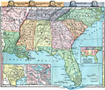
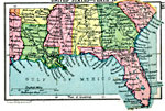
Southern States and Territories, 1899 Map of Southern States and Territories in color. Cities with populations of over 50,000 are underscored. |
 |
United States- Northern Section, 1901 Map of the northern section of the United States. |
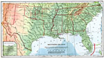 |
United States- Southern Section, 1901 Map of the southern section of the United States. |
 |
The Western States, 1903 A map of the Western States, including an inset of Alaska. |
 |
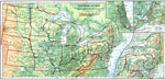
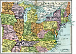
East Central States, 1906 Physical map of the east central states. |
 |
US Dependencies in the Pacific, 1910 A map showing United States dependencies in the Pacific Ocean in 1910. |
 |
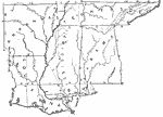
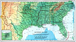
Southern United States, 1910 A map of the Southern United States. |
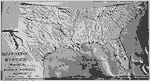 |
Relief Map of the United States, 1910 A relief map of the Southern states. |
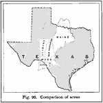 |
Texas and the New England States, 1916 A map showing a comparison of sizes between Texas and the New England states. |
 |
United States- Plate I, 1920 First in a series of regional maps of the United States. |
 |
United States- Plate II, 1920 Second in a series of regional maps of the United States. |
 |
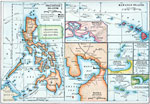
Possessions of the United States not on the American Continent, 1921 This map shows the " possessions of the United States not on the American continent." — Foster, 1921The outlying possessions include the Hawaiian Islands, Porto Rico, Virgin Islands, Samoa, Guam, and Philippine Islands. |
| Maps > United States > Other Regions |
Maps is a part of the Educational Technology Clearinghouse
Produced by the Florida Center for Instructional Technology © 2007
College of Education, University of South Florida