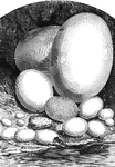
Comparative view of the size of the eggs of different animals
1, Epyornis; 2, Ostrich; 3, Cassoway; 4, Wild Goose; 5, hen; 6, Pigeon; 7, Humming-bird; 8, Eagle; 9,…
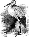
White Stork
Measuring about three feet in length, the white stork migrates to Europe during the summer, and back…
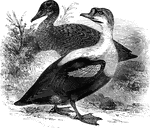
King Duck
Found in the Arctic regions of Europe, Asia, and North America, the king duck strongly resembles the…
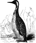
King Penguin
Also known as the pantagonian penguin, the king penguin is found in the far southern latitudes of South…
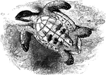
Imbricated turtle, overturned
An imbricated turtle, flipped onto its back, revealing its underbelly.
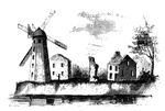
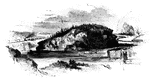
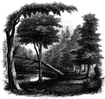
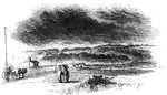
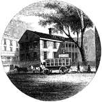
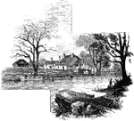
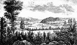
Wind-Mill Point
Wind-mill Point. This view was sketched from the steam-boat, when a little below the wind-mill, looking…
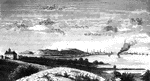
Oswego
Oswego in 1755. This view is looking north toward the lake. It is a reduced copy of the frontispiece…
Fort Oswego
View of Oswego and the Fort in 1798. This view is from the west side of the river, near the site of…
Oswego Harbor
View of Oswego Harbor, 1848. This view is from the top of the United States Hotel, looking east-northeast.…
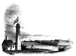
Fort Niagra
Distant view of Fort Niagra. This view is from the west side of the Niagra River, near the light-house.…
Niagra Bridge
Part of Niagra Suspension Bridge. This view, looking up from the river, comprises about one half the…
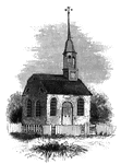
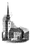
Caughnawaga Church
Caughnawaga church. This old church, now (1848) known as the Fonda Academy, under the management…
Little Falls
View at Little Falls. This view was taken from the rail-road near the village, looking down the river.…
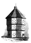
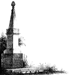
Fort Plain
Fort Plain block-house. There is considerable confusion in the accounts concerning Fort Plain, for which…
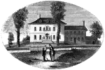
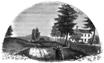
Old Parsonage and Church
Old Parsonage and Church. This view is from the high plain on the right of the block-house, looking…
![Distant view of Cherry Valley. Cherry Valley derived is name, according to Campbell, from the following circumstance: "Mr. Dunlop [the venerable pastor whose family suffered at the time of the massacre in 1778], engaged in writing some letters, inquired of Mr. Lindesay [the original proprietor of the soil] where he should date them, who proposed the name of a town in Scotland. Mr. Dunlop, pointing to the fine wild cherry-trees and to the valley, replied, 'Let us give our place an appropriate name, and call it Cherry Valley,' which was readily agreed to."](https://etc.usf.edu/clipart/13400/13460/cherry-vall_13460_mth.gif)
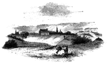
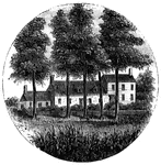
Cherry Valley
Distant view of Cherry Valley. Cherry Valley derived is name, according to Campbell, from the following…
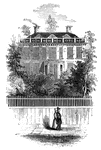
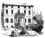
Schuyler's Mansion
Schuyler's Mansion. This view is from Schuyler Street. The edifice is of brick, having a closed octagonal…
Morristown
Washington's head-quarters at Morristown. This view is from the forks of the road, directly in front…
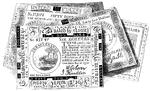
Continental Bills
Fac-simile of the Continental Bills. The paper on which these bills were printed was quite thick, and…

Tavern at Elizabethport
Old Tavern at Elizabethport. This view is looking eastward. In the distance, on the right, is seen a…
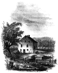
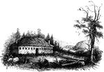
Steuben's Head-Quarters
Steuben's head-quarters. This view is from the field in front of the house, looking north. The dwelling…
Toby's Eddy
View near Toby's Eddy. The Moravians had established six missionary settlements in the vicinity of the…
Wintermoot's Fort
Site of Wintermoot's Fort. This view is from the ancient bed of the Susquehanna, looking west. The building,…
Monocasy Island
The Susquehanna at Monocasy Island. This view is from the left of eastern bank of the Susquehanna, opposite…
Queen Esther's Rock
Queen Esther's Rock. This view is near the ancient river bank, looking westward. The rock is a sort…
![The Yeoman House. This view is from the road, looking north. An attempt was made by a soldier to burn the house, but so rapid was the march of the invaders that the flames had made but little progress before the troops were far on their road to the village. An [African American] woman, who was concealed under some corn-stalks near, extinguished the flames. The house is about half a mile from the river, on the right side of the road from the landing to Kingston village.](https://etc.usf.edu/clipart/13500/13510/yeoman_13510_mth.gif)
Yeoman House
The Yeoman House. This view is from the road, looking north. An attempt was made by a soldier to burn…
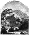
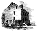
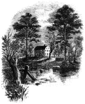
Van Schaick's Mill
Van Schaick's Mill. This view is taken from the left bank of the Walloomscoick, a little below the bridge.…
Bennington Battle-ground
The Bennington battle-ground. This view is from the hill on the southwest bank of the Walloomscoick,…
Compo
Distant view of Compo. This view is from the top of a high hill northeast of the dwelling of Mr. Ebenezer…
Ridgefield
Place of the barricade, Ridgefield. This view is at the north end of the main street. It was taken from…
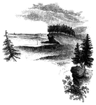
Fitch's Point
Fitch's Point, the landing-place of the British. This view is from the west side of Gregory's Point,…
Savin's Rock
Savin's Rock. This is a view of the spot where Farth landed, in Orange, formerly West Haven. It is between…
Milford Hill
West Bridge and Milford Hill. This view is from the Milford Road, eastward of West Bridge. The high…

Pine-Tree Shilling
The Pine-Tree Shilling. This is a fac-simile of the first money coined in America. The mint-master,…
Province House
"The Province House. The Province House, the residence of the colonial governors, is still standing,…
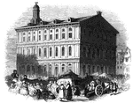
Faneuil Hall
"Faneuil Hall has been denominated 'the cradle of American liberty,' having been the popular gathering-place…
Old South
"The Old South. This venerable and venerated edifice, that stood through all the storms of the Revolution,…
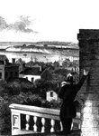
Boston
"View of Boston from Dorchester Heights in 1774. This picture is from an English print of the time.…
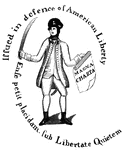
Treasury Note
"Reverse of a Massachusetts Treasury note. This is a fac simile of the device on the back of one of…
Charlestown
"Charlestown in 1775. No. 1 is Bunker Hill; 2, Breed's Hill; 3, Moulton's Point; 4, a causeway near…
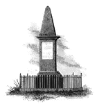
Lexington Monument
"Monument at Lexington. This view is from the Concord Road, looking eastward, and shows a portion of…
Arnold Landing-place
"View of the landing-place of Arnold. This sketch is from the west side of the cove in which the troops…
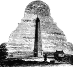
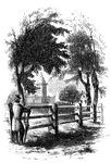
Groton Monument
"Monument at Groton. This is a view from the southwest angle of old Fort Griswold, looking northeast.…
Williams landing-place
"Landing-place of Roger Williams. This view is on the left bank of the Seekonk, looking south. The point…
Providence Tavern
"Old Tavern in Providence. This view is from the market, looking north. The building stands on the east…
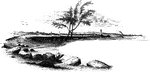
Gaspee Point
"Gaspee Point. This view is from the bank of the cove just below the Point, looking northeast, showing…
Tonomy Hill
"Top of Tonomy Hill. This view is from the northside of the hill, looking south. The wall appearance…
Prescott's Headquarters
"Prescott's Headquarters. This house is on the east side of the west road, about a mile from the bay.…
Goshen Monument
"Monument at Goshen. During the battle, Major Wood, of Goshen, made a masonic sign, by accident, which…
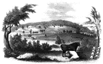
Plum Point
"Remains of fortifications at Plum Point. This view is from the interior of the redoubt looking eastward…
Greene and Knox Head-Quarters
"Head-quarters of Greene and Knox. This view is from the turnpike road, looking southeast. The water…
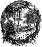
Temple
"The Temple. This view is from the site of the Temple, looking southeast. In the distance is…
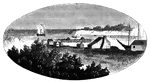
Camp Ground
"View of the Camp Ground. This is from a painting by Tice, in my possession. The land on which the encampment…
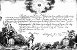
Society of the Cincinnati
"Society of the Cincinnati, member's certificate. This engraving is a fac simile of a certificate, about…
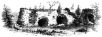
Fort Putnam
"Interior of Fort Putnam. This little sketch is a view of the remains of the casemates, or vaults, of…