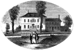
Washington's head-quarters at Morristown. This view is from the forks of the road, directly in front of the mansion. The house is of brick, covered with planks, and painted white. The rooms are large and well finished, and it was a fine mansion for the times.

Morristown

Washington's head-quarters at Morristown. This view is from the forks of the road, directly in front…

Mrs. Mathews' house. This sketch was made from the left bank of the Rahway, at the site of the old bridge. This is now the rear of the house, but, at the time of the battle, the road was upon this side of it, which formed the front. Remains of the abutments of the old bridge, where the British crossed, may still be seen.

Mrs. Mathews' house

Mrs. Mathews' house. This sketch was made from the left bank of the Rahway, at the site of the old bridge.…
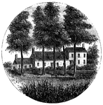
Steuben's head-quarters. This view is from the field in front of the house, looking north. The dwelling is at the end of a lane several rods from the main road leading to Middlebrook from New Brunswick. It is on the western side of the Raritan, and about a mile from the bridge near Middlebrook. Only the center building was in existence at the time in question, and that seems to have been enlarged. Each wing has since been added. The interior of the old part is kept in the same condition as it was when Steuben occupied it, being, like most of the better dwellings of that time, neatly wainscoted with pine, wrought into moldings and panels.

Steuben's Head-Quarters

Steuben's head-quarters. This view is from the field in front of the house, looking north. The dwelling…

The Yeoman House. This view is from the road, looking north. An attempt was made by a soldier to burn the house, but so rapid was the march of the invaders that the flames had made but little progress before the troops were far on their road to the village. An [African American] woman, who was concealed under some corn-stalks near, extinguished the flames. The house is about half a mile from the river, on the right side of the road from the landing to Kingston village.

Yeoman House

The Yeoman House. This view is from the road, looking north. An attempt was made by a soldier to burn…

The Bennington battle-ground. This view is from the hill on the southwest bank of the Walloomscoick, a little west of the road from the bridge to Starkville, looking northeast. The road over this hill existed at the time of the battle. The river, which here makes a sudden bend, is seen at two points- near the cattle, and at the bridge, in the distance, on the right. The house on the left, near the bridge, is Mr. Barnet's, and the road that crosses the center of the picture from right to left is the road from Bennington to Van Schaick's or North Hoosick. It passes along the river flat, at the foot of the hills where the battle occurred. The highest point on the distant hills, covered with woods, is the place where the Hessians were intrenched. From that point, along the hills to the left, for about two miles, the conflict was carried on; and upon the slopes, now cultivated, musket-balls and other relics of the battle have been plowed up.

Bennington Battle-ground

The Bennington battle-ground. This view is from the hill on the southwest bank of the Walloomscoick,…

Fitch's Point, the landing-place of the British. This view is from the west side of Gregory's Point, looking north-northwest. The promontory toward the left, covered with dark trees, is called Fort Point. There was an Indian fortification when the first settlers arrived at Norwalk. Further to the left, on the extreme edge of the picture, is seen one end of the rail-road bridge, which crosses Norwalk River. The New York and New Haven Rail-road was then in progress of construction. The point derives its name from its former proprietor, Governor Thomas Fitch, whose residence was Norwalk. He was Governor of the colony of Connecticut, and his name is among the beloved of his generation. He died July 18th, 1774, in the seventy-fifth year of his age.

Fitch's Point

Fitch's Point, the landing-place of the British. This view is from the west side of Gregory's Point,…

West Bridge and Milford Hill. This view is from the Milford Road, eastward of West Bridge. The high ground in the distance is Milford Mill, on which is seen on the road, directly over the umbrella. A little to the right of the road is the spot where Major Campbell was buried. West Bridge is about a mile and a half from the central part of New Haven.

Milford Hill

West Bridge and Milford Hill. This view is from the Milford Road, eastward of West Bridge. The high…
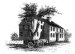
"Colonel Barrett's House. This sketch is from the road leading to the village of Concord by the way of the North Bridge. The home was erected about eighty yeras ago, by Colonel Barrett, and is now owned by his kinsman, Prescott Barrett."—Lossing, 1851

Barrett's House

"Colonel Barrett's House. This sketch is from the road leading to the village of Concord by the way…
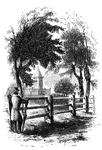
"Monument at Lexington. This view is from the Concord Road, looking eastward, and shows a portion of the inclosure of the Green. The distant building seen on the right is the old 'Buckman Tavern,' delineated in Doolittle's engraving. It now belongs to Mrs. Merriam, and exhibits many scars made by the bullets on the morning of the skirmish."—Lossing, 1851

Lexington Monument

"Monument at Lexington. This view is from the Concord Road, looking eastward, and shows a portion of…
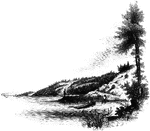
"Landing-place of Roger Williams. This view is on the left bank of the Seekonk, looking south. The point on which the figure stands is the famous rock, composed of a mass of dark slate, and rising but little above the water at high tide. The high banks are seen beyond, and on the extreme left is India Point, with the rail-road bridge near the entrance of the river into Narraganset Bay."—Lossing, 1851

Williams landing-place

"Landing-place of Roger Williams. This view is on the left bank of the Seekonk, looking south. The point…
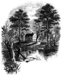
"Prescott's Headquarters. This house is on the east side of the west road, about a mile from the bay. The view is from the road where the small stream crosses, after leaving the pond seen in the picture. It is a beautiful summer residence, the grounds around it being finely shaded by willows, elms, and sycamores. The present occupant kindly showed me the room in which Prescott was lying at the time of his capture. It is on the second floor, at the southwest corner of the house, or on the right as seen in the engraving. It is a well-built frame house, and was probably then the most spacious mansion on the island out of Newport."—Lossing, 1851

Prescott's Headquarters

"Prescott's Headquarters. This house is on the east side of the west road, about a mile from the bay.…
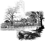
"Head-quarters of Greene and Knox. This view is from the turnpike road, looking southeast. The water in front is a mill-pond over the dam of which passes a foot-bridge. The mill is hidden by the trees in the ravine below. This side was originally the rear of the house, the old Goshen road passing upon the other side. The old front is a story and a half high. Captain Morton, the proprietor, is a son of the late General Jacob Morton, of New York city."—Lossing, 1851

Greene and Knox Head-Quarters

"Head-quarters of Greene and Knox. This view is from the turnpike road, looking southeast. The water…

"Mrs. Falls'. This house, now (1850) owned by Mr. Samuel Moore, is a frame building, and stands on the right side of the New Windsor road, at the southeastern angle of 'The Square.' It is surrounded by locust and large balm-of-Gilead trees. There Major Armstrong wrote the famous <em>Newburgh Addresses</em>, and there those in the secret held their private conferences."&mdash;Lossing, 1851

Mrs. Falls'

"Mrs. Falls'. This house, now (1850) owned by Mr. Samuel Moore, is a frame building, and stands on the…
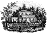
"Smith's House. This view is from the slope in front of the house. The main building is of stone; the wings are wood. The piazza in front of the main building, and the balustrades upon the top, are the only modern additions; otherwise the house appears the same as when Arnold and Andre were there. It stands upon a slope of <em>Treason Hill</em>, a few rods west of the road leading from Stony Point to Haverstraw, and about half way between the two places. It was in a room in the second story that the conspirators remained during the day of their arrival. The present owner of the house and grounds is Mr. William C. Houseman."&mdash;Lossing, 1851

Smith's House

"Smith's House. This view is from the slope in front of the house. The main building is of stone; the…

"View at Beverly Dock. This view is taken from the Hudson River rail-road, looking north. The dock, covered with cord wood, is seen near the point on the left. It is at the termination of a marsh, near the point of a bold, rocky promontory, through which is a deep rock cutting for the road. The distant hills on the extreme left are on the west side of the Hudson; and through the gorge formed for the road may be seen the military edifices of West Point."—Lossing, 1851

Beverly Dock

"View at Beverly Dock. This view is taken from the Hudson River rail-road, looking north. The dock,…
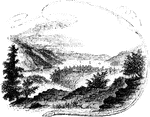
"View near Fort Montgomery. This view is from an eminence near the mountain road, about three quarters of a mile in the rear of Fort Montgomery. In the distance, the cultivated slopes of West Chester, between Peekskill and Verplanck's Point, are seen. On the left is the high, rocky promontory called Anthony's Nose; on the right is the Dunderberg, with a portion of Beveridge's Island; the buildings in the center of the picture, owned by Mrs. Pelham, denote the site of Fort Clinton; toward the right is seen the deep ravine through which flows Poplopen's Creek, and on the extreme right, partly hidden by the tree in the foreground, and fronting the river, is the site of Fort Montgomery. The scenery from this point of view is indeed magnificent."&mdash;Lossing, 1851

Fort Montgomery

"View near Fort Montgomery. This view is from an eminence near the mountain road, about three quarters…
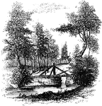
"Bridge over Sleepy Hollow Creek. Ichabod, according to Irving, in the <em>Legend</em>, returning from a late evening tarry with Katrina Van Tassel, on his lean steed Gunpowder, was chased by a huge horseman, without a head, from the Andre tree to the bridge. 'He saw the walls of the church dimly gleaming under the trees beyond. He recollected the place where Brom Bones' ghostly competitor had disappeared. "If I can reach that bridge," thought Ichabod, "I am safe." Just then he heard the black steed panting and blowing close behind him; he even fancied that he felt his hot breath. Another compulsive kick in the ribs, and old Gunpowder sprang upon the bridge; he thundered over the resounding planks; he gained the opposite side; and now Ichabod cast a look behind, to see if his pursuer should vanish, according to rule, in a flash of fire and brimstone. Just then he saw the goblin rising in his stirrups, and in the very act of hurling his head at him. Ichabod endeavored to dodge the horrible missile, but too late; it encountered his cranium with a terrible crash; he was tumbled headlong into the dust, and Gunpowder, the black steed, and the goblin rider, passed like a whirlwind.' A shattered pumpkin was found on the road the next day, but Ichabod had gone to parts unknown. Brom Bones, his rival, soon afterward let the pretty Katrina to the altar. The good country people always maintained that Ichabod was spirited away by the <em>headless horseman</em>, who was the ghost of a Hessian soldier, whose body, deprived of its caput by a cannon-ball, ws sleeping in the church-yard near."&mdash;Lossing, 1851

Sleepy Hollow

"Bridge over Sleepy Hollow Creek. Ichabod, according to Irving, in the Legend, returning from…

"Remains of intrenchments the Ramapo Pass. This view is from the road, looking north toward the village of Ramapo. The remains of the intrenchments are seen along the right in the foreground. On the left, in the distance, is seen a glimpse of the hills on the other side of the narrow valley."&mdash;Lossing, 1851

Ramapo Pass

"Remains of intrenchments the Ramapo Pass. This view is from the road, looking north toward the village…
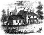
"The Hopper House. This view is from the road, looking northeast. The low part, on the left, is a portion of the old mansion of the Revolution, which contained the dining-hall. It was a long stone building. A part of it has been taken down, and the present more spacious edifice, of brick, was erected soon after the war."&mdash;Lossing, 1851

Hopper House

"The Hopper House. This view is from the road, looking northeast. The low part, on the left, is a portion…
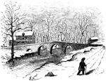
"Bridge at Worth's Mill's. This substantial stone bridge, over Stony Brook, is upon the site of the wooden one destroyed on the 3d of January, 1777. The old mill on the left is now owned by Josiah S. Worth, a son of the propietor during the Revolution. This sketch was made from the road on the bank of the stream, along which Mercer and his detachment marched to secure the bridge."—Lossing, 1851

Worth's Mills

"Bridge at Worth's Mill's. This substantial stone bridge, over Stony Brook, is upon the site of the…

"Washington's head-quarters. This view is from the Reading rail-road, looking east, and includes a portion of the range of hills in the rear whereon the Americans were encamped. The main building was erected in 1770; the wing is more modern, and occupies the place of the log addition mentioned by Mrs. Washington, in a letter to Mercy Warren, written in March, 1778: 'The general's apartment,' she wrote, 'is very small; he has had a log cabin built to dine in, which has made our quarters much more tolerable than they were at first.'"—Lossing, 1851

Washington's head-quarters

"Washington's head-quarters. This view is from the Reading rail-road, looking east, and includes a portion…
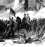
"Battle of Shiloh, or Pittsburg Landing, left wing- the woods on fire during the engagement of Sunday, April 6th, 1862- Forty-Fourth Indiana Volunteers engaged. The right wing of General Hurlbut's division stopped the advance of the Confederates by a determined defense along a side road leading through the woods on the right of the field. The Twenty-fifth and Seventeenth Kentucky and Forty-fourth and Thirty-first Indiana Regiments were engaged. By some means the dry leaves and thick underbrush which covered this locality took fire, filling the woods with volumes of smoke, and only discovering the position of the opposing forces to each other by the unceasing rattle of musketry and the whizzing of the bullets." &mdash; Frank Leslie, 1896

Battle of Shiloh

"Battle of Shiloh, or Pittsburg Landing, left wing- the woods on fire during the engagement of Sunday,…
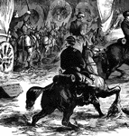
"Advance of Federal troops on Corinth- the Carnival of Mud- scene at Lick Creek Bottom, between Pittsburg Landing and Monterey, four miles from Corinth, May 5th, 1862- General Hurlbut's division forcing their way through the mud. Our illustration cannot fail to fasten the grand fact of mud firmly on the reader's mind. Our special artist, Mr. Lovie, carefully made the sketch on the spot at Lick Creek Bottom, when General Hurbut's division of Halleck's grand army was advancing from Pittsburg Landing to Monterey. In his letter he said: "Lick Creek Bottom is part of the road between Pittsburg Landing and Monterey. The hills on both sides are clayey ground, and the creek rises rapidly after every rain. On Monday, May 5th, an attempt was made to pull through the cannon and wagon train, but the mud was too deep, and the result was that in a few hours the bottom was filled with wagons and mules, hopelessly mired, and waiting for dry weather to be dug out. A moment's reflection will enable you to get a faint idea of the enormous task before us. The bottom land is very deep and rich, and only those who have tested the adherent and adhering qualities of this soil can appreciate its glorious consistency and persistency thoroughly. I have had considerable experiences of mud, but, in all my rides, or, rather, wallowings, I have seldom experienced such difficulty in getting my horse along, and I only succeeded by driving my spurs so vehemently into his poor sides, that he made those desperate plunges which carried us through." —Leslie, 1896

Lick Creek Bottom - Horse and Rider

"Advance of Federal troops on Corinth- the Carnival of Mud- scene at Lick Creek Bottom, between Pittsburg…
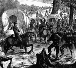
"Advance of Federal troops on Corinth- the Carnival of Mud- scene at Lick Creek Bottom, between Pittsburg Landing and Monterey, four miles from Corinth, May 5th, 1862- General Hurlbut's division forcing their way through the mud. Our illustration cannot fail to fasten the grand fact of mud firmly on the reader's mind. Our special artist, Mr. Lovie, carefully made the sketch on the spot at Lick Creek Bottom, when General Hurbut's division of Halleck's grand army was advancing from Pittsburg Landing to Monterey. In his letter he said: "Lick Creek Bottom is part of the road between Pittsburg Landing and Monterey. The hills on both sides are clayey ground, and the creek rises rapidly after every rain. On Monday, May 5th, an attempt was made to pull through the cannon and wagon train, but the mud was too deep, and the result was that in a few hours the bottom was filled with wagons and mules, hopelessly mired, and waiting for dry weather to be dug out. A moment's reflection will enable you to get a faint idea of the enormous task before us. The bottom land is very deep and rich, and only those who have tested the adherent and adhering qualities of this soil can appreciate its glorious consistency and persistency thoroughly. I have had considerable experiences of mud, but, in all my rides, or, rather, wallowings, I have seldom experienced such difficulty in getting my horse along, and I only succeeded by driving my spurs so vehemently into his poor sides, that he made those desperate plunges which carried us through." —Leslie, 1896

Lick Creek Bottom - In the Mud

"Advance of Federal troops on Corinth- the Carnival of Mud- scene at Lick Creek Bottom, between Pittsburg…
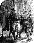
"Advance of Federal troops on Corinth- the Carnival of Mud- scene at Lick Creek Bottom, between Pittsburg Landing and Monterey, four miles from Corinth, May 5th, 1862- General Hurlbut's division forcing their way through the mud. Our illustration cannot fail to fasten the grand fact of mud firmly on the reader's mind. Our special artist, Mr. Lovie, carefully made the sketch on the spot at Lick Creek Bottom, when General Hurbut's division of Halleck's grand army was advancing from Pittsburg Landing to Monterey. In his letter he said: "Lick Creek Bottom is part of the road between Pittsburg Landing and Monterey. The hills on both sides are clayey ground, and the creek rises rapidly after every rain. On Monday, May 5th, an attempt was made to pull through the cannon and wagon train, but the mud was too deep, and the result was that in a few hours the bottom was filled with wagons and mules, hopelessly mired, and waiting for dry weather to be dug out. A moment's reflection will enable you to get a faint idea of the enormous task before us. The bottom land is very deep and rich, and only those who have tested the adherent and adhering qualities of this soil can appreciate its glorious consistency and persistency thoroughly. I have had considerable experiences of mud, but, in all my rides, or, rather, wallowings, I have seldom experienced such difficulty in getting my horse along, and I only succeeded by driving my spurs so vehemently into his poor sides, that he made those desperate plunges which carried us through." —Leslie, 1896

Lick Creek Bottom - Marching through the Mud

"Advance of Federal troops on Corinth- the Carnival of Mud- scene at Lick Creek Bottom, between Pittsburg…
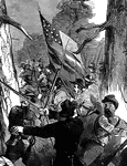
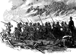
"Gallant attack by 150 of the Pennsylvania Bucktails, led by Colonel Kane, upon a portion of General Stonewall Jackson's Confederate Army, stronly posted in the woods, near Harrisonburg, Friday, June 6th, 1862. We illustrate one of the most heroic actions of the war, the attack of the famous Bucktails, under their gallant leader, Colonel Krane, upon a large portion of Stonewall Jackson's army, consisting of infantry, cavalry and artillery. The spot where this deadly conflict took place was about a mile and a half beyond Harrisonburg, on the road to Port Republic, toward which place the Confederates were in full retreat, closely but warily pursued by Generals Fremont and Shields. On Friday, June 6th, Colonel Sir Percy Wyndham, of the First New Jersey Cavalry, having been sent by General Bayard to reconnoitre, was led into an ambuscade, where his regiment was fearfully cut up, and himself wounded and taken prisoner. It will be seen that the humanity of Colonel Krane led him into a similar trap. News of what had occurred was rapidly transmitted to headquarters, and General Bayard was ordered out with fresh cavalry and a battalion of Pennsylvania Bucktails. But the Sixtieth Ohio had already beaten back the bold Confederates. The evening was waxing late; General Fremont did not wish to bring on a general engagement at this hour, and the troops were ordered back. "But do not leave poor Wyndham on the field, and all the wounded," remonstrated brave Colonel Krane of the Bucktails. "Let me at 'em, general, with my Bucktails." "Just forty minutes I'll give you, colonel," said General Bayard, pulling out his watch. "Peep through the woods on our left, see what is in there, and out again when the time is up." In go the 150 at an opening in the pines; they were soon surrounded by a cordon of fire flashing from the muzzles of more than a thousand muskets; but not a sign, nor the shadow of a sign, of yielding. Their fire met the enemy's straight and unyielding as the blade of a matador. Oh for re-enforcements! But none came. The brave Bucktails were forcd to retreat across the fields of waving green, firing as they did so- but not the 150 that went in. The rest lie under the arching dome of the treacherous forest." — Frank Leslie, 1896

Attack at Harrisonburg

"Gallant attack by 150 of the Pennsylvania Bucktails, led by Colonel Kane, upon a portion of General…
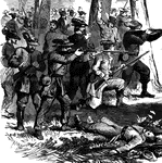
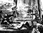
"Federal baggage train on its way to the army at Falmouth, VA., December, 1862. Our illustration represents a Federal baggage train hastening on to Falmouth with commissary stores for General Burnside's army before the crossing of the Rappahannock to attack Fredericksburg. The immense labor and fatigue attendant on operations in this region may be conceived by our sketch. The fearful road over rocks and cliffs, the storms, the constant fear of surprise by the enemy, where escape and defense are alike impossible, give to the life of the army train all the perils of romance."— Frank Leslie, 1896

Baggage Train to Falmouth, VA

"Federal baggage train on its way to the army at Falmouth, VA., December, 1862. Our illustration represents…

"Federal baggage train on its way to the army at Falmouth, VA., December, 1862. Our illustration represents a Federal baggage train hastening on to Falmouth with commissary stores for General Burnside's army before the crossing of the Rappahannock to attack Fredericksburg. The immense labor and fatigue attendant on operations in this region may be conceived by our sketch. The fearful road over rocks and cliffs, the storms, the constant fear of surprise by the enemy, where escape and defense are alike impossible, give to the life of the army train all the perils of romance."— Frank Leslie, 1896

Baggage Train Wagon

"Federal baggage train on its way to the army at Falmouth, VA., December, 1862. Our illustration represents…
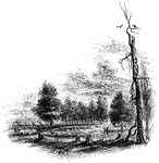
"The Regulator battle-ground. This view is from the south side of the Salisbury Road, which is marked by the fence on the left. The belligerents confronted in the open field seen on the north of the road, beyond the fence. Between the blasted pine, to which a muscadine is clinging, and the road, on the edge of a small morass, several of those who were slain in that engagement were buried. I saw the mounds of four graves by the fence, where the sheep, seen in the picture, are standing. The tree by the road side is a venerable oak, in which are a few scars produced by the bullets."&mdash;Lossing, 1851

Regulator Battle-ground

"The Regulator battle-ground. This view is from the south side of the Salisbury Road, which is marked…
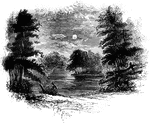
"Trading Ford. This view of the Trading Ford, where greene, with Morgan and his light troops, crossed the Yadkin, is from the east side of the river. It is just at the foot of an island, about a mile and a half below the great bridge on the road to Salisbury. The river is usually fordable between the island and the stakes seen in the picture; below that point the water is deep."&mdash;Lossing, 1851

Trading Ford

"Trading Ford. This view of the Trading Ford, where greene, with Morgan and his light troops, crossed…

"View of the battle-ground. This view is from the eminence southwest of the site of old Guilford Court House, near the junction of the roads running one north to Bruce's Cross-roads, the other west to Salem. The log-house, partially clapboarded, seen on the right, was uninhabited. It stands near the woods which intervene between Martinsville and the plantation of Mr. Hotchkiss. In the distance, near the center, is seen Martinsville, and between it and the foreground is the rolling vale, its undulations furrowed by many gulleys. In an open field, on the left of the road, seen in the hollow toward the left of the picture, was the fiercest part of the battle, where Washington charged upon the guards. Upon the ridge extending to the right through the center of the picture, the second line (Virginians) was posted. The fence running to the right from Martinsville, down into the valley on the right, denotes the Salisbury road. The snow was falling very fast when I made this sketch, and distant objects were seen with great difficulty. Our point of view, at the old loghouse, is the extreme westerly boundary of the field of controversy."—Lossing, 1851

Guilford Battle-ground

"View of the battle-ground. This view is from the eminence southwest of the site of old Guilford Court…

"View at Rugeley's. This view is from the south side of the bridge. The counterfeit cannon was placed in the road where the first wagon is seen. The house and barn of Rugeley were in the cleared field seen beyond the wagons."—Lossing, 1851

Rugeley's

"View at Rugeley's. This view is from the south side of the bridge. The counterfeit cannon was placed…

"View at Gravesend Bay. This view is from the road on the high shore, a little below Fort Hamilton, looking southeast; the house in the center belonged to Simon Cortelyou, a Tory, during the Revolution, and has not been altered. Gravesend Bay is seen beyond the house, and the distant land is Coney Island beach."&mdash;Lossing, 1851

Gravesend Bay

"View at Gravesend Bay. This view is from the road on the high shore, a little below Fort Hamilton,…
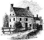
"Cortelyou's House. This house, built of stone, with a brick gable from eaves to peak, is yet (1852) standing upon the eastern side of the road leading from Brooklyn to Gowanus Creek, looking southeast. In the extreme distance is seen the 'Yellow Mill' between which and the one in the foreground so many of the patriots perished."&mdash;Lossing, 1851

Cortelyou's House

"Cortelyou's House. This house, built of stone, with a brick gable from eaves to peak, is yet (1852)…
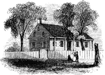
"Washington's head-quarters. The house occupied by Washington while the army was at White Plains is yet standing. It is a frame building, on the east side of the road, about two miles above the village. This view is from the road, looking northeast. When I last visited it (1851), Miss Jemima Miller, a maiden ninety-three yeras of age, and her sister, a few years her junior, were living therein, the home of their childhood. A chair and table, used by the chief, is carefully preserved by the family, and a register for the names of the numerous visitors is kept. This house was in the deep solitude of the forests, among the hills, when Washington was there; now the heights and the plain near by smile with cultivation."—Lossing, 1851

Washington's Head-Quarters

"Washington's head-quarters. The house occupied by Washington while the army was at White Plains is…

"Chatterton's Hill, from the rail-way station. This is a view of the southeastern side of Chatterton's Hill, from the rail-way station. They crossed the Bronx at a point seen on the extreme right. On the top of the hill, in the edge of the woods on the left, Hamilton's cannons were placed."&mdash;Lossing, 1851

Chatterton's Hill

"Chatterton's Hill, from the rail-way station. This is a view of the southeastern side of Chatterton's…
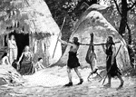
"Early Germans. These German ancestors of ours, for so we must consider them, since the chief element of the English-speaking race is German, continued in the barbarous stage while the Romans advanced to the founding of a great empire and were already on the road to decline; and from the first century B.C. to the fourth century A.D. there was little change in their condition."&mdash;Colby, 1899

Germans

"Early Germans. These German ancestors of ours, for so we must consider them, since the chief element…

"The first passenger locomotive built in the United States. A year after the Enterprise sailed for India, the first railroad in the United States was opened in Massachusetts, from the Quincy quarries to tide water. It was only two miles long, and was used for hauling granite; the cars were drawn by horses. It was the first use of rails in America. In 1830 the first passenger railway in America was opened. It extended westward from Baltimore about fifteen miles, and now forms a part of the Baltimore and Ohio Railroad. The cars were at first drawn by horses, but a locomotive was used the next year. Its first locomotive was built by Peter Cooper, who made later the generous and useful gift of the Cooper Union to the city of New York. Now began the construction of railroads in various directions; in the next twenty years nearly ten thousand miles of road were built. This mileage has constantly been increased, until in 1895 there were in operation in the United States nearly one hundred and eighty thousand miles of railway."—Scudder, 1897

Passenger Train

"The first passenger locomotive built in the United States. A year after the Enterprise sailed for India,…

"Among the anceient Romans, a functionary whose duty it was to observe and to interpret, according to traditional rules, the auspices, or reputed natural signs concerning future events."-Whitney, 1902.

Auger

"Among the anceient Romans, a functionary whose duty it was to observe and to interpret, according to…
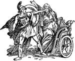
"When grown up, Oedipus is told by the oracle that he would slay his father and marry his mother. On his return to Corinth he met Laius in a narrow pass and, in a dispute about the road, slew him." &mdash; The Delphian Society, 1913

Death of Laius

"When grown up, Oedipus is told by the oracle that he would slay his father and marry his mother. On…
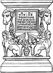
"A low column, sometimes round, but more frequently rectangular. Cippi were used for various purposes; the decrees of the senate were sometimes inscribed upon them; and with distances engraved upon them, they also served as mile-stones. They were however, more frequently employed as sepulchral monuments. It was also usual to place at one corner of the burying-ground a cippus, on which the extent of the burying-ground was marked, towards the road, and backwards to the fields." &mdash; Smith, 1873

Cippus

"A low column, sometimes round, but more frequently rectangular. Cippi were used for various purposes;…

"A. Pinacotheca, B. Temple of Nike Apteros, C. Pedestal of Agrippa, D. Road leading to the central entrace, E. Central enterance, F. Hail corresponding to the Pinacotheca." &mdash; Smith, 1882

Propylea restored

"A. Pinacotheca, B. Temple of Nike Apteros, C. Pedestal of Agrippa, D. Road leading to the central entrace,…

"A bridge. As the rivers of Greece were small, and the use of the arch known to them only to a limited extent, it is probable that the Greek bridges were built entirely of wood, or, at best, were nothing more than a wooden platform supported upon stone piers at each extremity. Pliny mentions a bridge over the Acheron 1000 feet in length; and also says that the island Euboea was joined to Boeotia by a bridge; but it is probably that both these works were executed after the Roman conquest. The Romans were the first people who applied the arch to the construction of bridges, by which they were enabled to erect structures of great beauty and solidity, as well as utility. The width of the passage-way in a roman bridge was commonly narrow, as compared with modern structures of the same kind, and corresponded with the road leading to and from it. It was divided into three parts. the centre one, for horses and carriages, was denominated agger or iter; and the raised foot paths on each side decursoria, which were enclosed by parapet walls similar in use and appearance to the pluteus in the basilica." — Smith, 1873

Pons Cestius

"A bridge. As the rivers of Greece were small, and the use of the arch known to them only to a limited…

"A bridge. As the rivers of Greece were small, and the use of the arch known to them only to a limited extent, it is probable that the Greek bridges were built entirely of wood, or, at best, were nothing more than a wooden platform supported upon stone piers at each extremity. Pliny mentions a bridge over the Acheron 1000 feet in length; and also says that the island Euboea was joined to Boeotia by a bridge; but it is probably that both these works were executed after the Roman conquest. The Romans were the first people who applied the arch to the construction of bridges, by which they were enabled to erect structures of great beauty and solidity, as well as utility. The width of the passage-way in a roman bridge was commonly narrow, as compared with modern structures of the same kind, and corresponded with the road leading to and from it. It was divided into three parts. the centre one, for horses and carriages, was denominated agger or iter; and the raised foot paths on each side decursoria, which were enclosed by parapet walls similar in use and appearance to the pluteus in the basilica." — Smith, 1873

Pons Aelius

"A bridge. As the rivers of Greece were small, and the use of the arch known to them only to a limited…

"A bridge. As the rivers of Greece were small, and the use of the arch known to them only to a limited extent, it is probable that the Greek bridges were built entirely of wood, or, at best, were nothing more than a wooden platform supported upon stone piers at each extremity. Pliny mentions a bridge over the Acheron 1000 feet in length; and also says that the island Euboea was joined to Boeotia by a bridge; but it is probably that both these works were executed after the Roman conquest. The Romans were the first people who applied the arch to the construction of bridges, by which they were enabled to erect structures of great beauty and solidity, as well as utility. The width of the passage-way in a roman bridge was commonly narrow, as compared with modern structures of the same kind, and corresponded with the road leading to and from it. It was divided into three parts. the centre one, for horses and carriages, was denominated agger or iter; and the raised foot paths on each side decursoria, which were enclosed by parapet walls similar in use and appearance to the pluteus in the basilica." — Smith, 1873

Pons Ariminum

"A bridge. As the rivers of Greece were small, and the use of the arch known to them only to a limited…

"A bridge. As the rivers of Greece were small, and the use of the arch known to them only to a limited extent, it is probable that the Greek bridges were built entirely of wood, or, at best, were nothing more than a wooden platform supported upon stone piers at each extremity. Pliny mentions a bridge over the Acheron 1000 feet in length; and also says that the island Euboea was joined to Boeotia by a bridge; but it is probably that both these works were executed after the Roman conquest. The Romans were the first people who applied the arch to the construction of bridges, by which they were enabled to erect structures of great beauty and solidity, as well as utility. The width of the passage-way in a roman bridge was commonly narrow, as compared with modern structures of the same kind, and corresponded with the road leading to and from it. It was divided into three parts. the centre one, for horses and carriages, was denominated agger or iter; and the raised foot paths on each side decursoria, which were enclosed by parapet walls similar in use and appearance to the pluteus in the basilica." — Smith, 1873

Pons Trajan

"A bridge. As the rivers of Greece were small, and the use of the arch known to them only to a limited…

Also called the ground cuckoo, road runner, or paisano. A large errestrial bird or the family Cuculid&aelig;.

Chaparral

Also called the ground cuckoo, road runner, or paisano. A large errestrial bird or the family Cuculidæ.
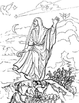
"Represents a Roman augur, with his litmus or divining staff, observing the signs in the heavens." &mdash; Anthon, 1891

Roman augur

"Represents a Roman augur, with his litmus or divining staff, observing the signs in the heavens." —…
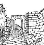
"Via, a public road. It was not until the period of the long protracted Samnite wars that the necessity was felt of securing a safe communication between the city and the legions; and then for the first time we hear of those famous paved roads, which, in after ages, connected Rome with her most distant provinces, constituting the most lasting of all her works. The excellence of the principles upon which they were constructed is sufficiently attested by their extraordinary durability, many specimens being found in the country around Rome which have been used without being repaired for more than a thousand years." &mdash; Smith; 1873

Via

"Via, a public road. It was not until the period of the long protracted Samnite wars that the necessity…
Known as the Commodore Vanderbilt and director of the Long Island Rail Road.

Cornelius Vanderbilt

Known as the Commodore Vanderbilt and director of the Long Island Rail Road.

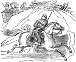
"That prince escaped from the battle of Worcester as soon as he saw that the day was lost. With a small company of attendants, he eluded the pursuit of the enemy's cavalry by the fleetness of his horse, and struck off from the high road without well knowning which way to go." &mdash; Goodrich, 1844

Escape of Charles II

"That prince escaped from the battle of Worcester as soon as he saw that the day was lost. With a small…
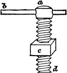
"The screw may be considered as a winding wedge; for it has the same relation to a straight wedge that a road, winding up a hill or town, has to a straight road of the same length and activity." &mdash; Goodrich, 1844

Screw

"The screw may be considered as a winding wedge; for it has the same relation to a straight wedge that…

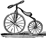
A light road-carriage for a single person.

Velocipede

A light road-carriage for a single person.

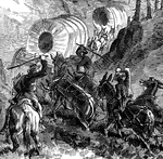
Emigrants on the road to the West.

Emigrants

Emigrants on the road to the West.

This illustration shows a machine used to put oil on roads during its construction, in the nineteenth century

Road Oiler

This illustration shows a machine used to put oil on roads during its construction, in the nineteenth…
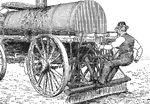
This illustration shows a machine used to put oil on roads during its construction, in the nineteenth century

Road Oiler

This illustration shows a machine used to put oil on roads during its construction, in the nineteenth…
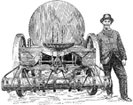
This illustration shows a machine used to put oil on roads during its construction, in the nineteenth century

Road Oiler

This illustration shows a machine used to put oil on roads during its construction, in the nineteenth…