Radish
View of a radish, illustrating the root-hairs, which absorb most of the water the plant needs.
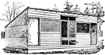
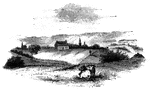
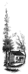
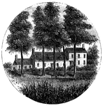
Side View of Farmhouse
Scattered planting of trees pruned in artificial shapes in front of a farmhouse.
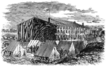
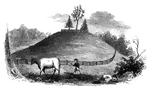
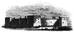
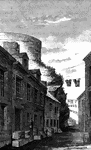
Prison Pen
"The great Prison Pen at Andersonville, Ga. The stockade was orginally eleven acres, which was increased…
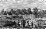
Prison Reception
"Reception of Confederate prisoners at the Federal prison, Elmira, N. Y. The prison at Elmira, N. Y.,…
General McGowen
"General McGowen addressing the Thirty-Fifth Abbeville (S. C.) Volunteers, in front of the Charleston…
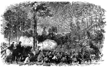
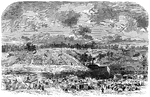
Battle of Carrick's Ford
"Battle of Carrick's Ford, between the troops of General McClellan's command, under General Morris,…
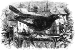
Black Redstart
A black redstart perched on a branch in front of a stone building. It greatly resembles the redstart.
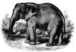
African Elephant
"The head is rounded, the front convex instead of concave, and the nails on each hind-foot are three…
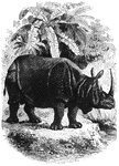
Indian Rhinoceros
"The head and neck are rather short; the eye is small and lateral, and the snimal cannot see in front,…
Front Royal
"Front Royal, Manassas Gap Railroad, Blue Ridge Mountains in the distance- the Federal army entering…
Heights of Charlestown
"A profile view of the Heights of Charlestown, in the American Revolution."—E. Benjamin Andrews,…

Palos
View of Palos. The pile of buildings in this view, standing upon the bluff, is the ancient Church of…
Battle-ground
This view is taken from near the house of Mr. Neilson, looking northwest. In the foreground, on the…
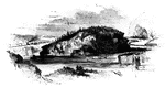
Fraser Burial
Fraser's burial-place. The hill on which the 'great redoubt' was erected, and where General Fraser was…

British Surrender
View of the place where the British laid down their arms. The sketch here presented, of the place where…
first interview
Site of the first interview between Gates and Burgoyne. This view is taken from the turnpike, looking…
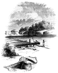
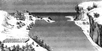
The Falls
View below the Falls. This view was taken from under the bridge, looking down the river. The cave opens…
William's Rock
William's Rock. This view is taken from the road, looking northward. In the distance is seen the highest…
Fort Anne
Site of Fort Anne. This view is from the bridge which crosses Wood Creek, looking south. The distant…
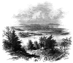
Sholes's Landing
View from Shole's Landing. This is a view from Chipman's Point, or Sholes's Landing, looking north.…
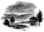
Chimney Point
Chimney Point Landing. This view is taken from the green in front of the inn at Chimney Point, looking…
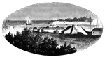
St. John's
Military establishment at St. John's. This view is taken from the eastern side of the river, near the…
Fort at Chambly
Fort at Chambly, this is a view of the south and west sides of the fort, looking toward the river. It…
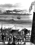
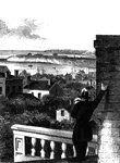
Point Levi
View of Point Levi from Durham Terrace, Quebec. This sketch is taken from Durham Terrace, near the north…
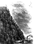
Cape Diamond
Cape Diamond, this is a view of the spot where Montgomery was killed. The cliff is Cape Diamond, crowned…
Arnold Wounded
Place where Arnold was wounded. This view is in a narrow alley near the north end of Sault au Matelot…
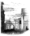
Palace Gate
Palace Gate, inside. This sketch is a view from within Palace Street, looking out upon the open country…
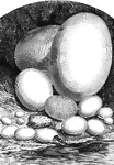
Comparative view of the size of the eggs of different animals
1, Epyornis; 2, Ostrich; 3, Cassoway; 4, Wild Goose; 5, hen; 6, Pigeon; 7, Humming-bird; 8, Eagle; 9,…
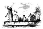
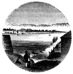
Wind-Mill Point
Wind-mill Point. This view was sketched from the steam-boat, when a little below the wind-mill, looking…
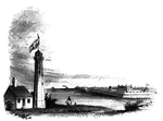
Oswego
Oswego in 1755. This view is looking north toward the lake. It is a reduced copy of the frontispiece…
Fort Oswego
View of Oswego and the Fort in 1798. This view is from the west side of the river, near the site of…
Oswego Harbor
View of Oswego Harbor, 1848. This view is from the top of the United States Hotel, looking east-northeast.…
Fort Niagra
Distant view of Fort Niagra. This view is from the west side of the Niagra River, near the light-house.…
Niagra Bridge
Part of Niagra Suspension Bridge. This view, looking up from the river, comprises about one half the…
Little Falls
View at Little Falls. This view was taken from the rail-road near the village, looking down the river.…
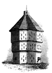
Fort Plain
Fort Plain block-house. There is considerable confusion in the accounts concerning Fort Plain, for which…
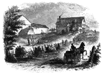
Old Parsonage and Church
Old Parsonage and Church. This view is from the high plain on the right of the block-house, looking…
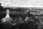
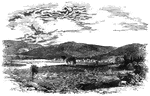
![Distant view of Cherry Valley. Cherry Valley derived is name, according to Campbell, from the following circumstance: "Mr. Dunlop [the venerable pastor whose family suffered at the time of the massacre in 1778], engaged in writing some letters, inquired of Mr. Lindesay [the original proprietor of the soil] where he should date them, who proposed the name of a town in Scotland. Mr. Dunlop, pointing to the fine wild cherry-trees and to the valley, replied, 'Let us give our place an appropriate name, and call it Cherry Valley,' which was readily agreed to."](https://etc.usf.edu/clipart/13400/13460/cherry-vall_13460_mth.gif)
Cherry Valley
Distant view of Cherry Valley. Cherry Valley derived is name, according to Campbell, from the following…
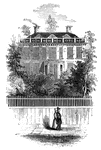
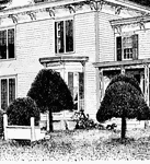
Schuyler's Mansion
Schuyler's Mansion. This view is from Schuyler Street. The edifice is of brick, having a closed octagonal…
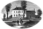
Morristown
Washington's head-quarters at Morristown. This view is from the forks of the road, directly in front…
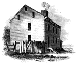
Mrs. Mathews' house
Mrs. Mathews' house. This sketch was made from the left bank of the Rahway, at the site of the old bridge.…
Tavern at Elizabethport
Old Tavern at Elizabethport. This view is looking eastward. In the distance, on the right, is seen a…
Steuben's Head-Quarters
Steuben's head-quarters. This view is from the field in front of the house, looking north. The dwelling…