

Cumming's Phleomys
"Found on the Island of Lucon. It is a rare species, even in its native island, and its habits are little…
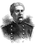
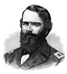
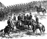
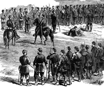
General Edward Hatch
"General Hatch, born in Bangor, Me., December 22nd, 1832. In April, 1861, he was a member of the District…
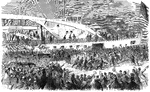
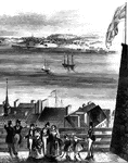
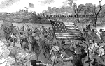
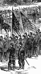
Rhode Island Regiments
"Rhode Island Regiments embarking at Providence for New York and Washington. Within five days after…
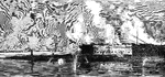
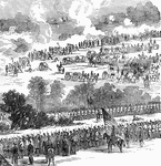
Fort Pulaski
"The bombardment of Fort Pulaski, second day, Friday, April 11th, 1862. General Quincy A. Gilmore took…

General Winfield Scott Hancock
"General Hancock, born in Montgomery Square, Montgomery County, Pa., February 14th, 1824; died on Governor's…
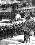
General John Pope
"General John Pope was involved in New Madrid and Island No. 10 during the Civil War."—E. Benjamin…
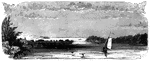
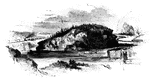
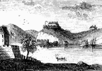
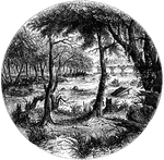
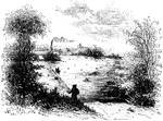
Long Point
Long Point and vicinity. This little sketch was taken from the steam-boat , near the south end of Long…
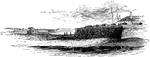
Arnold's Battle
Scene of Arnold's naval battle. This sketch was made from the pilot's room of the steam-boat just after…
Isle Aux Noix
Isle Aux Noix, in the Sorel. The sketch was made from the pilot's room of the steam-boat, about half…
Point Levi
View of Point Levi from Durham Terrace, Quebec. This sketch is taken from Durham Terrace, near the north…

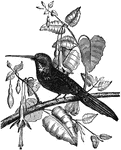
Long-Billed Parrot
The long-billed parrot (nestor productus) is thought to be the connecting link between parrots…
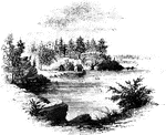
Cascades
The Cascades, on St. Ann's Rapids. These rapids are so called from the cirumstance that a village of…

Smooth terrapin
The smooth terrapin is found from Rhode island southward along the eastern coast of the United States.
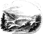
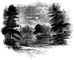
Little Falls
View at Little Falls. This view was taken from the rail-road near the village, looking down the river.…
Monocasy Island
The Susquehanna at Monocasy Island. This view is from the left of eastern bank of the Susquehanna, opposite…
Compo
Distant view of Compo. This view is from the top of a high hill northeast of the dwelling of Mr. Ebenezer…

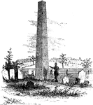
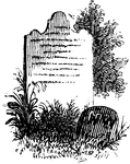
Seabury's Monument
"Bishop Seabury's Monument. The following is the inscription upon the slab: 'Here lieth the body of…
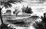
Hubbard's House and Mill
"Hubbard's House and Mill. The inscriptions upon the monument are as follows: East Side: "Oliver Hazard…
Prescott's Headquarters
"Prescott's Headquarters. This house is on the east side of the west road, about a mile from the bay.…
Plum Point
"Remains of fortifications at Plum Point. This view is from the interior of the redoubt looking eastward…
West Point
"West Point in 1780. This view is from a print published in the New York Magazine for 1790.…
Fort Montgomery
"View near Fort Montgomery. This view is from an eminence near the mountain road, about three quarters…
Peekskill Landing
"View from Peekskill Landing. This view is from Peekskill landing, looking up the river. On the left…
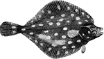
Plaice
"Weighing six to twelve pounds; it feeds on mollusca, crustacea, and young fish; inhabits sandy banks…

Penn's seal and signature
"Penn's Seal and Signature. This is a representation of the seal and signature of William Penn attached…
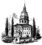
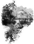
Annapolis State House
"The State House in Annapolis. This fine building is situated upon an elevation in the center of the…
Battle of Roanoke Island
"Battle of Roanoke Island, February 8th, 1862- decisive bayonet charge of the Ninth New York Volunteers…
Battle of Roanoke Island
"Battle of Roanoke Island, February 8th, 1862- decisive bayonet charge of the Ninth New York Volunteers…
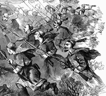
Battle of Roanoke Island
"Battle of Roanoke Island, February 8th, 1862- decisive bayonet charge of the Ninth New York Volunteers…
Battle of Malvern Hill
"Battle of Malvern Hill, near Turkey Bend, James River, Va., fought Tuesday, July 1st, 1862. The battle…
Battle of Malvern Hill
"Battle of Malvern Hill, near Turkey Bend, James River, Va., fought Tuesday, July 1st, 1862. The battle…
Battle of Malvern Hill
"Battle of Malvern Hill, near Turkey Bend, James River, Va., fought Tuesday, July 1st, 1862. The battle…
Battle of Malvern Hill
"Battle of Malvern Hill, near Turkey Bend, James River, Va., fought Tuesday, July 1st, 1862. The battle…
Battle of Malvern Hill
"Battle of Malvern Hill, near Turkey Bend, James River, Va., fought Tuesday, July 1st, 1862. The battle…
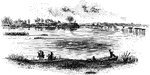
James River
"Scene on the James River, at Richmond. This view is from a long shaded island extending up the river…
Jamestown Island
"Distant view of Jamestown Island. This view is from the north side of what was once a marsh, but now…
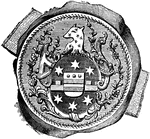
William Tryon Seal
"Seal and signature of Tryon. William Tryon was a native of Ireland, and was educated to the profession…
Trading Ford
"Trading Ford. This view of the Trading Ford, where greene, with Morgan and his light troops, crossed…
Cherokee Ford
"View at the Cherokee Ford. This view is from the east bank of the river. Toward the extreme right is…
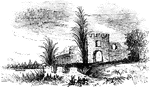
Frederica
"Ruins of Oglethorpe's Barracks at Frederica. This is from a sketch made by W. W. Hazzard, Esq., in…
Fort Moultrie
"View at Fort Moultrie. This view is from the southwestern angle of Fort Sullivan, looking toward Jame's…
Turtle Bay
"View at Turtle Bay. Turtle Bay is a small rock-bound cove of the East River, at the foot of Forty-seventh…
Gravesend Bay
"View at Gravesend Bay. This view is from the road on the high shore, a little below Fort Hamilton,…
Woodhull's Grave
"Woodhull's Grave. Nathaniel Woodhull was born at Mastic, Long Island, December 30, 1722. Agriculture…
William the Conqueror
"William the Conqueror (1066-1087), as represented on his seal. Although William really ruled 'as king…
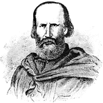
Garibaldi
"Garibaldi was a patriot who started up a revolt in Sicily and took possession of the island, then passed…
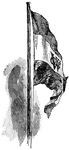
Dutch West India Flag
"Flag of the Dutch West India Company. When the rights of the company ceased, a new and more powerful…
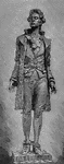
Hale Statue
"Statue of Nathan Hale. It was during his treated that an event occurred which showed how much Americans…

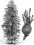
Norfolk Island Pine
"1. Norfolk Island Pine (Araucaria excelsa). 2. Cone of Araucaria Cookii."-Whitney, 1902