Maps Site map
  Maps > Europe > Regional Maps >Scandinavia
Site Map  

  Record   1   to   10  of   17

Regional European maps of the Scandinavia region from the Maps ETC collection. This includes physical and political maps, early history and empires, WWI maps, climate maps, relief maps, vegetation maps, population density and distribution maps, cultural maps, and economic/resource maps.
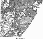
Fra Mauro Map, 1459
A facsimile of a portion of the Fra Mauro map from 1459 showing Norvegia (Norway), Datia (Denmark), and Ixilandia (Iceland). The map is oriented to the south as was not uncommon in medieval and Muslim cartography, and pictorially shows cities and cas...

Scandinavia in the time of Gustavus Vasa, 1520
A map showing Scandinavia in the time of Gustavus Vasas (Gustav I of Sweden, 1496–1560). This map is color–coded to show the Swedish territories of Finmark, Lappmark, East and West Bothnia, Finland, Svealand, Gothland, Småland, and ...

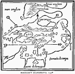
Bordone's Scandavia, 1547
A facsimile of the Italian cartographer Benedetto Bordone's map of Scandinavia (1547) showing the Baltic Sea, Denmark, and Norway. ...

Scandinavia, 1555
A facsimile of the 1555 map of northern Scandinavia by Olaus Magnus, showing Dania (Denmark), Norvegia (Norway), Svetia and Gothia (Sweden), Finladia (Finland), Isladia (Iceland), and portions of Scotia and Aglia (British Isles), Esthia (Estonia), Li...

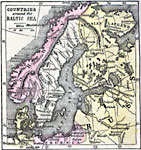
Countries around the Baltic Sea, 1789
A map of the countries surrounding the Baltic Sea during the Napoleonic War period (1792–1815). The map shows Norway, with its capital Christiania (Oslo), Sweden, Russian Lapland, portions of Prussia, and Denmark. The map shows major cities, po...

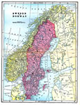
Sweden and Norway, 1903
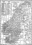
A map of the Scandinavian countries of Norway and Sweden in 1903. This map shows political subdivisions, cities, waterways, and railways....

Sweden and Norway, 1906
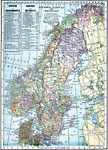
A map from 1906 of Sweden and Norway showing the national boundaries, including the boundary with Russia (Finland) along the Tana Elf, Anar, and Tornea rivers, major cities, ports, and towns, rivers, islands, costal features, and mountain systems. Th...

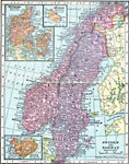
Sweden, Norway, and Denmark, 1909
A map from 1909 of Sweden, Norway, and Denmark showing major cities, ports, and towns, railroads, canals, rivers, coastal features, and mountain systems. This map is color–coded to show the governmental districts of Sweden and Norway, with a nu...

Sweden, Norway, and Denmark, 1912
A map from 1912 of Sweden, Norway, and Denmark, showing cities, waterways, mountain ranges, canals, and railroads. The map also shows Norway's districts and Sweden's government boundaries....

Norway, Sweden, and Denmark, 1914–1919
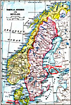
A map from 1919 of the Scandinavian countries (Norway, Sweden, and Denmark) showing borders after World War I. The map shows principal cities and ports, railroads, canals, steam ship routes, rivers, islands, and coastal features....

Next Last


  Maps > Europe > Regional Maps >Scandinavia
Site Map  

Maps is a part of the Educational Technology Clearinghouse
Produced by the Florida Center for Instructional Technology © 2009
College of Education , University of South Florida