|
|
|
| Maps > United States > Civil War |
A collection of historic maps of the American Civil War, including regional seats of the war, battle and campaign maps, and territories held by Confederate and Union forces.

|
Campaign in Western Virginia,
1861 |

|
The First Battle of Bull Run,
1861 |

|
Vicinity of Charleston,
1861 |

|
United States and Confederate States,
1861 |

|
Movement of Armies,
1861 |

|
State Secessions,
1861 |
|
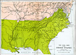
The Civil War in the United States,
1861 |

|
Vicinity of Manassas Junction,
1861 |

|
Battles of Wilson's Creek and Pea Ridge,
1861–1862 |

|
Theatre of Southwestern Campaigns,
1861–1865 |
| First | Previous | Next | Last |
| Maps > United States > Civil War |
Maps ETC is a part of the Educational Technology Clearinghouse
Produced by the Florida Center for Instructional Technology © 2009
College of Education, University of South Florida