Maps Site map
  Maps > United States > Early America 1400-1800
Site Map  

  Record   151   to   160  of   199

A collection of historic maps of early America from explorations and settlements of the English, French, and Spanish, to the end of the American Revolutionary War.

Estimated Degree of Severity of Legislation Against the Loyalists, 1777–1780
A map of the American colonies during the civil war between the Whigs and Tories (Loyalists) at the time of the American Revolutionary War. The map shows the estimated degree of severity of legislation against the Loyalists, ranging from harsh in the...

Progress of Emancipation, 1777–1804
A map of the eastern United States showing the progress of emancipation from 1777 to 1804. The map is coded to show states and territories with dates of emancipation, including States granting emancipation by State Constitution, State Statutes (gradu...

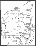
Middle Atlantic States, 1778–1779
A map of the Middle States during the American Revolutionary War showing the major northern battle sites from Crown Point on Lake Champlain south to Brandywine and west to Pittsburgh (Fort Duquesne) and Venago....

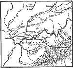
Clark's Campaign in the West, 1778–1779
A map of the Ohio country where in 1778–1779 George Rogers Clark led the Illinois Campaign to capture the British stronghold at Vincennes, marking an end to British power in the west. The map shows Clark's route along the Ohio River to the Brit...

Clark's Campaign in the Northwest, 1778–1779
A map showing the route of Colonel George Rogers Clark's Campaign in the Northwest (1778–1779) during the American Revolutionary War. The map shows Clark's starting point at Fort Pit, and route along the Ohio River to the British Fort Kaskaskia...

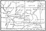
The Campaigns in the South, 1778–1779
A map of parts of Virginia, North Carolina, South Carolina, and Georgia involved in the southern campaigns of the American Revolutionary War (1778–1779). The map shows cities and towns, rivers and terrain, forts, and battle sites of the region...

The Hudson River – Newburg to New York, 1779
A map of the Hudson River area from Newburg to the Long Island Sound showing the Revolutionary War posts and towns along the river, including West Point, Peekskill, Verplanck's Point, King's Ferry, Stony Point, Haverstraw Bay, Tarrytown, Dobbs Ferry,...

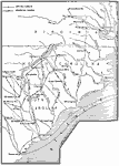
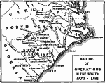
Scene of Operations in the South, 1779–1781
A map of southern Virginia, North Carolina, South Carolina, and Georgia showing the scene of operations in the South during the American Revolutionary War from 1779—1781. The map shows the route of Greene's retreat from Cowpens to the Dan River...

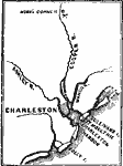
Charleston and vicinity , 1780
A map of Charleston Harbor, North Carolina, during the Siege of Charleston (1780). The map shows Charleston, Sullivan's Island and Fort Moultrie, the rivers in the area, and the site of the Battle of Monk's Corner, 30 miles north of Charleston....

Plan of the Battle at Springfield, 1780
A map of the vicinity of Springfield, New Jersey, showing the battle site during the American Revolutionary War (June 23, 1780). "The stream with branches, and running in a southerly direction, is the Rahway River; (a) is the house of Mrs. Mathe...

First Previous Next Last


  Maps > United States > Early America 1400-1800
Site Map  

Maps ETC is a part of the Educational Technology Clearinghouse
Produced by the Florida Center for Instructional Technology © 2009
College of Education, University of South Florida