|
|
|
| Maps > United States > Early America 1400-1800 |
A collection of historic maps of early America from explorations and settlements of the English, French, and Spanish, to the end of the American Revolutionary War.
|
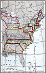
United States at the Close of the Revolution,
1783 |
|
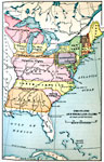
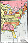
The States and their Land Claims at close of Revolution,
1783 |
|
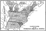
Land Claims of the Thirteen Original States,
1783 |
|
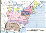
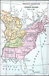
The Territory of the Thirteen Original States,
1783 |
|
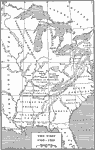
The West,
1783–1789 |
|
State Claims to Western Lands,
1783–1802 |
|
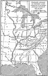
Early Territory of the United States,
1783–1863 |
|
Proposed Division of Western Lands,
1784 |
|
Division of States according to the Ordinance of 1784,
1784 |
|
Barlow's Map,
1785 |
| First | Previous | Next | Last |
| Maps > United States > Early America 1400-1800 |
Maps ETC is a part of the Educational Technology Clearinghouse
Produced by the Florida Center for Instructional Technology © 2009
College of Education, University of South Florida