|
|
|
| Maps > United States > Early America 1400-1800 |
A collection of historic maps of early America from explorations and settlements of the English, French, and Spanish, to the end of the American Revolutionary War.

|
New England,
1650 |
|
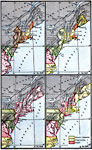
Atlantic Coast Development,
1650–1695 |
|
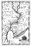
Visscher's Map of the Delaware Bay and River, and New Sweden,
1651 |
|
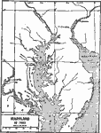
Chesapeake and Delaware Bays,
1652 |
|
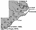
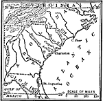
The Carolinas,
1653–1680 |
|
Lindstrom's Map of New Sweden and Pennsylvania,
1654–1655 |
|
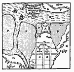
Siege of Christina Fort,
1655 |
|
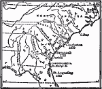
Development of Early Carolina,
1663–1732 |
|
The Carolina Grant,
1665 |

|
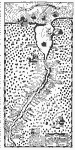
Connecticut River,
1666 |
| First | Previous | Next | Last |
| Maps > United States > Early America 1400-1800 |
Maps ETC is a part of the Educational Technology Clearinghouse
Produced by the Florida Center for Instructional Technology © 2009
College of Education, University of South Florida