|
|
|
| Maps > United States > Growth of Nation |
A collection of historic maps of territorial acquisitions and growth of the United States for use in the K-12 classroom.
|
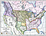
The United States,
1840 |
|
The United States,
1840 |
|
Trade and Migration,
1840–1850 |
|
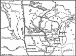
Migration and Settlement Along the Upper Mississippi and around the Great Lakes,
1840–1850 |
|
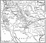
The Santa Fe and Oregon trails to the Pacific Coast,
1840–1850 |
|
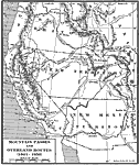
Mountain Passes and Overland Routes in the West,
1841–1850 |
|
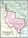
Territory Claimed by Texas,
1845 |
|
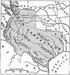
Texas Annexation,
1845 |
|
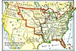
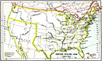
United States,
1845 |
|
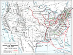
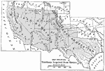
Territory Acquired from Mexico,
1845–1848 |
| First | Previous | Next | Last |
| Maps > United States > Growth of Nation |
Maps ETC is a part of the Educational Technology Clearinghouse
Produced by the Florida Center for Instructional Technology © 2009
College of Education, University of South Florida