Maps Site map
  Maps > United States > Growth of Nation
Site Map  

  Record   81   to   90  of   120

A collection of historic maps of territorial acquisitions and growth of the United States for use in the K-12 classroom.
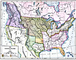
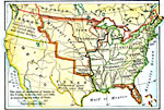
The United States, 1840
A map of the United States in 1840 showing the State and territory boundaries, the Oregon Country jointly controlled by Great Britain and the United States, and the Mexican possessions at the time. The map is color–coded to show the free states...

The United States, 1840
A map of the United States in 1840, showing the frontier line, indicate by the thick black line. The map shows the States east of the frontier of the Mississippi, south of the frontier line in Michigan and Maine, and north of the frontier line in Flo...

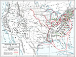
Trade and Migration, 1840–1850
A map of the United States showing the principal trade and westward migration routes between 1840 and 1850. The map shows state and territory boundaries at the time, major cities, ports, outposts, forts, and settlements, rivers, mountain barriers, an...

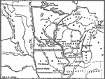
Migration and Settlement Along the Upper Mississippi and around the Great Lakes, 1840–1850
Showing area along the Upper Mississippi and around the Great Lakes. ...

The Santa Fe and Oregon trails to the Pacific Coast, 1840–1850
A map of the western United States in 1840–1850 showing the Oregon Trail and Santa Fe, the two principal overland routes from Independence, Missouri, to the western territories and the Pacific. The map shows the territory boundaries, outposts a...

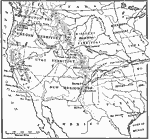
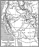
Mountain Passes and Overland Routes in the West, 1841–1850
A map of the Pacific region of the United States west of the Rocky Mountains in 1841–1850. The map shows the Old Spanish Trail from Los Angeles to Santa Fe, the Pioneer Route from the Platte River to San Francisco, the routes of Fremont (1843&n...

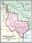
Territory Claimed by Texas, 1845
A map of territory claimed by Texas when admitted into the Union, 1845. The map is color–coded to show the frontiers of Texas with the United States and Mexico, the territory in the east covered under the old Spanish land grants, and the disput...

Texas Annexation, 1845
A map of territory claimed by Texas when admitted into the Union in 1845. The map is coded to show the frontiers of Texas with the United States and Mexico, and the disputed territory in the west between the Rio Grande and Nueces rivers....

United States, 1845
A map of the United States in 1845 after the Louisiana Purchase, the Lewis and Clark Expedition, and the annexation of Texas. The map is color–coded to show the States and territory of the United States west to the Pacific with the dates of sta...

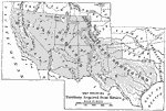
Territory Acquired from Mexico, 1845–1848
A map of the territory acquired from Mexico including the annexation of Texas in 1845 and California, Utah Territory, and New Mexico Territory in 1848....

First Previous Next Last


  Maps > United States > Growth of Nation
Site Map  

Maps ETC is a part of the Educational Technology Clearinghouse
Produced by the Florida Center for Instructional Technology © 2009
College of Education, University of South Florida