Maps Site map
  Maps > United States > New York
Site Map  

  Record   71   to   80  of   160

A collection of historic and contemporary political and physical maps of New York, including early exploration and settlement maps, Revolutionary War maps, geophysical maps, and automobile route maps.

Clyde Quadrangle, 1911
A contour map of part of the Clyde quadrangle in the vicinity of Clyde and Rose, showing typical drumlin topography in central New York....

Canandaigua Quadrangle, 1911
A contour map of part of the Cananaigua quadrangle in the vicinity of Ionia, showing typical moraine topography in central New York....

New York City, 1911
A map from 1911 of part of New York City, showing streets, bridges, and landmarks. ...

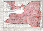
New York, 1912
A map from 1912 of New York showing the capital of Albany, counties and county seats, principal cities and towns, railroads, canals, mountains, lakes, and rivers. An inset map details southeastern New York and Long Island. A grid reference in the mar...

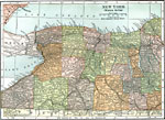
Western New York, 1914
A map from 1914 of the western part of New York showing counties and county seats, principal cities and towns, railroads, canals, lakes, and rivers...

New York, 1914
A map from 1914 of New York showing the capital of Albany, counties and county seats, principal cities and towns, railroads, canals, mountains, lakes, and rivers. An inset map details southeastern New York and Long Island....

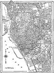
Buffalo, New York Road Map, 1914
A map from 1914 of Buffalo New York showing the principal streets and avenues, harbor district, railroad lines, parks, and major landmarks....

Drumlins in New York, 1916
A map from 1916 of the vicinity of Cato showing drumlin topography (oval hills composed of glacial waste) in New York. ...

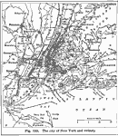
New York City and Vicinity, 1916
A map from 1916 of New York City and its vicinity showing cities and towns, principal roads, and railroads. ...

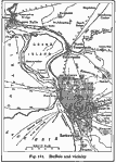
Buffalo and Vicinity, 1916
A map from 1916 of Buffalo New York and vicinity, showing Lake Erie, Niagara River and falls, railroads, the harbor with steamer routes to all lake ports, and the Erie Canal....

First Previous Next Last


  Maps > United States > New York
Site Map  

Maps ETC is a part of the Educational Technology Clearinghouse
Produced by the Florida Center for Instructional Technology © 2009
College of Education, University of South Florida