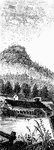
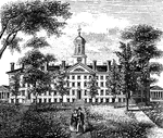
West Point
"West Point in 1780. This view is from a print published in the New York Magazine for 1790.…
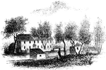
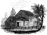
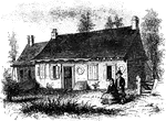
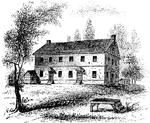
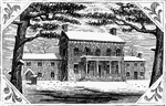
Smith's House
"Smith's House. This view is from the slope in front of the house. The main building is of stone; the…
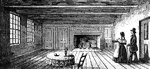
Breakfast Room
"The Breakfast Room. This is a view of the room in the Robinson House in which Arnold was at breakfast…
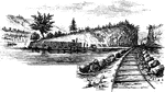
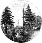
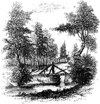
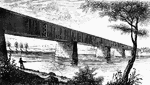
Beverly Dock
"View at Beverly Dock. This view is taken from the Hudson River rail-road, looking north. The dock,…
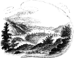
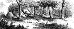
Fort Montgomery
"View near Fort Montgomery. This view is from an eminence near the mountain road, about three quarters…
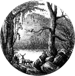
Lake Sinnipink
"Lake Sinnipink, or Bloody Pond. This view is from the outlet of the lake, within a few rods of the…
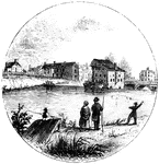
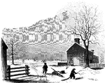
Peekskill Landing
"View from Peekskill Landing. This view is from Peekskill landing, looking up the river. On the left…
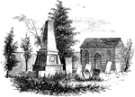
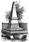
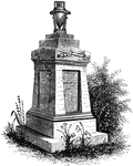
Paulding's Monument and St. Peter's Church
"Paulding's Monument and St. Peter's Church. The site of this church and the grave-yard was a gift of…
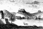
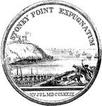
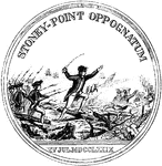
Stony Point
"Rear view at Stony Point. This sketch presents a rear view of the old embankments of the fort, and…
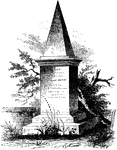
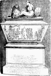
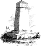
Wayne's Monument
General Anthony Wayne's monument at St. David's Episcopal Church, Radnor, Pennsylvania.
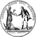
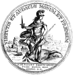
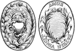
Wayne Medal Front
"Gold medal awarded by Congress to General Wayne. This is a representation of the medal, the size of…
Wayne Medal Back
"Gold medal awarded by Congress to General Wayne. This is a representation of the medal, the size of…
De Fleury Medal Front
"Medal awarded to Lieutenant-colonel De Fleury. This is a representation of the medal, the size of the…
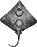
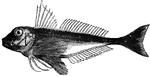
Skate
"It is very voracious, and grows to large size. Found in the European and American waters" — Goodrich,…
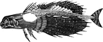
Flying Gurnard
"Is from six to fifteen inches long, and is found in the Mediterranean, and also in the European and…
Red Gurnard
"Twelve to sixteen inches long; it feeds on curstaceous animals; spawns in May or June; it is esteemed…
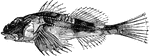
Sea Scorpion
"Is five to eight inches long; is very voracious, swims rapidly, and si found under stones and sea-weed…
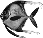
Blepharis
"Five to six inches long; blueish-white above, shiny beneath; found, though rarely, on the American…
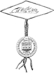
Stewart Medal Front
"Medal awarded to Major Stewart. This represents the medal the size of the original. The device is America…
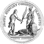
Stewart Medal Back
"Medal awarded to Major Stewart. This represents the medal the size of the original. On the back side…
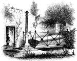
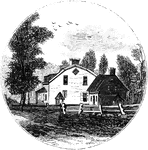
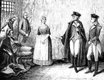
Jameson's Head-quarters
"Colonel Jameson's head-quarters. This is a view of the out-buildings of Mr. Sands, at North Castle,…
Sleepy Hollow Church
"Ancient Dutch Church in Sleepy Hollow. This view is from the church-yard, looking southwest. The porch…
Sleepy Hollow
"Bridge over Sleepy Hollow Creek. Ichabod, according to Irving, in the Legend, returning from…
Van Wart's Monument
"Van Wart's monument. The following are the inscriptions upon this monument: North Side: 'Here repose…
Sunnyside
"View of 'Sunnyside,' the residence of Washington Irving. Built by Wolfert Ecker and known famously…
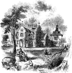
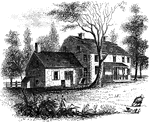
Livingston Mansion
"The Livingston Mansion. This is a view from the lawn on the north side. It is embowerd in trees and…
Tappan head-quarters
"Washington's head-quarters at Tappan. This view is from the yard, near the well. The date of its erection…
John André's Monument
Major John André's monument in Westminster Abbey. André was executed as a spy by Americans in 1780.…
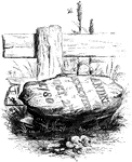
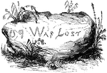
Andre's Execution
"Place of execution. The place of Andre's execution is now designated by a stone, lying on the right…
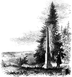
Torn Rock
"Torn Rock. This view is from the verge of the dam above the Ramapo works, near the rail-way, looking…
Ramapo Pass
"Remains of intrenchments the Ramapo Pass. This view is from the road, looking north toward the village…
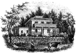
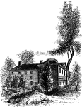
Hopper House
"The Hopper House. This view is from the road, looking northeast. The low part, on the left, is a portion…
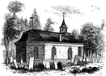
Friends' meeting-house
"Friends' meeting-house. This view is from the shed in the yard, looking southeast. The building stands…
Colonel Rall
"Washington's visit to Colonel Rall. This is a copy, by permission, of a picture by Flagg, in the possession…
Trenton
"Trenton Bridge and vicinity. This view is from the north side of the Assanpink, a few rods above the…
Princeton battle-ground
"View of the battle-ground near Princeton. This view, looking north, is from the carriage gate of Mr.…
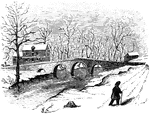
Worth's Mills
"Bridge at Worth's Mill's. This substantial stone bridge, over Stony Brook, is upon the site of the…
Morven
"Morven, Stockton's estate. This sketch is from the lawn in front, which is shaded by venerable pines…
Treaty Monument
"Treaty Monument. This monument stands near the intersection of Hanover and Beach Streets, Kensington,…
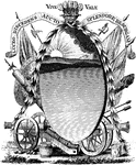
Penn's seal and signature
"Penn's Seal and Signature. This is a representation of the seal and signature of William Penn attached…
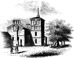
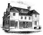
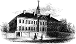
Carpenters' Hall
"Carpenters' Hall. This building is constructed of small imported bricks, each alternate one glazed,…
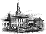
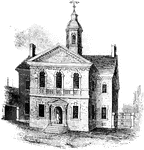
State House
"Walnut Street front of the State House in 1776. This gives the appearance of the shorter steeple, which…
Red Bank Monument
"Monument at Red Bank. This view includes the monument, a portion of the Delaware, and the mouth of…
Penn's House
"Penn's House. This view is from Second Street. The building is of imported brick, except the modern…
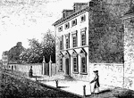
Howe's Quarters
"General Howe's quarters were in a house on High Street, one door east from the southeast corner of…
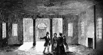
Walnut Street Prison
"The Walnut Street Prison. This edifice was erected in 1774, and taken down in 1836. The beautiful new…