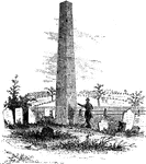
Oswego in 1755. This view is looking north toward the lake. It is a reduced copy of the frontispiece to <em>Smith's History of New York</em>, first ediction, London, 1757, and represents the encampment of Shirley there at that time.

Oswego

Oswego in 1755. This view is looking north toward the lake. It is a reduced copy of the frontispiece…
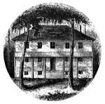
This was the residence of Colonel Guy Johnson, and is still standing, on the north side of the Mohawk, about a mile from the village of Amsterdam, in Montgomery county. It is substantially built of stone, and may stand a century yet. Embowered in trees, it is a beautiful summer residence.

Guy Park

This was the residence of Colonel Guy Johnson, and is still standing, on the north side of the Mohawk,…

The battle-ground of Oriskany. This sketch was made from the eastern side of the ravine, looking west. The marsh in the bottom of the ravine, mentioned in the text, is partially drained by a rivulet. When I visited the spot (August, 1848), many logs of the old causeway were still visible, and afforded a crossing-place for cattle. These logs are seen in the picture. The road on the left is the present highway between Oriskany and Rome. The barn stands upon the road southeasterly, the ambush was placed. The hottest of the battle occurred upon the high plain between the ravine is the foreground and another beyond the most distant trees in the picture. The hills seen in the xtreme distance, on the right, are those upon the north side of the Mohawk. The frame-work in the ravine is the remains of the scaffolding erected for the speakers at the celebration alluded to, in 1844.

Oriskany

The battle-ground of Oriskany. This sketch was made from the eastern side of the ravine, looking west.…

Old Parsonage and Church. This view is from the high plain on the right of the block-house, looking north. The building upon the hill across the ravine is the old parsonage, which was immediately built upon the ruins of the one that was burned. On the left I have placed a church in its proper relative position to the parsonage, as indicated by Mr. Lipe. It was about half a mile northwest of the fort. On the right are seen the Mohawk River and Plain, a train of cars in the distance, and the hills that bound the view on the north side of the Mohawk Valley, in the direction of Stone Arabia and Klock's Field, where two battles were fought in 1780. These will be hereafter noticed.

Old Parsonage and Church

Old Parsonage and Church. This view is from the high plain on the right of the block-house, looking…
North point of Johnson Hall.

Johnson Hall

North point of Johnson Hall.

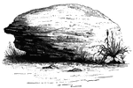
Brant's Rock. This rock, which is about four feet high, lies in a field on the left of the road leading from Cherry Valley to the Mohawk, about a mile and a half north of the residence of Judge Campbell. It is a fossiliferous mass, composed chiefly of shells. Behind this rock the body of Lieutenant Wormwood, lifeless and the head scalped, was found by the villagers, who had heard the firing on the previous evening. Judge campbell, who accompanied us to the spot, pointed out the stump of a large tree by the road side, as the place where Lieutenant Wormwood fell.

Brant's Rock

Brant's Rock. This rock, which is about four feet high, lies in a field on the left of the road leading…
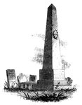
Caldwell's monument. The following are the inscriptions upon the Caldwell monument: East Side: "This monument is erected to the memory of the Rev. James Caldwell, the pious and fervent Christian, the zealous and faithful minister, the eloquent preacher, and a prominent leader among the worthies who secured the independence of his country. His name will be cherished in the church and in the state so long as Virtue is esteemed and Patriotism honored." West Side: "Hannah, wife of the Rev. James Caldwell, and daughter of Johnathan Ogden, of Newark, was killed at Connecticut Farms by a shot from a British soldier, June 25th, 1780, cruelty sacrificed by the enemies of her husband and of her country." North Side: "The memory of the just is blessed. Be of good courage- and let us behave ourselves valiant for our people, and for the cities of our God, and let the Lord do that which is good in his sight. The glory of children are their fathers." South Side: "James Caldwell. Born in Charlotte county, in Virginia, April, 1734. Graduated at Princeton College, 1759. Ordained pastor of the First Presbyterian Church of Elizabethtown, 1762. After serving as chaplain in the army of the Revolution, and acting as commissary to the troops in New Jersey, he was killed by a shot from a sentinel at Elizabethtown Point, November 24th, 1781."

Caldwell's Monument

Caldwell's monument. The following are the inscriptions upon the Caldwell monument: East Side: "This…
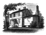
Liberty Hall. Some time after the death of Governor Livingston this property was purchased by Lord Blingbroke, who, under the assumed name of John Belesis, ran away from England with a daughter of Baron Hompasch, a German general. She was at a boarding school there, and Bolingbroke had a wife living. He married the girl here. She died in England in 1848. The grandmother of the present proprietor, Susan, the daughter of Peter Van Burgh Livingston, bought the farm of Lord Bolingbroke, and it has been in possession of the family ever since. Her first husband was John Kean, a member of Congress from South Carolina from 1785 to 1787, and was first cashier of the first United States Bank, chartered by an act of Congress passed February 8th, 1791. Her second husband was Count Niemcewicz, a Polish nobleman.

Liberty Hall

Liberty Hall. Some time after the death of Governor Livingston this property was purchased by Lord Blingbroke,…
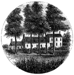
Steuben's head-quarters. This view is from the field in front of the house, looking north. The dwelling is at the end of a lane several rods from the main road leading to Middlebrook from New Brunswick. It is on the western side of the Raritan, and about a mile from the bridge near Middlebrook. Only the center building was in existence at the time in question, and that seems to have been enlarged. Each wing has since been added. The interior of the old part is kept in the same condition as it was when Steuben occupied it, being, like most of the better dwellings of that time, neatly wainscoted with pine, wrought into moldings and panels.

Steuben's Head-Quarters

Steuben's head-quarters. This view is from the field in front of the house, looking north. The dwelling…

The Yeoman House. This view is from the road, looking north. An attempt was made by a soldier to burn the house, but so rapid was the march of the invaders that the flames had made but little progress before the troops were far on their road to the village. An [African American] woman, who was concealed under some corn-stalks near, extinguished the flames. The house is about half a mile from the river, on the right side of the road from the landing to Kingston village.

Yeoman House

The Yeoman House. This view is from the road, looking north. An attempt was made by a soldier to burn…

The Bennington battle-ground. This view is from the hill on the southwest bank of the Walloomscoick, a little west of the road from the bridge to Starkville, looking northeast. The road over this hill existed at the time of the battle. The river, which here makes a sudden bend, is seen at two points- near the cattle, and at the bridge, in the distance, on the right. The house on the left, near the bridge, is Mr. Barnet's, and the road that crosses the center of the picture from right to left is the road from Bennington to Van Schaick's or North Hoosick. It passes along the river flat, at the foot of the hills where the battle occurred. The highest point on the distant hills, covered with woods, is the place where the Hessians were intrenched. From that point, along the hills to the left, for about two miles, the conflict was carried on; and upon the slopes, now cultivated, musket-balls and other relics of the battle have been plowed up.

Bennington Battle-ground

The Bennington battle-ground. This view is from the hill on the southwest bank of the Walloomscoick,…
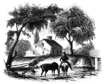
Head-quarters of Agnew and Erskine. This house is on the south bank of Still River, at the north end of the main street. It was built by Benjamind Knapp, in 1770, and was owned by him at the time of the invasion. His birth-place is also standing, on the north side of the river. They were among the few houses not burned. At the bridge seen on the right the British planted a cannon, and kept a strong guard there until their departure. This house is now (1848) owned by Noah Knapp.

Agnew and Erskine

Head-quarters of Agnew and Erskine. This house is on the south bank of Still River, at the north end…

Place of the barricade, Ridgefield. This view is at the north end of the main street. It was taken from the spot where, traditions asserts, Arnold's horse was killed, which is on the west side of the street, near a maple-tree, about one hundred yards southwest of the house of Samuel Stebbins, Esq., seen on the right in the picture. While making this sketch an old man came along, and informed me that on the day after the battle himself and some other boys skinned Arnold's horse, and discovered nine bullet-holes in his side. The escape of the rider seemed miraculous.

Ridgefield

Place of the barricade, Ridgefield. This view is at the north end of the main street. It was taken from…

Fitch's Point, the landing-place of the British. This view is from the west side of Gregory's Point, looking north-northwest. The promontory toward the left, covered with dark trees, is called Fort Point. There was an Indian fortification when the first settlers arrived at Norwalk. Further to the left, on the extreme edge of the picture, is seen one end of the rail-road bridge, which crosses Norwalk River. The New York and New Haven Rail-road was then in progress of construction. The point derives its name from its former proprietor, Governor Thomas Fitch, whose residence was Norwalk. He was Governor of the colony of Connecticut, and his name is among the beloved of his generation. He died July 18th, 1774, in the seventy-fifth year of his age.

Fitch's Point

Fitch's Point, the landing-place of the British. This view is from the west side of Gregory's Point,…
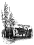
The old Colony Seal.

Colony Seal

The old Colony Seal.

"Clark's House, Lexington. This building was standing when I visited Lexington in 1848. It was built by Thomas Hancock, Esq., of Boston, as a parsonage for his father, the Reverend John Hancock, of Lexington, about 130 years ago. Mr. Hancock was a minister at Lexington fifty-two years, and was succeeded by the Reverend Jonas Clark, the occupant of the house at the time of the skirmish at Lexington. Mr. Clark lived in the house fifty-two years. The room in which the two patriots, Samuel Adams and John Hancock, were sleeping on the night before the skirmish at Lexington, is retained in its original condition. The wainscoting is of Carolina pine, and the sides of the room are covered with a heavy paper, with dark figures, pasted upon the boards in rectangular pieces about fourteen inches square. In an adjoining room is one of those ancient fire-places, ornamented with pictorial tiles, so rarely found in New England."&mdash;Lossing, 1851

Clark's House

"Clark's House, Lexington. This building was standing when I visited Lexington in 1848. It was built…
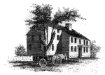
"Colonel Barrett's House. This sketch is from the road leading to the village of Concord by the way of the North Bridge. The home was erected about eighty yeras ago, by Colonel Barrett, and is now owned by his kinsman, Prescott Barrett."&mdash;Lossing, 1851

Barrett's House

"Colonel Barrett's House. This sketch is from the road leading to the village of Concord by the way…

"New London Harbor, looking north. This little sketch shows the relative position of the forts. Fort Trumbull is seen on the left of the picture, and Fort Griswold, with the Groton Monument, is on the extreme right."&mdash;Lossing, 1851

New London Harbor

"New London Harbor, looking north. This little sketch shows the relative position of the forts. Fort…
Rhode Island Governor Nicholas Cooke's Monument.

Governor Nicholas Cooke's Monument

Rhode Island Governor Nicholas Cooke's Monument.

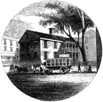
"Old Tavern in Providence. This view is from the market, looking north. The building stands on the east side of the square and parallel with its front commences North Main Street. In the yard on the right is venerable horse-chestnut tree, standing between the house and the Roger Williams' Bank. In former times, a balcony extended across the front. The door that opend upon it is still there, but the balcony is gone. The roof is completely overgrown with moss, and every appearance of age marks it."&mdash;Lossing, 1851

Providence Tavern

"Old Tavern in Providence. This view is from the market, looking north. The building stands on the east…
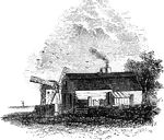
"Hubbard's House and Mill. The inscriptions upon the monument are as follows: East Side: "Oliver Hazard Perry. At the age of 27 years he achieved the victory of Lake Erie September 10, 1813.' North Side: 'Born in South Kingston, R. I., August 23rd, 1785. Died at Fort Spain, Trinidad, August 23d, 1819, aged 34 years.' West Side: 'His remains were conveyed to his native land in a ship of war, according to a resolution of Congress, and were here interred, December 4, 1826.' South Side: 'Erected by the State of Rhode Island.'"—Lossing, 1851

Hubbard's House and Mill

"Hubbard's House and Mill. The inscriptions upon the monument are as follows: East Side: "Oliver Hazard…
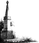
"Monument at Goshen. During the battle, Major Wood, of Goshen, made a masonic sign, by accident, which Brant, who was a Free-mason, perceived and heeded. Wood's life was spared, and as a prisoner he was treated kindly, until the Mohawk chief perceived that he was not a Mason. Then, with withering scorn, Brant looked upon Wood, believing that he had obtained the masonic sign which he used, by deception. It was purely an accident on the part of Wood. When released, he hastened to become a member of the fraternity by whose instrumentality his life had been spared. The house in which Major Wood lived is yet standing (though much altered), at the foot of the hill north of the rail-way station at Goshen. The house of Roger Townsend, who was among the slain, is also standing, and well preserved. It is in the southern part of the village."&mdash;Lossing, 1851

Goshen Monument

"Monument at Goshen. During the battle, Major Wood, of Goshen, made a masonic sign, by accident, which…
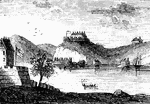
"West Point in 1780. This view is from a print published in the <em>New York Magazine</em> for 1790. It was taken from Constitution Island. On the left is seen a portion of old Fort Constitution. The great chain, four hundred and fifty yards in length, and covered by a strong battery, is seen stretched across the river, immediately below Fort Clinton, the structure on the high point. In the distance, on the left, two mountain summits are seen, crowned with fortifications. These were the North and Middle Redoubts. Upon the range of the Sugar Loaf Mountain, higher than these, and hidden, in the view, by Fort Clinton, was another redoubt, called the South Battery."—Lossing, 1851

West Point

"West Point in 1780. This view is from a print published in the New York Magazine for 1790.…

"View at Beverly Dock. This view is taken from the Hudson River rail-road, looking north. The dock, covered with cord wood, is seen near the point on the left. It is at the termination of a marsh, near the point of a bold, rocky promontory, through which is a deep rock cutting for the road. The distant hills on the extreme left are on the west side of the Hudson; and through the gorge formed for the road may be seen the military edifices of West Point."—Lossing, 1851

Beverly Dock

"View at Beverly Dock. This view is taken from the Hudson River rail-road, looking north. The dock,…
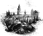
"Rear view at Stony Point. This sketch presents a rear view of the old embankments of the fort, and of the light-house, which is seen by all travelers upon the river, just before entering the Highlands. The beacon stands exactly in the center of the fort, upon the site of the magazine. There was a covered way toward the water on the north side of the hill, and about twenty yards in the rear are some prominent remains of the ravelins which extended across the point."&mdash;Lossing, 1851

Stony Point

"Rear view at Stony Point. This sketch presents a rear view of the old embankments of the fort, and…

"Resembles the tuna in form, but is seldom more than thirty inches long. It is extensively distributed, being most common i nthe tropical seas, but is still met with on the coasts of Europe and North America. It is said to rival the dorado in its perpetual chase of flying-fish." &mdash; Goodrich, 1859

Bonito

"Resembles the tuna in form, but is seldom more than thirty inches long. It is extensively distributed,…

"Four to six feet long, breadth eight inches, thickness one inch; found in the North Atlantic, and has been taken on the British coast." &mdash; Goodrich, 1859

Dealfish

"Four to six feet long, breadth eight inches, thickness one inch; found in the North Atlantic, and has…

"Weighing six to twelve pounds; it feeds on mollusca, crustacea, and young fish; inhabits sandy banks and muddy grounds in the seal is sometime staken with hooks and sometimes with spears, though more generally with trawl-nets." &mdash; Goodrich, 1859

Plaice

"Weighing six to twelve pounds; it feeds on mollusca, crustacea, and young fish; inhabits sandy banks…
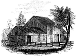
"Colonel Jameson's head-quarters. This is a view of the out-buildings of Mr. Sands, at North Castle, situated a few yards from his residence. The lowest building, on the left, is the dwelling, now attached to the barn of Mr. Sands, which Jameson used as his head-quarters. In that building Andre was kept guarded until sent to West Point."&mdash;Lossing, 1851

Jameson's Head-quarters

"Colonel Jameson's head-quarters. This is a view of the out-buildings of Mr. Sands, at North Castle,…
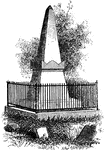
"Van Wart's monument. The following are the inscriptions upon this monument: North Side: 'Here repose the mortal remains of Isaac Van Wart, an elder in the Greenburgh church, who died on the 23d of May, 1828, in the 69th year of his age. Having lived the life, he died the death, of the Christian. South Side: 'The citizens of the county of West Chester erected this tomb in testimony of the high sense they entertained for the virtuous and patriotic conduct of their fellow-citizen, as a memorial sacred to public graditute.' East Side: 'Vincent, Amor Patriae. Nearly half a century before this monument was built, the conscript fathers of America had, in the Senate chamber, voted that Isaac Van Wart was a faithful patriot, one in whom the love of country was invincible, and this tomb bears testimony that the record is true.' West Side: 'Fidelity. On the 23d of September, 1780, Isaac Van Wart, accompanied by John Paulding and David Williams, all farmers of the county of West Chester, intercepted Major Andre, on his return from the American lines in the character of a spy, and, notwithstanding the large bribes offered them for his release, nobly disclaimed to sacrifice their country for gold, secured and carried him to the commanding officer of the district, whereby the dangerous and traitorous conspiracy of Arnold was brought to light, the insiduous designs of the enemy, baffled, the American army saved, and our beloved country free.'"—Lossing, 1851

Van Wart's Monument

"Van Wart's monument. The following are the inscriptions upon this monument: North Side: 'Here repose…
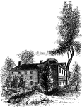
"The Livingston Mansion. This is a view from the lawn on the north side. It is embowerd in trees and shrubbery, and is one of the most pleasantly-located mansions in the country, overlooking interesting portios of the Hudson River. Within its walls many of the leading men of the Revolution were entertained. It was the head-quarters of Washington, when he abandoned an attempt to capture Cornwallis. There, at the close of the war, Washington, Governor Clinton, and General Sir Guy Carleton, and their respective suites, met to make arrangements for the evacuation of the city of New York by the British. Washington and Clinton came down the river from West Point in a barge; Carleton ascended in a frigate. Four companies of American Infantry performed the duty of guards on that occasion."—Lossing, 1851

Livingston Mansion

"The Livingston Mansion. This is a view from the lawn on the north side. It is embowerd in trees and…

"Remains of intrenchments the Ramapo Pass. This view is from the road, looking north toward the village of Ramapo. The remains of the intrenchments are seen along the right in the foreground. On the left, in the distance, is seen a glimpse of the hills on the other side of the narrow valley."&mdash;Lossing, 1851

Ramapo Pass

"Remains of intrenchments the Ramapo Pass. This view is from the road, looking north toward the village…
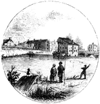
"Trenton Bridge and vicinity. This view is from the north side of the Assanpink, a few rods above the bridge, looking south. The bridge, seen upon the right, is built of stone, and very strong, and is upon the site of the old one. The creek is curbed by a dam near the bridge, and forms the sheet of water seen in the picture. The old 'Stacey Mill' of the Revolution, the largest building in the sketch, was quite dilapidated from the effects of fire and flood, when I was there. The two old houses on the left of it are of stone, covered with stucco, and were there at the time in question. On the bank, between them and the house of Mr. Timothy Abbott, seen on the extreme left, was a building used as a tavern, in the Revolution. It was demolished a few years ago. Along the high bank, from the mill eastward to the rail-way, now covered with houses and gardens, and also westward, some distance toward the Delaware, the Americans were encamped. The bank was being terraced when I visited Trenton, and will, in time, be a beautiful spot."&mdash;Lossing, 1851

Trenton

"Trenton Bridge and vicinity. This view is from the north side of the Assanpink, a few rods above the…
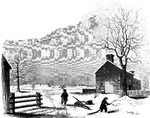
"View of the battle-ground near Princeton. This view, looking north, is from the carriage gate of Mr. John Clarke, owner of the house in which General Mercer died, which is situated about seventy rods from the Trenton turnpike. That dwelling is represented in the foreground of the picture, on the extreme right. The distant view includes almost the whole field of action. Near the center of the picture, over the head of the dark figure, is seen the house of William Clark, and his out-buildings. The barn, a little more to the left, with a tree in front, is upon the spot from whence Mercer rushed forward to the hedge-fence. That fence was upon the line of the present turnpike, denoted in the sketch by the fence passing down the slope beyond the large tree on the extreme left. The 'high ground' for which both parties were aiming, to secure advantage, is seen in the extreme distance. The dark spot between the tree in the second field and the barn denotes the spot where Mercer fell. The house of William Clark, in the distance, is about a quarter of a mile from the one in the foreground, where Mercer died. The hollow between the two houses was the space between the belligerents when Washington advanced to the support of Mercer. The place of conflict is about a mile and a quarter south of Princeton. The turnpike passes directly through it."&mdash;Lossing, 1851

Princeton battle-ground

"View of the battle-ground near Princeton. This view, looking north, is from the carriage gate of Mr.…
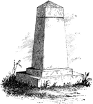
"Treaty Monument. This monument stands near the intersection of Hanover and Beach Streets, Kensington, on the spot where the celebrated <em>Treaty Tree</em> stood. The tree was blown down in 1810, when it was ascertained to be 283 years old. When the British were in possession of Philadelphia, during the winter of 1778, their foraging parties were out in every direction for fuel. To protect this tree from the ax, Colonel Simcoe, of the Queen's Rangers, placed a sentinel under it. Of its remains, many chairs, vases, work-stands, and other articles have been made. The commemorative monument was erected by the Penn Society. Upon it are the following inscriptions: North Side: 'Treaty ground of William Penn and the indian nation, 1682. Unbroken Faith.' South Side: 'William Penn, born 1644. Died, 1718.' West Side: 'Placed by the Penn Society, A. D. 1827, to mark the site of the great Elm Tree.' East Side: 'Pennsylvania founded, 1681, by deeds of Peace.'"&mdash;Lossing, 1851

Treaty Monument

"Treaty Monument. This monument stands near the intersection of Hanover and Beach Streets, Kensington,…
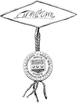
"Penn's Seal and Signature. This is a representation of the seal and signature of William Penn attached to the Pennsylvania charter. The names of the subscribing witnesses to the instrument are James Claypoole, Francis Plumsted, Thomas Barker, Philip Ford, Edward Pritchard, Andrew Soule, Christopher Taylor, Charles Lloyd, William Gibson, U. More, George Rudyard, Harbt. Springett."—Lossing, 1851

Penn's seal and signature

"Penn's Seal and Signature. This is a representation of the seal and signature of William Penn attached…
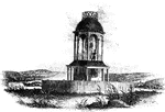
"The observatory. This view is from the field, looking north. On the left is seen the winding Schuylkill, and the rolling country beyond; and on the right, the distant hills of Montgomery county."—Lossing, 1851

Observatory

"The observatory. This view is from the field, looking north. On the left is seen the winding Schuylkill,…

"Washington Monument. The following are the inscriptions on the monument: East front: 'To George Washington, by the State of Maryland. Born 23d February, 1732. Died 14th December, 1799.' South front: 'To George Washington, President of the United States, 4th March, 1789. Returned to Mount Vernon, 4th March, 1797.' West front: To George Washington. Trenton, 25th December, 1776. Yorktown, 19th October, 1781.' North Front: 'To George Washington. Commander-in-chief of the American armies, 15th June, 1775. Commission resigned at Annapolis, 23d December, 1783.'"—Lossing, 1851

Washington Monument

"Washington Monument. The following are the inscriptions on the monument: East front: 'To George Washington,…
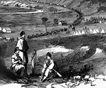
"View of the town of Strasburg, valley of the Shenandoah, occupied by the Federal forces under General Banks, March 25th, 1862.  Towns which had hitherto remained buried in obscurity and pleasant foilage were suddenly converted into places of national importance. Strasburg, through whose rural streets the resounding tramp of two hostile armies had passed, was a post village of Shenandoah County, Va., on the north fork of Shenandoah River and on the Manassas Gap Railroad, eighteen miles southwest of Winchester. It had three churches and a population of about eight hundred persons. It was occupied by General Banks's division of the Federal army immediately after the battle of Winchester." —Leslie, 1896

Strasburg Lookout

"View of the town of Strasburg, valley of the Shenandoah, occupied by the Federal forces under General…
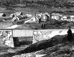
"View of the town of Strasburg, valley of the Shenandoah, occupied by the Federal forces under General Banks, March 25th, 1862.  Towns which had hitherto remained buried in obscurity and pleasant foilage were suddenly converted into places of national importance. Strasburg, through whose rural streets the resounding tramp of two hostile armies had passed, was a post village of Shenandoah County, Va., on the north fork of Shenandoah River and on the Manassas Gap Railroad, eighteen miles southwest of Winchester. It had three churches and a population of about eight hundred persons. It was occupied by General Banks's division of the Federal army immediately after the battle of Winchester." —Leslie, 1896

Bridge at Strasburg

"View of the town of Strasburg, valley of the Shenandoah, occupied by the Federal forces under General…

"Distant view of Jamestown Island. This view is from the north side of what was once a marsh, but now a deep bay, four hundred yards wide. On the left is seen the remains of a bridge, destroyed by a gale and high tide a few years ago; and beyond is the James River. Near the point of the island, toward the end of the bridge, are the remains of an ancient church. Mr. Coke resided upon the island when the tempest occurred which destroyed the bridge. The island was submerged, and for three days himself and family were prisoners. It was in winter, and he was obliged to cut the branches of ornamental trees that were close to his house, for fuel. I was gravely informed by a man on the beach, while making the sketch, that Pocahontas crossed at that very spot '<em>in her skiff</em>,' when she went to warn the Jamestown settlers of threatened danger. The dear child had no need of a skiff, had such a thing existed in America, for I was told by Mr. Coke that his father-in-law well remembered when a marsh, so narrow and firm that a person might cross it upon a fence rail, was where the deep water at the ruined bridge now is. Every year the current of James River is changing its margins in this region, and within a few years Jamestown Island, made so only by a marsh on the land side, will have a navigable channel around it. Already a large portion of it, whereon the ancient town was erected, has been washed away; and I was informed that a cypress-tree, now many yards from the shore stood at the end of a carriage-way to the wharf, sixty yards from the water's edge, only sixteen years ago. The destructive flood is gradually approaching the old church tower, and if the hand of man shall not arrest its sure progress, that too will be swept away, and not a vestige of Jamestown will remain. Virginians, look to it, and let a wall of masonry along the river margin attest your reverence for the most interesting historical relic within your borders! Some remains of the old fort may be seen at low water, several yards from the shore."&mdash;Lossing, 1851

Jamestown Island

"Distant view of Jamestown Island. This view is from the north side of what was once a marsh, but now…
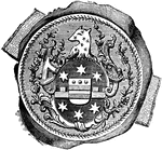
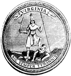
"Great Seal of Virginia."&mdash;Lossing, 1851

Virginia Seal

"Great Seal of Virginia."—Lossing, 1851

"Seal and signature of Tryon. William Tryon was a native of Ireland, and was educated to the profession of a soldier. He was an officer in the British service. He married Miss Wake, a relative of the Earl of Hillsborough, secretary for the colonies. Thus connected, he was a favorite of government, and was appointed lieutenant governor of North Carolina, in 1765. On the death of Governor Dobbs, he succeeded him in office, and exercised its functions until called to fill the same office in New York, in 1771. The history of his administration in North Carolina is a record of extortion, folly, and crime. During his administration in New York, the Revolution broke out, and he was the last royal governor of that state, though nominally succeeded in office in 1780 by General Robertson, when he was returned to England. His property in North Carolina and in New York was confiscated."—Lossing, 1851

William Tryon Seal

"Seal and signature of Tryon. William Tryon was a native of Ireland, and was educated to the profession…

"Front view of Tryon's Palace. The view here given was the north front, toward the town. The center edifice was the palace. The building on the right was the secretary's office and the laundry; that upon the left was the kitchen and servant's hall. These were connected with the palace by a curviform colonmade, of five columns each, and covered. Between these buildings, in front of the palace, was a handsome court. The rear of the building was finished in the style of the Mansion-House in London."&mdash;Lossing, 1851

Tryon Palace

"Front view of Tryon's Palace. The view here given was the north front, toward the town. The center…
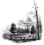
"The Regulator battle-ground. This view is from the south side of the Salisbury Road, which is marked by the fence on the left. The belligerents confronted in the open field seen on the north of the road, beyond the fence. Between the blasted pine, to which a muscadine is clinging, and the road, on the edge of a small morass, several of those who were slain in that engagement were buried. I saw the mounds of four graves by the fence, where the sheep, seen in the picture, are standing. The tree by the road side is a venerable oak, in which are a few scars produced by the bullets."&mdash;Lossing, 1851

Regulator Battle-ground

"The Regulator battle-ground. This view is from the south side of the Salisbury Road, which is marked…

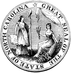
"Great Seal of the State of North Carolina."&mdash;Lossing, 1851

North Carolina Seal

"Great Seal of the State of North Carolina."—Lossing, 1851

"View of the battle-ground. This view is from the eminence southwest of the site of old Guilford Court House, near the junction of the roads running one north to Bruce's Cross-roads, the other west to Salem. The log-house, partially clapboarded, seen on the right, was uninhabited. It stands near the woods which intervene between Martinsville and the plantation of Mr. Hotchkiss. In the distance, near the center, is seen Martinsville, and between it and the foreground is the rolling vale, its undulations furrowed by many gulleys. In an open field, on the left of the road, seen in the hollow toward the left of the picture, was the fiercest part of the battle, where Washington charged upon the guards. Upon the ridge extending to the right through the center of the picture, the second line (Virginians) was posted. The fence running to the right from Martinsville, down into the valley on the right, denotes the Salisbury road. The snow was falling very fast when I made this sketch, and distant objects were seen with great difficulty. Our point of view, at the old loghouse, is the extreme westerly boundary of the field of controversy."—Lossing, 1851

Guilford Battle-ground

"View of the battle-ground. This view is from the eminence southwest of the site of old Guilford Court…
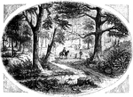
"View at King's Mountain battle-ground. This view is from the foot of the hill, whereon the hottest of the fight occurred. The north slope of that eminence is seen on the left. In the center, within a sort of basin, into which several ravines converge, is seen the simple monument erected to the memory of Ferguson and others; and in the foreground, on the right, is seen the great tulip-tree, upon which, tradition says, ten Tories were hung."&mdash;Lossing, 1851

King's Mountain Battle-Ground

"View at King's Mountain battle-ground. This view is from the foot of the hill, whereon the hottest…

"These are little fish-like animals furnished with one or two fin-like organs on the body and a broad and usually bilobed caudal-fin. they are of small size and swim with great rapidity. They have hitherto been found principally in the North Sea and in the Mediterranean. The name of <em>Sagitta</em>, given to these animals, refers to their arrow-like appearance." &mdash; Goodrich, 1859

Sagitta

"These are little fish-like animals furnished with one or two fin-like organs on the body and a broad…

"View at Sander's Creek. This view is from the north side of the Creek. like the other stream, it is filled with canes, shrubs, and many blasted pines."&mdash;Lossing, 1851

Sander's Creek

"View at Sander's Creek. This view is from the north side of the Creek. like the other stream, it is…
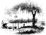
"View at Nelson's Ferry, the spot here portrayed, was an important locality during the Revolution. It was the principal crossing-place of the Santee for travelers or troops passing between Camden and Charleston, and as such, commanded the attention of the British after they captured the latter city. A redoubt was cast up there upon the north side of the Santee, and garrisoned by a small detachment; and to that point, as we have seen, Lord Rawdon retreated from Camden."&mdash;Lossing, 1851

Nelson's Ferry

"View at Nelson's Ferry, the spot here portrayed, was an important locality during the Revolution. It…

"Site of Fort Watson."—Lossing, 1851

<p>The Siege of Fort Watson was an American Revolutionary War confrontation in South Carolina that began on April 15, 1781 and lasted until April 23, 1781. Continental Army forces under Henry "Light Horse Harry" Lee and South Carolina militia under Francis Marion besieged Fort Watson, a fortified British outpost that formed part of the communication and supply chain between Charleston and other British outposts further inland.

<p>The attackers, lacking artillery, were unable to make a dent in the fortified works, and failed in attempts to deny the garrison of a water supply. They then devised a plan to build a tower from which sharpshooters could fire into the fort's walls. Fort Watson was once again attacked by the Americans on April 23, with the British forces unable to control the walls due to musket fire from the tower. They surrendered shortly afterwards.

Fort Watson

"Site of Fort Watson."—Lossing, 1851 The Siege of Fort Watson was an American Revolutionary War confrontation…
"Pulaski's seal."&mdash;Lossing, 1851

Pulaski's Seal

"Pulaski's seal."—Lossing, 1851

"South Carolina Flag."&mdash;Lossing, 1851

South Carolina Flag

"South Carolina Flag."—Lossing, 1851

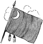
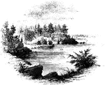
"View at Turtle Bay. Turtle Bay is a small rock-bound cove of the East River, at the foot of Forty-seventh Street. The banks are high and precipitous, and afforded a safe retreat for small vessels. Here the government had made a magazine of military stores, and these the Sons of Liberty determined to seize. Under the direction of Lamb, Sears, Willett, and McDougal, a party procured a sloop at Greenwich, came stealthily through the dangerous vortex of Hell Gate at twilight, and at midnight surprised and captured the guard, and secured the stores. The old store-house in which they were deposited is yet standing upon a wharf on the southern side of the little bay. The above view is from the bank at the foot of Forty-sixth Street. Beyond the rocky point on the north side of the bay is seen the lower end of Blackwell's Island, with the shore of Long Island in the distance. On the left of the old store-house, is seen the bridge across the mouth of Newtown Creek, a locality which will be mentioned presently in connection with a notice of the landing of troops under Sir Henry Clinton."—Lossing, 1851

Turtle Bay

"View at Turtle Bay. Turtle Bay is a small rock-bound cove of the East River, at the foot of Forty-seventh…
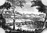
"Place where the British crossed the Bronx. This view is from the southeastern side of the Bronx, a little more than half a mile below the rail-way station at White Plains, looking north. The rail-way bridge is seen on the extreme right. Between that and the barn on the left the British ascended. In the field, seen a little to the left of the telegraph posts, toward the center, and the one on the summit beyond, the hottest of the engagement occurred. The latter is on the land of Mr. Cornelius Horton. In a hollow, near a large hickory-tree, on the southwest side of Chatterton's Hill, are the graves of many of the slain."&mdash;Lossing, 1851

Bronx

"Place where the British crossed the Bronx. This view is from the southeastern side of the Bronx, a…
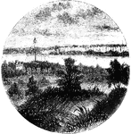
"View at Fort Washington. This is a view from the site of the interior works at Fort Washington from the foot of the flag-staff, loking southwest. In the foreground are seen the remains of the embankments. The tall mast seen near the river below is the support for telegraph wires which cross the Hudson there, from the rocky point of Jefrrey's Hook. In the distance across the river are the Palisades, and the mast upon their summit denotes the site of the redoubt north of Fort Lee. This little sketch exhibits the relative position of Forts Washington and Lee."&mdash;Lossing, 1851

Fort Washington

"View at Fort Washington. This is a view from the site of the interior works at Fort Washington from…
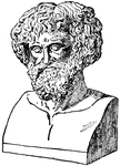
"Hannibal's Passage of the Alps. Hannibal determined to carry the war into Italy. To do this, he had to fight his way through Spain and cross the Alps, which were regarded as an impassable barrier between Italy and the North. In this he succeeded, although he lost one half of his troops and almost all the beasts of burden in the passage. This is justly regarded as one of the greatest military feats in history. In modern times Napoleon accomplished it, but both he and his historians have accounted it one of the best proofs of his genius, that he, in the nineteenth century, should be able to do what Hannibal had accomplished in the third century B. C. Hannibal crossed the Alps probably by way of what is now known as the Little St. Bernard Pass. The Gauls on the Italian side of the Alps welcomed him as their deliverer, and he was soon in the plains of northern Italy."&mdash;Colby, 1899

Hannibal

"Hannibal's Passage of the Alps. Hannibal determined to carry the war into Italy. To do this, he had…
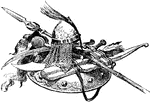
"Saracen Arms. Charlemagne now had to deal with certain non-Germanic peoples who were threatening his borders. These were the Saracens, Slavs, and Avars. The Mohammedan Saracens, or Moors, had gained possession of the whole of Spain, but there were still small fragments of the ancient Visigothic kingdom in the north. It was to save these little Christian states from their Mohammedan oppressors, as well as to round out the limits of his own kingdom, that Charlemagne undertook a campaign against the Saracens."&mdash;Colby, 1899

Saracen Arms

"Saracen Arms. Charlemagne now had to deal with certain non-Germanic peoples who were threatening his…
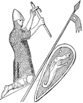
"William the Conqueror (1066-1087), as represented on his seal. Although William really ruled 'as king by the edge of the sword,' he preferred to base his title on the promise of Edward the Confessor rather than on force of arms; and he adhered to far as possible to Anglo-Saxon usages, causing himself to be crowned at Westminster and binding himself to frame good laws and observe justice, as his predecessors had done. In fact he professed to regard himself as the lawful successor of the Anglo-Saxon kings, and not merely as a feudal conqueror. He had great difficulty in making the people recognize him as such, but when this was once done, he was a far more powerful ruler as king of England than he was as Norman duke."&mdash;Colby, 1899

William the Conqueror

"William the Conqueror (1066-1087), as represented on his seal. Although William really ruled 'as king…