Maps Site map
  Maps > Asia > A Complete Map of Asia
Site Map  

  Record   31   to   40  of   71

Historic and contemporary maps of Asia, including physical and political maps, early exploration and colonization period maps, climate maps, relief maps, population density and distribution maps, vegetation maps, and economic/resource maps.
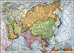
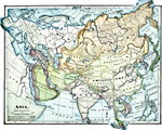
Asia, 1909
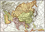
A map of Asia from 1909 showing country boundaries at the time, foreign possessions, major cities, rivers, lakes, terrain, and coastal features. This map shows the principal railways of the region with connections to Europe. The map shows the extent ...

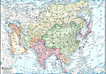
Political Asia, 1909
A map of Asia from 1910 showing country boundaries at the time, foreign possessions, major cities, rivers, lakes, terrain, and coastal features. This map shows the extent of the Russian Empire and Turkish Ottoman Empire in Asia, the Empire of Japan a...

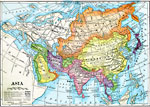
Asia, 1909
A map from 1909 of Asia showing country borders and capitals, principal cities and ports, railroads, canals, mountain systems, lakes, rivers, islands, and coastal features....

Asia, 1910
A map of Asia from 1910 showing country boundaries at the time, foreign possessions, major cities, rivers, lakes, terrain, and coastal features. This map shows the principal railways of the region with connections to Europe. This map shows the extent...

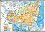
Physical Asia, 1910
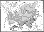
A map from 1910 of Asia, showing physical features and general elevations. This map uses color-contours to show land elevations ranging from below sea level around the Caspian Sea to over 6,500 feet, and water depths from sea level to below 13,000 fe...

Population Density of Asia, 1910
A map from 1910 showing the political boundaries and the distribution of population density of Asia at the time. This map uses gradated shading to shows areas of population densities ranging from under 2 inhabitants per square mile to over 512 inhabi...

Asia, 1912
A map of Asia from 1912 showing country boundaries at the time, foreign possessions, major cities, rivers, lakes, terrain, and coastal features. This map shows the principal railways of the region with connections to Europe. This map shows the extent...

Elevations of the Asian Continent, 1912
An orographic map of Asia from 1912 showing average elevations and land features of the region. The map uses color-contouring to show land elevations from depressions below sea level to above 12,000 feet. Offshore fathom contour lines are given to in...

River Basins of Asia, 1912
A map from 1912 showing the various drainage basins across the Asian region. This map is color-coded to show watersheds draining to the Pacific Ocean in pink, to the Indian Ocean in green, to the Arctic Ocean in purple and inland basins that do not d...

Production of Copper, Lead, and Zinc in Asia Excluding Malay Archipelago, 1913
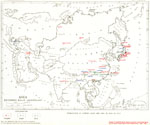
"Production of copper, lead, and zinc in Asia in 1913...Each dot represents 1 per cent of world's production. A cross represents less than 1/2 per cent of world's production ...Changes in boundaries and of names of countries in Asia caused by th...

First Previous Next Last


  Maps > Asia > A Complete Map of Asia
Site Map  

Maps ETC is a part of the Educational Technology Clearinghouse
Produced by the Florida Center for Instructional Technology © 2009
College of Education, University of South Florida