|
|
|
| Maps > Europe > United Kingdom |
A collection of historic and contemporary maps of England, Scotland, and Wales, including historic divisions, empires and kingdoms, detailed travel maps, climate maps, population density and distribution maps, vegetation maps, and economic/resource maps.
|
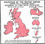
Countries of the British Empire,
1915 |
|
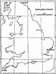
Tide Gauges in Britain,
1915 |
|
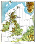
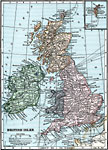
British Isles,
1915 |
|
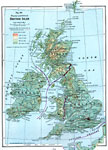
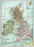
British Isles,
1916 |
|
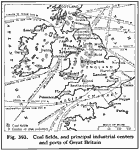
Coal Fields and Principal Industrial Centers and Ports of Great Britain,
1916 |
|
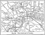
Central London,
1916 |
|
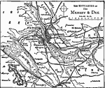
Estuaries of the Mersey and Dee,
1919 |
|
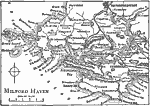
Milford Haven,
1919 |
|
The British Isles,
1919 |
|
British Isles,
1920 |
| First | Previous | Next | Last |
| Maps > Europe > United Kingdom |
Maps ETC is a part of the Educational Technology Clearinghouse
Produced by the Florida Center for Instructional Technology © 2009
College of Education, University of South Florida