|
|
|
| Maps > Globes and Multi-continent > Complete Maps |
A collection of world and multi-continent maps, including various projections, hemispheric maps, physical and political maps, early known world maps, climate maps, relief maps, ocean current maps, population density and distribution maps, vegetation maps, and economic/resource maps.
|
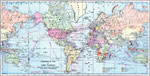
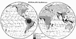
Commercial Map of the World showing the Chief Countries and their Possessions,
1899 |
|
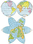
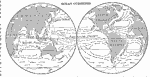
Hemisphere and Star-Shaped Map of the World,
1901 |
|
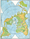
World- Slopes and Divides Polar Perspective,
1901 |
|
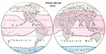
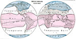
Heat Belts- July,
1901 |
|
Heat Belts- January,
1901 |
|
Heat Changes During the Year,
1901 |
|
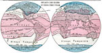
Prevailing Winds and Rainfall Distribution,
1901 |
|
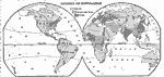
Global Ocean Currents,
1901 |
|
World Vegetation Regions,
1901 |
|
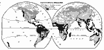
World Density of Population,
1901 |
| First | Previous | Next | Last |
| Maps > Globes and Multi-continent > Complete Maps |
Maps ETC is a part of the Educational Technology Clearinghouse
Produced by the Florida Center for Instructional Technology © 2009
College of Education, University of South Florida