Maps Site map
  Maps > Globes and Multi-continent > Complete Maps
Site Map  

  Record   121   to   130  of   316

A collection of world and multi-continent maps, including various projections, hemispheric maps, physical and political maps, early known world maps, climate maps, relief maps, ocean current maps, population density and distribution maps, vegetation maps, and economic/resource maps.

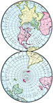
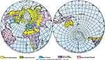
Northern and Southern Hemispheres, 1901
A double–sphere map from 1901 showing the earth from the North and South poles. The map shows lines of latitude and longitude, and the outlines of the landmasses....

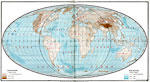
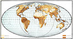
Relief Map of the World - Mollweide's Projection, 1901
A relief map from 1901 of the world on a Mollweide's Projection, showing general land elevations and water depths. The map is color–coded to show land elevations between sea level and 3,000 feet, 3,000 to 12,000 feet, and above 12,000 feet, and...

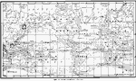
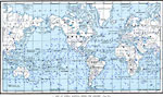
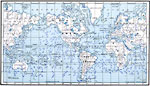
Map of Ocean Currents, 1901
A chart from 1901 showing the principal ocean currents and ocean drifts of the world. The map shows both warm and cold currents and direction of flow for the Gulf Stream, Labrador, Greenland, Japan, California, and South Equatorial currents, the West...

Map of World Showing Winds for January, 1901
A map from 1901 of the world, showing the prevailing wind directions for the month of January....

Map of World Showing Winds for July, 1901
A map from 1901 of the world, showing the prevailing wind directions for the month of July....

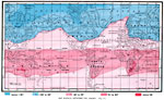
Map Showing Isotherms for January, 1901
A map from 1901 of the world, showing the temperature belts for the month of January, given in degrees Fahrenheit. The map is color–coded to show the regions where mean temperatures for the month fall below –30°, between –30°...

Map Showing Isotherms for July, 1901
A map from 1901 of the world, showing the temperature belts for the month of July, given in degrees Fahrenheit. The map is color–coded to show the regions where mean temperatures for the month fall below –30°, between –30° an...

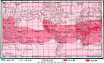
Rainfall Map of the World - Mollweide's Projection, 1901
A map from 1901 of the world on a Mollweide's Projection, showing the mean annual distribution of rainfall. The map is color–coded to show regions where annual rainfall averages less than 10 inches, regions of rainfall between 10 and 20 inches,...

Map Showing Vegetation Regions, 1901
A map from 1901 of the world on a hemisphere projection showing the general vegetation regions. The map is color–coded to show regions of deserts and tundra, evergreen forests, open forests, grassy lands with few or no trees, and dense tropical...

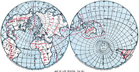
Map Showing Life Regions, 1901
Map showing life regions of the world....

First Previous Next Last


  Maps > Globes and Multi-continent > Complete Maps
Site Map  

Maps ETC is a part of the Educational Technology Clearinghouse
Produced by the Florida Center for Instructional Technology © 2009
College of Education, University of South Florida