Maps Site map
  Maps > Globes and Multi-continent > Complete Maps
Site Map  

  Record   131   to   140  of   316

A collection of world and multi-continent maps, including various projections, hemispheric maps, physical and political maps, early known world maps, climate maps, relief maps, ocean current maps, population density and distribution maps, vegetation maps, and economic/resource maps.

World Map of Population Density, 1901
A map from 1901 of the world on a Mercator's Projection, showing the general distribution of population density at the time. The map is color–coded to show areas of dense population, moderately dense, and areas of sparse population density....

The Hemispheres, 1901
A double hemisphere map of the world from 1901 showing the earth's Land Hemisphere and Water Hemisphere. The hemispheres are given on an oblique perspective, allowing the area around both poles to be shown, and illustrate the predominance of landmass...

The World, 1901
A map from 1901 of the world showing colonial possessions at the time, principal steamship routes, and submarine cables and telegraph lines. The map is color–coded to show the possessions of Great Britain, France, Germany, Portugal, Spain, Neth...

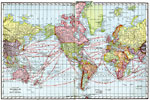
A Map of the World showing Ocean Routes, 1901
A map from 1901 of the world on a Mercator's Projection, showing the steamship routes between major ports, with distances given in nautical miles. The map shows territorial borders at the time, major cities and ports, and the International Date Line ...

The World on Mercator's Projection, 1903
A Mercator's Projection map of the world from 1903, showing the United States and its possessions in red....

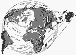
Global Temperature Belts, 1904
A global map from 1904 showing the four temperature belts of the earth. The map shows the landmasses in relief, highlighting mountain and river systems....

Heat Belts and Seasons of the World, 1904
World map with heat belts and temperature indicators....

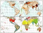
The World: Density of Population; Races and Religions, 1904
Two world maps showing population density, races and religions current to 1900. ...

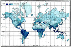
The World: Rainfall, 1904
A World map from 1904 showing the averaged rainfall distribution measured in inches per year, ranging from under 10 inches to over 80 inches....

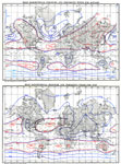
The World: Distribution of Atmospheric Pressure (January and July), 1904
Two world maps from 1904 showing mean barometrical pressure and prevailing winds for January and mean barometrical pressure and prevailing winds for July. Orange isobar lines indicate pressures of 30 inches and above; blue isobar lines indicate press...

First Previous Next Last


  Maps > Globes and Multi-continent > Complete Maps
Site Map  

Maps ETC is a part of the Educational Technology Clearinghouse
Produced by the Florida Center for Instructional Technology © 2009
College of Education, University of South Florida