Maps Site map
  Maps > Globes and Multi-continent > Complete Maps
Site Map  

  Record   171   to   180  of   316

A collection of world and multi-continent maps, including various projections, hemispheric maps, physical and political maps, early known world maps, climate maps, relief maps, ocean current maps, population density and distribution maps, vegetation maps, and economic/resource maps.

An isothermal chart of the world for July, 1910
An isothermal chart from 1910 of the world for the month of July. ...

The World Distribution of Animal Regions, 1910
Map from 1910 of the world distribution of animal regions. ...

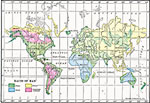
Races of Man, 1910
A map from 1910 showing the races of man as defined at the time....

The religions of the world, 1910
A map from 1910 of the principal religions of the world....

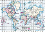
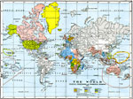
British Empire, 1910
A map of the world from 1910 showing the United Kingdom and its possessions and dependencies. The map is color–coded to show British Empire at the time, including Canada, Australia, India, territories in Africa, Indonesia, and the Americas, as ...

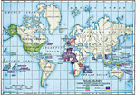
Map of the World showing possessions of United States, Germany, France, and the Netherlands, 1910
A map from 1910 of the World color–coded to possessions of United States, Germany, France, and the Netherlands....

Distribution of People in the World, 1910
A map from 1910 showing the distribution of people or population density in the world at the time. This map is color–coded to show areas ranging in population density from very dense (250 or more people per square mile), dense (125 to 250 peopl...

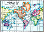
Transportation Routes and Telegraph Lines, 1910
A map from 1910 showing the location of then–current transcontinental railway and steamship transportation routes, submarine cables, and telegraph lines in the world. The map also shows the International Date Line....

Colonial Possessions and Commercial Highways of the World , 1910
A map from 1910 showing colonial territorial possessions and commercial trade routes of the world at the time. The map is color–coded to show countries having foreign or colonial possessions, including the British, United States, German, Russia...

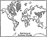
Distribution of Archean Rocks, 1910
This is a map of the world from 1910, showing the distribution of Archean Rocks. "the non–committal epithet ‘pre–cambrian’ is often applied...a lowermost group [of rocks] with a prevailing granitoid, gneissic and schistos...

First Previous Next Last


  Maps > Globes and Multi-continent > Complete Maps
Site Map  

Maps ETC is a part of the Educational Technology Clearinghouse
Produced by the Florida Center for Instructional Technology © 2009
College of Education, University of South Florida