|
|
|
| Maps > Globes and Multi-continent > Complete Maps |
A collection of world and multi-continent maps, including various projections, hemispheric maps, physical and political maps, early known world maps, climate maps, relief maps, ocean current maps, population density and distribution maps, vegetation maps, and economic/resource maps.
|
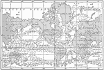
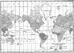
Currents and Drifts of the Oceans,
1910 |
|
Isothermal Chart of the World for January,
1910 |
|
Animal Regions of the World,
1910 |
|
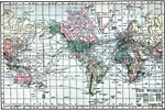
The World,
1910 |
|
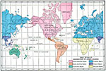
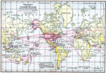
The World showing United States and its dependencies,
1910 |
|
Map of Temperature Zones,
1910 |
|
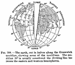
Earth and the Greenwich Meridian,
1910 |
|
Wind Belts,
1910 |
|
Mean Annual Rainfall of the World,
1910 |
|
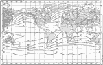
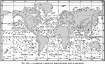
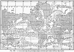
The principal ocean currents and ocean drifts of the world,
1910 |
| First | Previous | Next | Last |
| Maps > Globes and Multi-continent > Complete Maps |
Maps ETC is a part of the Educational Technology Clearinghouse
Produced by the Florida Center for Instructional Technology © 2009
College of Education, University of South Florida